TopoQuest Logo
Do you find TopoQuest useful?
Help keep TopoQuest running and adding new maps/features by donating!
Bitcoin:  19c7KJd3qBynnjoSw5npx9KScwjBe4ifkT
Litecoin:  LXs6TkuXGGXo1vDsWCkWVdjQX94eUKd6ui
Home View Maps Find Maps Find Places Resources & Links


Belden, California Topographic Map

USGS Map Title: Belden, CA
USGS Map MRC: 40121A3
DRG (GeoTIFF) Download: o40121a3.tif


Neighboring USGS Topographic Map Quads:


  Humboldt Peak, CA  
40121B4
 

  Humbug Valley, CA  
40121B3
 

  Almanor, CA  
40121B2
 

  Jonesville, CA  
40121A4
 

  Belden, CA  
40121A3
 

  Caribou, CA  
40121A2
 

  Kimshew Point, CA  
39121H4
 

  Storrie, CA  
39121H3
 

  Bucks Lake, CA  
39121H2


Map MRC Location:

N41°
W122°
N41°
W121°
H8 H7 H6 H5 H4 H3 H2 H1
G8 G7 G6 G5 G4 G3 G2 G1
F8 F7 F6 F5 F4 F3 F2 F1
E8 E7 E6 E5 E4 E3 E2 E1
D8 D7 D6 D5 D4 D3 D2 D1
C8 C7 C6 C5 C4 C3 C2 C1
B8 B7 B6 B5 B4 B3 B2 B1
A8 A7 A6 A5 A4 A3 A2 A1
N40°
W122°
N40°
W121°

Belden, CA USGS 1:24K Topographic Map Preview:
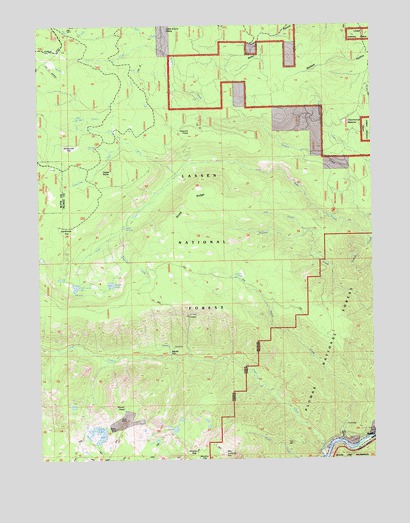
Belden, CA USGS Topographic Map
Click on map above to begin viewing in our Map Viewer.

This topographic map contains these locations and features:
Feature Name Type Latitude Longitude GNIS ID View Map
Belden Census Designated PlaceCensusN40.0060°W121.2531°2407822View Map
Belden RavineValleyN40.0054°W121.2502°218978View Map
Ben LomondSummitN40.0021°W121.3066°256816View Map
Big SpringsSpringN40.0966°W121.3602°257024View Map
Blue Lead GulchValleyN40.0863°W121.2511°266468View Map
Castle RocksSummitN40.0827°W121.3491°258068View Map
Chips LakeLakeN40.0087°W121.3257°258340View Map
Cottonwood MeadowFlatN40.0935°W121.2586°258771View Map
Cub CreekStreamN40.0654°W121.2752°258977View Map
Ebbe Stamp MillLocaleN40.0074°W121.2508°274897View Map
Firstwater CreekStreamN40.0649°W121.3458°260139View Map
Frog LakeLakeN40.0521°W121.3689°260427View Map
Green Island LakeLakeN40.0498°W121.3625°260852View Map
Grizzly CreekStreamN40.0688°W121.2527°260916View Map
Humbug SummitSummitN40.1071°W121.3733°261617View Map
Indian CreekStreamN40.0046°W121.2636°261721View Map
Indian SpringsSpringN40.0518°W121.3027°261768View Map
L-T CreekStreamN40.0818°W121.3241°262251View Map
Lott MineMineN40.0116°W121.3430°262966View Map
Milkhouse FlatFlatN40.0899°W121.3642°263581View Map
Morris LakeLakeN40.0052°W121.3550°263840View Map
Morris MineMineN40.0093°W121.3475°263841View Map
Mount HopeSummitN40.0154°W121.3444°261457View Map
Myrtle FlatFlatN40.0304°W121.3275°253257View Map
Panhandle CreekStreamN40.0921°W121.3436°264462View Map
Peacock PointRidgeN40.0946°W121.3189°264590View Map
Rock CreekStreamN40.1221°W121.3280°265491View Map
Saucer LakeLakeN40.0504°W121.3491°265852View Map
Sawmill Tom CreekStreamN40.1174°W121.3258°265888View Map
Shores GapGapN40.0027°W121.3177°266131View Map
Soda CreekStreamN40.0641°W121.2539°267360View Map
Soda RidgeRidgeN40.0746°W121.3166°267366View Map
Soda SpringSpringN40.0674°W121.3439°267369View Map
Sunflower FlatFlatN40.0668°W121.3625°267956View Map
Wallack HollowValleyN40.1238°W121.2522°268763View Map
Yellow CreekStreamN40.0066°W121.2508°269340View Map

Note: Coordinates in the location and feature list above are referenced to NAD83 datum.


Copyright (C) 2008-2025 Ryan Niemi / Sunset Dynamics ... All Rights Reserved