TopoQuest Logo
Do you find TopoQuest useful?
Help keep TopoQuest running and adding new maps/features by donating!
Bitcoin:  19c7KJd3qBynnjoSw5npx9KScwjBe4ifkT
Litecoin:  LXs6TkuXGGXo1vDsWCkWVdjQX94eUKd6ui
Home View Maps Find Maps Find Places Resources & Links


King, North Carolina Topographic Map

USGS Map Title: King, NC
USGS Map MRC: 36080C3
DRG (GeoTIFF) Download: o36080c3.tif


Neighboring USGS Topographic Map Quads:


  Pilot Mountain, NC  
36080D4
 

  Hanging Rock, NC  
36080D3
 

  Danbury, NC  
36080D2
 

  Pinnacle, NC  
36080C4
 

  King, NC  
36080C3
 

  Walnut Cove, NC  
36080C2
 

  Vienna, NC  
36080B4
 

  Rural Hall, NC  
36080B3
 

  Walkertown, NC  
36080B2


Map MRC Location:

N37°
W81°
N37°
W80°
H8 H7 H6 H5 H4 H3 H2 H1
G8 G7 G6 G5 G4 G3 G2 G1
F8 F7 F6 F5 F4 F3 F2 F1
E8 E7 E6 E5 E4 E3 E2 E1
D8 D7 D6 D5 D4 D3 D2 D1
C8 C7 C6 C5 C4 C3 C2 C1
B8 B7 B6 B5 B4 B3 B2 B1
A8 A7 A6 A5 A4 A3 A2 A1
N36°
W81°
N36°
W80°

King, NC USGS 1:24K Topographic Map Preview:
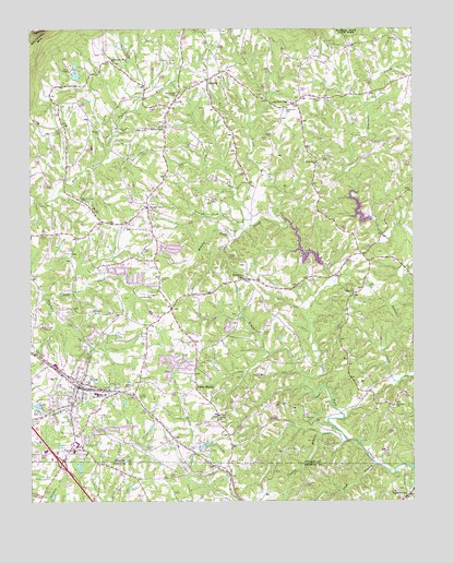
King, NC USGS Topographic Map
Click on map above to begin viewing in our Map Viewer.

This topographic map contains these locations and features:
Feature Name Type Latitude Longitude GNIS ID View Map
BannertownPopulated PlaceN36.2521°W80.2514°980531View Map
Bennett CemeteryCemeteryN36.3485°W80.3517°980995View Map
Bethel United Methodist ChurchChurchN36.2729°W80.3134°981170View Map
Boyles ChapelPopulated PlaceN36.3501°W80.3303°2729467View Map
Boyles ChapelChurchN36.3493°W80.3306°981796View Map
Browder CemeteryCemeteryN36.2712°W80.2837°981994View Map
Brushy Fork CreekStreamN36.3249°W80.2912°982068View Map
C F Stone Estate DamDamN36.2585°W80.3748°1000430View Map
C F Stone Estate LakeReservoirN36.2585°W80.3748°1000429View Map
Camp HanesLocaleN36.3643°W80.3614°982534View Map
Camp Hanes DamDamN36.3618°W80.3581°1000548View Map
Camp Hanes LakeReservoirN36.3628°W80.3597°1000549View Map
CapellaPopulated PlaceN36.3618°W80.3164°982632View Map
Capella Church of ChristChurchN36.3596°W80.3223°1952656View Map
Chestnut Grove Junior High SchoolSchoolN36.3193°W80.3742°1006948View Map
City of KingCivilN36.2768°W80.3560°2404830View Map
Corinth Church of ChristChurchN36.2751°W80.2559°983565View Map
Cross Roads Airport (historical)AirportN36.3060°W80.3373°998059View Map
FriendshipPopulated PlaceN36.3085°W80.2659°1952667View Map
Friendship Institute (historical)SchoolN36.3049°W80.2692°1952669View Map
Friendship Missionary Baptist ChurchChurchN36.3054°W80.2687°985459View Map
Goff CreekStreamN36.3054°W80.3709°985762View Map
Haw Pond Church of ChristChurchN36.3396°W80.2803°986516View Map
KingPopulated PlaceN36.2807°W80.3592°1021043View Map
King CemeteryCemeteryN36.2715°W80.3737°987978View Map
King Elementary SchoolSchoolN36.2785°W80.3556°1006941View Map
King Fire DepartmentBuildingN36.2836°W80.3623°2638606View Map
King High SchoolSchoolN36.2782°W80.3531°1952673View Map
King Intermediate SchoolSchoolN36.3190°W80.3623°1006949View Map
King Police DepartmentBuildingN36.2822°W80.3591°2769716View Map
King Post OfficePost OfficeN36.2665°W80.3600°2774034View Map
King Recreational AcresParkN36.2854°W80.3692°1007871View Map
Leak BranchStreamN36.2601°W80.2628°988248View Map
Mount OlivePopulated PlaceN36.3279°W80.3364°990458View Map
Mount Olive ChurchChurchN36.3290°W80.3362°1952694View Map
Mountain ViewPopulated PlaceN36.3090°W80.3039°990715View Map
Mountain View Baptist ChurchChurchN36.3101°W80.3039°1952696View Map
NeatmanPopulated PlaceN36.3137°W80.2645°1023601View Map
North Carolina State Highway Patrol Troop E District 5BuildingN36.2796°W80.3447°2769801View Map
Oak Grove School (historical)SchoolN36.3493°W80.3556°1952698View Map
Old Capella CemeteryCemeteryN36.3582°W80.3267°991538View Map
Old Mount Olive CemeteryCemeteryN36.3304°W80.3584°991587View Map
Oliver CemeteryCemeteryN36.3210°W80.3714°991645View Map
Paynes BranchStreamN36.2662°W80.2717°991960View Map
Poplar SpringsPopulated PlaceN36.2801°W80.3209°1022045View Map
Poplar Springs Church of ChristChurchN36.2815°W80.3212°1952702View Map
Quaker GapPopulated PlaceN36.3557°W80.2878°992931View Map
Quaker Gap Missionary Baptist ChurchChurchN36.3554°W80.2892°1952703View Map
Sauratown MountainSummitN36.3746°W80.3714°994372View Map
Sauratown Mountain ChurchChurchN36.3662°W80.3473°994373View Map
Sauratown Volunteer Fire DepartmentBuildingN36.3504°W80.3309°2638940View Map
Sizemore CemeteryCemeteryN36.3674°W80.2789°994874View Map
Southern CemeteryCemeteryN36.3724°W80.2539°995231View Map
Stevenson CemeteryCemeteryN36.3535°W80.2914°995488View Map
Straight Fork CreekStreamN36.3221°W80.3062°995601View Map
Tillotson CemeteryCemeteryN36.3312°W80.3353°996108View Map
Timmons CemeteryCemeteryN36.3090°W80.3320°996111View Map
Timmons CreekStreamN36.2826°W80.2851°996112View Map
Town Fork Creek Watershed Dam Number SixteenDamN36.3249°W80.2635°1000521View Map
Town Fork Creek Watershed Dam Number TenDamN36.3130°W80.2797°1000506View Map
Town Fork Creek Watershed Lake SixteenReservoirN36.3235°W80.2631°1000520View Map
Town Fork Creek Watershed Lake TenReservoirN36.3118°W80.2798°1000507View Map
Township of YadkinCivilN36.3255°W80.3672°1027209View Map
Tuttle CemeteryCemeteryN36.2954°W80.2984°996377View Map
Union Hill CemeteryCemeteryN36.3562°W80.2798°996496View Map
WKTE-AM (King)TowerN36.2968°W80.3714°1018558View Map

Note: Coordinates in the location and feature list above are referenced to NAD83 datum.


Copyright (C) 2008-2024 Ryan Niemi / Sunset Dynamics ... All Rights Reserved