TopoQuest Logo
Do you find TopoQuest useful?
Help keep TopoQuest running and adding new maps/features by donating!
Bitcoin:  19c7KJd3qBynnjoSw5npx9KScwjBe4ifkT
Litecoin:  LXs6TkuXGGXo1vDsWCkWVdjQX94eUKd6ui
Home View Maps Find Maps Find Places Resources & Links


Kingsbury, Maine Topographic Map

USGS Map Title: Kingsbury, ME
USGS Map MRC: 45069A6
DRG (GeoTIFF) Download: o45069a6.tif


Neighboring USGS Topographic Map Quads:


  Dimmick Mountain, ME  
45069B7
 

  Foster Ridge, ME  
45069B6
 

  Whetstone Pond, ME  
45069B5
 

  Mahoney Hill, ME  
45069A7
 

  Kingsbury, ME  
45069A6
 

  Wellington, ME  
45069A5
 

  Solon, ME  
44069H7
 

  Athens, ME  
44069H6
 

  Harmony, ME  
44069H5


Map MRC Location:

N46°
W70°
N46°
W69°
H8 H7 H6 H5 H4 H3 H2 H1
G8 G7 G6 G5 G4 G3 G2 G1
F8 F7 F6 F5 F4 F3 F2 F1
E8 E7 E6 E5 E4 E3 E2 E1
D8 D7 D6 D5 D4 D3 D2 D1
C8 C7 C6 C5 C4 C3 C2 C1
B8 B7 B6 B5 B4 B3 B2 B1
A8 A7 A6 A5 A4 A3 A2 A1
N45°
W70°
N45°
W69°

Kingsbury, ME USGS 1:24K Topographic Map Preview:
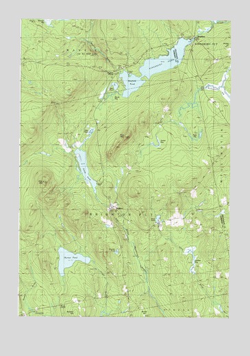
Kingsbury, ME USGS Topographic Map
Click on map above to begin viewing in our Map Viewer.

This topographic map contains these locations and features:
Feature Name Type Latitude Longitude GNIS ID View Map
Bigelow BrookStreamN45.1028°W69.6912°562251View Map
BrightonPopulated PlaceN45.0453°W69.6948°562969View Map
Bryant BogSwampN45.0912°W69.6951°563091View Map
Bunker HillSummitN45.0006°W69.6742°563182View Map
Decker BogSwampN45.0759°W69.6673°564936View Map
Flanders CemeteryCemeteryN45.1056°W69.6877°2737022View Map
Foss Hill CemeteryCemeteryN45.1055°W69.6371°566440View Map
Foss MountainSummitN45.0757°W69.6869°566441View Map
Kelley CemeteryCemeteryN45.0950°W69.7075°2737029View Map
Kelly MountainSummitN45.0566°W69.7353°569081View Map
KingsburyPopulated PlaceN45.1195°W69.6492°579453View Map
Kingsbury DamDamN45.1170°W69.6469°1773823View Map
Kingsbury PondReservoirN45.1170°W69.6469°569213View Map
Mayfield CornerPopulated PlaceN45.1037°W69.6931°579506View Map
Mayfield PondLakeN45.1052°W69.6700°570939View Map
Moody CornerPopulated PlaceN45.0048°W69.7253°579534View Map
Otter PondLakeN45.0972°W69.6936°572836View Map
Palin PondLakeN45.0778°W69.7076°572936View Map
Plantation of BrightonCivilN45.0476°W69.6960°579053View Map
Potter BogSwampN45.0778°W69.6439°573720View Map
Prentiss PondLakeN45.0275°W69.6917°573777View Map
Scribner BogSwampN45.0253°W69.6453°575068View Map
Smith PondLakeN45.0626°W69.7109°575635View Map
Trout PondLakeN45.0416°W69.6676°577349View Map
Wellington BogSwampN45.0948°W69.6289°577992View Map
Wyman PondLakeN45.0239°W69.7197°578732View Map

Note: Coordinates in the location and feature list above are referenced to NAD83 datum.


Copyright (C) 2008-2025 Ryan Niemi / Sunset Dynamics ... All Rights Reserved