TopoQuest Logo
Do you find TopoQuest useful?
Help keep TopoQuest running and adding new maps/features by donating!
Bitcoin:  19c7KJd3qBynnjoSw5npx9KScwjBe4ifkT
Litecoin:  LXs6TkuXGGXo1vDsWCkWVdjQX94eUKd6ui
Home View Maps Find Maps Find Places Resources & Links


Mahoney Hill, Maine Topographic Map

USGS Map Title: Mahoney Hill, ME
USGS Map MRC: 45069A7
DRG (GeoTIFF) Download: o45069a7.tif


Neighboring USGS Topographic Map Quads:


  Caratunk, ME  
45069B8
 

  Dimmick Mountain, ME  
45069B7
 

  Foster Ridge, ME  
45069B6
 

  Bingham, ME  
45069A8
 

  Mahoney Hill, ME  
45069A7
 

  Kingsbury, ME  
45069A6
 

  Embden Pond, ME  
44069H8
 

  Solon, ME  
44069H7
 

  Athens, ME  
44069H6


Map MRC Location:

N46°
W70°
N46°
W69°
H8 H7 H6 H5 H4 H3 H2 H1
G8 G7 G6 G5 G4 G3 G2 G1
F8 F7 F6 F5 F4 F3 F2 F1
E8 E7 E6 E5 E4 E3 E2 E1
D8 D7 D6 D5 D4 D3 D2 D1
C8 C7 C6 C5 C4 C3 C2 C1
B8 B7 B6 B5 B4 B3 B2 B1
A8 A7 A6 A5 A4 A3 A2 A1
N45°
W70°
N45°
W69°

Mahoney Hill, ME USGS 1:24K Topographic Map Preview:
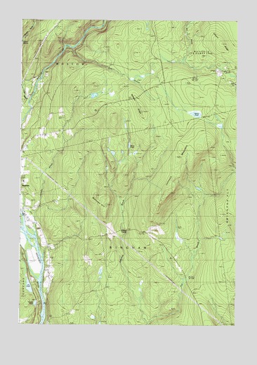
Mahoney Hill, ME USGS Topographic Map
Click on map above to begin viewing in our Map Viewer.

This topographic map contains these locations and features:
Feature Name Type Latitude Longitude GNIS ID View Map
Babbitt RidgeRidgeN45.0928°W69.8081°561387View Map
Baker CemeteryCemeteryN45.0803°W69.8619°2727469View Map
Bassett BrookStreamN45.1164°W69.8745°561709View Map
Bingham Census Designated PlaceCensusN45.0582°W69.8729°2377890View Map
Chase StreamStreamN45.0912°W69.8712°563892View Map
Coburn RidgeRidgeN45.1159°W69.7589°564138View Map
Fall Brook CemeteryCemeteryN45.0206°W69.7793°2737021View Map
Gadabout Gaddis AirportAirportN45.0420°W69.8700°582118View Map
Gulf StreamStreamN45.1134°W69.8453°567379View Map
Jackson BrookStreamN45.0384°W69.8664°568730View Map
Johnson BrookStreamN45.0009°W69.8017°568913View Map
Johnson CornerPopulated PlaceN45.0378°W69.8203°579437View Map
Johnson MountainSummitN45.0732°W69.7649°568932View Map
Lily PondLakeN45.0155°W69.8693°581448View Map
Mahoney HillSummitN45.0531°W69.8311°570661View Map
Morse PondLakeN45.0734°W69.8120°571709View Map
Tibbetts PondLakeN45.0088°W69.8656°577095View Map
Town of BinghamCivilN45.0320°W69.8161°582354View Map
Town of MoscowCivilN45.1212°W69.8717°582609View Map
Upper Kennebec Valley Memorial High SchoolSchoolN45.0586°W69.8727°1908722View Map
Withee PondLakeN45.0867°W69.7733°578629View Map

Note: Coordinates in the location and feature list above are referenced to NAD83 datum.


Copyright (C) 2008-2025 Ryan Niemi / Sunset Dynamics ... All Rights Reserved