TopoQuest Logo
Do you find TopoQuest useful?
Help keep TopoQuest running and adding new maps/features by donating!
Bitcoin:  19c7KJd3qBynnjoSw5npx9KScwjBe4ifkT
Litecoin:  LXs6TkuXGGXo1vDsWCkWVdjQX94eUKd6ui
Home View Maps Find Maps Find Places Resources & Links


Athens, Maine Topographic Map

USGS Map Title: Athens, ME
USGS Map MRC: 44069H6
DRG (GeoTIFF) Download: o44069h6.tif


Neighboring USGS Topographic Map Quads:


  Mahoney Hill, ME  
45069A7
 

  Kingsbury, ME  
45069A6
 

  Wellington, ME  
45069A5
 

  Solon, ME  
44069H7
 

  Athens, ME  
44069H6
 

  Harmony, ME  
44069H5
 

  Madison East, ME  
44069G7
 

  Skowhegan, ME  
44069G6
 

  Canaan, ME  
44069G5


Map MRC Location:

N45°
W70°
N45°
W69°
H8 H7 H6 H5 H4 H3 H2 H1
G8 G7 G6 G5 G4 G3 G2 G1
F8 F7 F6 F5 F4 F3 F2 F1
E8 E7 E6 E5 E4 E3 E2 E1
D8 D7 D6 D5 D4 D3 D2 D1
C8 C7 C6 C5 C4 C3 C2 C1
B8 B7 B6 B5 B4 B3 B2 B1
A8 A7 A6 A5 A4 A3 A2 A1
N44°
W70°
N44°
W69°

Athens, ME USGS 1:24K Topographic Map Preview:
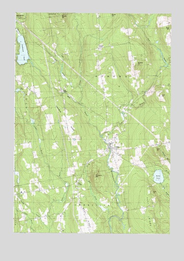
Athens, ME USGS Topographic Map
Click on map above to begin viewing in our Map Viewer.

This topographic map contains these locations and features:
Feature Name Type Latitude Longitude GNIS ID View Map
AthensPopulated PlaceN44.9231°W69.6728°561330View Map
Athens CemeteryCemeteryN44.9273°W69.6676°1908480View Map
Athens Elementary SchoolSchoolN44.9241°W69.6725°1908481View Map
Athens Historical Society MuseumBuildingN44.9270°W69.6726°1908482View Map
Athens Post OfficePost OfficeN44.9279°W69.6747°1908483View Map
Athens Volunteer Fire DepartmentBuildingN44.9251°W69.6739°2552811View Map
Barker PondLakeN44.9074°W69.6341°561605View Map
Bog BrookStreamN44.8826°W69.6731°562647View Map
Bog BrookStreamN44.9578°W69.6978°562648View Map
Cass CornerPopulated PlaceN44.9037°W69.6989°579182View Map
Chapman RidgeRidgeN44.9387°W69.7076°563853View Map
Cleveland SchoolSchoolN44.8881°W69.6587°564092View Map
Cornville Elementary School (historical)SchoolN44.8915°W69.6974°562946View Map
Corson BrookStreamN44.9484°W69.6981°564376View Map
Corsons CornerPopulated PlaceN44.9798°W69.6817°579217View Map
Dore HillSummitN44.9918°W69.6261°565213View Map
Dore Hill CemeteryCemeteryN44.9873°W69.6259°1908523View Map
East Branch Wesserunsett StreamStreamN44.9295°W69.6789°565583View Map
Ironbound PondLakeN44.9778°W69.7439°578009View Map
Kinsman CemeteryCemeteryN44.9009°W69.6989°569223View Map
Lily PondLakeN44.9558°W69.7473°569579View Map
Longley BrookStreamN44.9053°W69.7112°570339View Map
Lords HillSummitN44.9534°W69.6328°570388View Map
Lords Hill CemeteryCemeteryN44.9570°W69.6289°1908598View Map
Meadow BrookStreamN44.9909°W69.7495°571081View Map
Mount Rest CemeteryCemeteryN44.9273°W69.6669°571786View Map
Mulhern HillSummitN44.9990°W69.7133°571972View Map
Paine BrookStreamN44.8767°W69.7212°572928View Map
Parlin HillSummitN44.9226°W69.6368°573006View Map
Porcupine MountainSummitN44.9082°W69.6850°573664View Map
Somerset AcademySchoolN44.9267°W69.6717°575718View Map
Somerset Academy (historical)SchoolN44.9270°W69.6726°1908700View Map
Somerset Academy Community CenterBuildingN44.9270°W69.6726°1908701View Map
Spurwink School CornvilleSchoolN44.8759°W69.6923°2738174View Map
Stetson SchoolSchoolN44.9556°W69.7126°576309View Map
Stickney HillSummitN44.9703°W69.6526°576343View Map
Town of AthensCivilN44.9537°W69.6637°579052View Map
Waite HillSummitN44.8987°W69.6394°577778View Map
Washington SchoolSchoolN44.9228°W69.6678°577864View Map
West AthensPopulated PlaceN44.9534°W69.7109°578017View Map
West Branch Wesserunsett StreamStreamN44.9295°W69.6789°578102View Map
Whittier SchoolSchoolN44.8826°W69.7401°578444View Map

Note: Coordinates in the location and feature list above are referenced to NAD83 datum.


Copyright (C) 2008-2025 Ryan Niemi / Sunset Dynamics ... All Rights Reserved