TopoQuest Logo
Do you find TopoQuest useful?
Help keep TopoQuest running and adding new maps/features by donating!
Bitcoin:  19c7KJd3qBynnjoSw5npx9KScwjBe4ifkT
Litecoin:  LXs6TkuXGGXo1vDsWCkWVdjQX94eUKd6ui
Home View Maps Find Maps Find Places Resources & Links


Bar V Ranch NE, Montana Topographic Map

USGS Map Title: Bar V Ranch NE, MT
USGS Map MRC: 45107B1
DRG (GeoTIFF) Download: o45107b1.tif


Neighboring USGS Topographic Map Quads:


  Wolf Mountain Lookout, MT  
45107C2
 

  Spring Creek Ranch, MT  
45107C1
 

  Kirby, MT  
45106C8
 

  Kid Creek, MT  
45107B2
 

  Bar V Ranch NE, MT  
45107B1
 

  Half Moon Hill, MT  
45106B8
 

  Little Bear Creek, MT  
45107A2
 

  Bar V Ranch, MT  
45107A1
 

  Pearl School, MT  
45106A8


Map MRC Location:

N46°
W108°
N46°
W107°
H8 H7 H6 H5 H4 H3 H2 H1
G8 G7 G6 G5 G4 G3 G2 G1
F8 F7 F6 F5 F4 F3 F2 F1
E8 E7 E6 E5 E4 E3 E2 E1
D8 D7 D6 D5 D4 D3 D2 D1
C8 C7 C6 C5 C4 C3 C2 C1
B8 B7 B6 B5 B4 B3 B2 B1
A8 A7 A6 A5 A4 A3 A2 A1
N45°
W108°
N45°
W107°

Bar V Ranch NE, MT USGS 1:24K Topographic Map Preview:
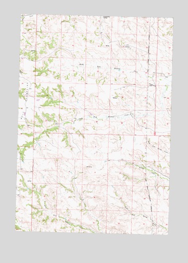
Bar V Ranch NE, MT USGS Topographic Map
Click on map above to begin viewing in our Map Viewer.

This topographic map contains these locations and features:
Feature Name Type Latitude Longitude GNIS ID View Map
07S38E12DCA_01 SpringSpringN45.2416°W107.0201°808549View Map
07S38E14ACDD01 SpringSpringN45.2328°W107.0363°808517View Map
07S38E24DADB01 SpringSpringN45.2155°W107.0148°808458View Map
07S38E24DADB02 SpringSpringN45.2155°W107.0165°808459View Map
07S38E24DBD_01 WellWellN45.2161°W107.0165°808463View Map
07S38E24DBD_02 SpringSpringN45.2155°W107.0165°808460View Map
07S39E07BDB_01 SpringSpringN45.2494°W107.0059°808577View Map
07S39E19CAD_01 WellWellN45.2158°W107.0062°808461View Map
07S39E19CBD_01 WellWellN45.2161°W107.0098°808462View Map
07S39E19DCB_01 SpringSpringN45.2139°W107.0015°808450View Map
07S39E31ABBB01 WellWellN45.1953°W107.0023°808387View Map
08S38E01CCDB01 SpringSpringN45.1686°W107.0067°808278View Map
08S38E02CCBA01 SpringSpringN45.1697°W107.0292°808284View Map
08S38E11ADBC01 SpringSpringN45.1625°W107.0151°808244View Map
08S38E11ADBD01 WellWellN45.1625°W107.0145°808243View Map
08S38E12CBBC01 SpringSpringN45.1591°W107.0092°808226View Map
08S38E17DADD01 WellWellN45.1427°W107.0723°808162View Map
08S38E17DADD02 WellWellN45.1427°W107.0723°808163View Map
North Fork Rosebud CreekStreamN45.2136°W107.0026°774795View Map
South Fork Rosebud CreekStreamN45.2133°W107.0020°776865View Map

Note: Coordinates in the location and feature list above are referenced to NAD83 datum.


Copyright (C) 2008-2024 Ryan Niemi / Sunset Dynamics ... All Rights Reserved