TopoQuest Logo
Do you find TopoQuest useful?
Help keep TopoQuest running and adding new maps/features by donating!
Bitcoin:  19c7KJd3qBynnjoSw5npx9KScwjBe4ifkT
Litecoin:  LXs6TkuXGGXo1vDsWCkWVdjQX94eUKd6ui
Home View Maps Find Maps Find Places Resources & Links


Half Moon Hill, Montana Topographic Map

USGS Map Title: Half Moon Hill, MT
USGS Map MRC: 45106B8
DRG (GeoTIFF) Download: o45106b8.tif


Neighboring USGS Topographic Map Quads:


  Spring Creek Ranch, MT  
45107C1
 

  Kirby, MT  
45106C8
 

  Taintor Desert, MT  
45106C7
 

  Bar V Ranch NE, MT  
45107B1
 

  Half Moon Hill, MT  
45106B8
 

  Tongue River Dam, MT  
45106B7
 

  Bar V Ranch, MT  
45107A1
 

  Pearl School, MT  
45106A8
 

  Decker, MT  
45106A7


Map MRC Location:

N46°
W107°
N46°
W106°
H8 H7 H6 H5 H4 H3 H2 H1
G8 G7 G6 G5 G4 G3 G2 G1
F8 F7 F6 F5 F4 F3 F2 F1
E8 E7 E6 E5 E4 E3 E2 E1
D8 D7 D6 D5 D4 D3 D2 D1
C8 C7 C6 C5 C4 C3 C2 C1
B8 B7 B6 B5 B4 B3 B2 B1
A8 A7 A6 A5 A4 A3 A2 A1
N45°
W107°
N45°
W106°

Half Moon Hill, MT USGS 1:24K Topographic Map Preview:
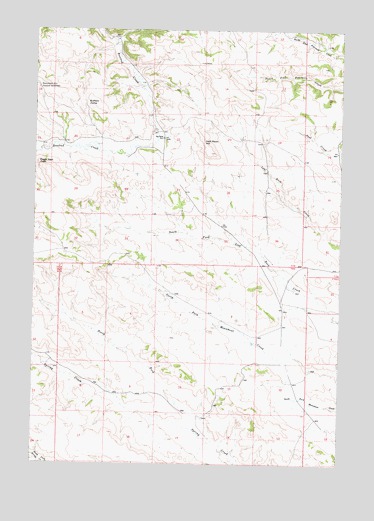
Half Moon Hill, MT USGS Topographic Map
Click on map above to begin viewing in our Map Viewer.

This topographic map contains these locations and features:
Feature Name Type Latitude Longitude GNIS ID View Map
06S40E07CABB01 SpringSpringN45.2453°W106.8856°808565View Map
07S39E08BCAD01 SpringSpringN45.2494°W106.9887°808576View Map
07S39E09CBA_01 WellWellN45.2455°W106.9687°808566View Map
07S39E09CBD_01 WellWellN45.2450°W106.9695°808563View Map
07S39E10BCAC01 SpringSpringN45.2497°W106.9487°808580View Map
07S39E10CCDA__ SpringSpringN45.2344°W106.9473°808525View Map
07S39E11DDB_01 WellWellN45.2422°W106.9153°808551View Map
07S39E12ACDD01 SpringSpringN45.2486°W106.8962°808573View Map
07S39E14AAD_01 WellWellN45.2372°W106.9131°808535View Map
07S39E15BCD_01 SpringSpringN45.2341°W106.9473°808524View Map
07S39E15DBA_01 WellWellN45.2328°W106.9384°808516View Map
07S39E16ACD_01 WellWellN45.2339°W106.9584°808521View Map
07S39E16ADAD01 WellWellN45.2350°W106.9537°808529View Map
07S39E16ADC_01 WellWellN45.2330°W106.9578°808518View Map
07S39E20DAAC01 WellWellN45.2166°W106.9751°808465View Map
07S39E20DADA01 WellWellN45.2164°W106.9745°808464View Map
07S39E21ADA_01 WellWellN45.2203°W106.9534°808486View Map
07S39E21ADA_02 WellWellN45.2203°W106.9534°808485View Map
07S39E21CDA_01 WellWellN45.2133°W106.9634°808446View Map
07S39E21CDA_02 WellWellN45.2133°W106.9631°808445View Map
07S39E22BCDC01 WellWellN45.2189°W106.9476°808478View Map
07S39E23ACD_02 WellWellN45.2189°W106.9176°808476View Map
07S39E23ACD_03 WellWellN45.2186°W106.9178°808472View Map
07S39E23ACD_04 WellWellN45.2200°W106.9145°808482View Map
07S39E23ACD_05 WellWellN45.2203°W106.9151°808483View Map
07S39E23ACD_06 WellWellN45.2203°W106.9153°808484View Map
07S39E23ACD_07 WellWellN45.2189°W106.9178°808477View Map
07S39E23ACDD01 SpringSpringN45.2191°W106.9173°808480View Map
07S39E24BCD_01 WellWellN45.2189°W106.9065°808475View Map
07S39E24DDD_01 WellWellN45.2130°W106.8928°808443View Map
07S39E27CDC_01 WellWellN45.1966°W106.9453°808391View Map
07S39E27DCDD01 WellWellN45.1975°W106.9381°808393View Map
07S39E31ACA_01 WellWellN45.1925°W106.9992°808377View Map
07S39E34BCCB01 WellWellN45.1908°W106.9515°808365View Map
07S39E35ACC_01 WellWellN45.1894°W106.9156°808361View Map
07S39E35DAB_01 WellWellN45.1908°W106.9203°808364View Map
07S39E36CDD_01 WellWellN45.1830°W106.8937°808340View Map
07S40E18BBBC01 SpringSpringN45.2364°W106.8903°808532View Map
07S40E18BBDD01 SpringSpringN45.2350°W106.8867°808528View Map
07S40E30CCBD01 WellWellN45.1966°W106.8898°808390View Map
07S40E30DABB01 WellWellN45.2014°W106.8751°808406View Map
08S38E01ADAA01 SpringSpringN45.1775°W106.9915°808318View Map
08S38E12DCDD01 WellWellN45.1525°W106.9951°808198View Map
08S38E13ABAB01 SpringSpringN45.1525°W106.9970°808199View Map
08S39E01ABAA01 WellWellN45.1747°W106.8937°808310View Map
08S39E01BABB01 WellWellN45.1814°W106.9040°808328View Map
08S39E01DCCC01 WellWellN45.1547°W106.8976°808211View Map
08S39E02DAAD01 WellWellN45.1603°W106.9095°808230View Map
08S39E02DAAD02 WellWellN45.1605°W106.9095°808235View Map
08S39E04BBBB01 SpringSpringN45.1700°W106.9695°808287View Map
08S39E04CBBC01 SpringSpringN45.1597°W106.9692°808229View Map
08S39E08CCAD01 SpringSpringN45.1419°W106.9862°808153View Map
08S39E12ACBB01 WellWellN45.1497°W106.8970°808187View Map
08S39E12ACBB02 WellWellN45.1500°W106.8981°808188View Map
08S39E13BBCC01 WellWellN45.1369°W106.9087°808124View Map
08S39E14CBBC01 WellWellN45.1314°W106.9290°808087View Map
08S39E16ADCA01 SpringSpringN45.1339°W106.9528°808105View Map
08S40E07BBCA01 WellWellN45.1525°W106.8867°808197View Map
08S40E18BBAD01 WellWellN45.1391°W106.8845°808137View Map
Big Bend SchoolSchoolN45.2189°W106.9484°768748View Map
Bluffer Post Office (historical)Post OfficeN45.1605°W106.9728°1716498View Map
Buffalo JumpSummitN45.2289°W106.9740°769354View Map
Eagle Nest PeakSummitN45.2119°W106.9990°770961View Map
Half Moon HillSummitN45.2183°W106.9317°772069View Map
Monument HillLocaleN45.2330°W106.9987°801185View Map
North Fork Spring CreekStreamN45.1322°W106.9262°774814View Map
Rosebud Battlefield State ParkParkN45.2305°W106.9978°1716369View Map

Note: Coordinates in the location and feature list above are referenced to NAD83 datum.


Copyright (C) 2008-2025 Ryan Niemi / Sunset Dynamics ... All Rights Reserved