TopoQuest Logo
Do you find TopoQuest useful?
Help keep TopoQuest running and adding new maps/features by donating!
Bitcoin:  19c7KJd3qBynnjoSw5npx9KScwjBe4ifkT
Litecoin:  LXs6TkuXGGXo1vDsWCkWVdjQX94eUKd6ui
Home View Maps Find Maps Find Places Resources & Links


Bar V Ranch, Montana Topographic Map

USGS Map Title: Bar V Ranch, MT
USGS Map MRC: 45107A1
DRG (GeoTIFF) Download: o45107a1.tif


Neighboring USGS Topographic Map Quads:


  Kid Creek, MT  
45107B2
 

  Bar V Ranch NE, MT  
45107B1
 

  Half Moon Hill, MT  
45106B8
 

  Little Bear Creek, MT  
45107A2
 

  Bar V Ranch, MT  
45107A1
 

  Pearl School, MT  
45106A8
 

  Ranchester, WY  
44107H2
 

  Monarch, WY  
44107H1
 

  Acme, WY  
44106H8


Map MRC Location:

N46°
W108°
N46°
W107°
H8 H7 H6 H5 H4 H3 H2 H1
G8 G7 G6 G5 G4 G3 G2 G1
F8 F7 F6 F5 F4 F3 F2 F1
E8 E7 E6 E5 E4 E3 E2 E1
D8 D7 D6 D5 D4 D3 D2 D1
C8 C7 C6 C5 C4 C3 C2 C1
B8 B7 B6 B5 B4 B3 B2 B1
A8 A7 A6 A5 A4 A3 A2 A1
N45°
W108°
N45°
W107°

Bar V Ranch, MT USGS 1:24K Topographic Map Preview:
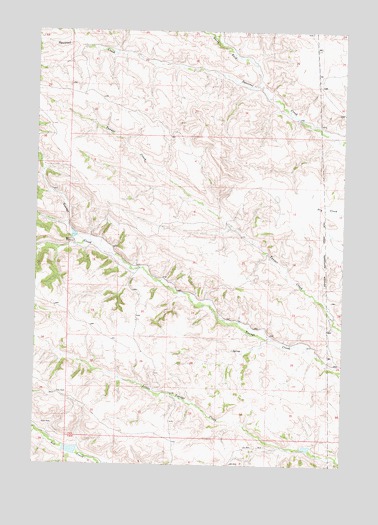
Bar V Ranch, MT USGS Topographic Map
Click on map above to begin viewing in our Map Viewer.

This topographic map contains these locations and features:
Feature Name Type Latitude Longitude GNIS ID View Map
08S38E28DADB01 WellWellN45.1139°W107.0526°807977View Map
08S38E28DADB02 WellWellN45.1139°W107.0526°807978View Map
08S38E31CADC01 SpringSpringN45.0989°W107.1048°807903View Map
09S38E07DADB01 WellWellN45.0702°W107.0934°807707View Map
09S38E10CCAA01 WellWellN45.0691°W107.0467°807688View Map
09S38E10CCAA02 WellWellN45.0691°W107.0467°807689View Map
09S38E22CBB_01 SpringSpringN45.0433°W107.0498°807510View Map
09S38E22DADA01 WellWellN45.0419°W107.0312°807504View Map
09S38E22DADC01 WellWellN45.0414°W107.0320°807497View Map
09S38E23CDAD01 WellWellN45.0391°W107.0212°807477View Map
09S38E23CDDA01 WellWellN45.0364°W107.0179°807452View Map
09S38E24BBBC01 WellWellN45.0491°W107.0095°807540View Map
09S38E24BCAC01 WellWellN45.0475°W107.0095°807530View Map
09S38E24CABC01 WellWellN45.0428°W107.0037°807509View Map
09S38E24CABC02 WellWellN45.0425°W107.0051°807506View Map
09S38E25BCBA01 WellWellN45.0328°W107.0084°807428View Map
09S38E25CBDC01 WellWellN45.0269°W107.0065°807390View Map
09S38E26ABAB01 WellWellN45.0364°W107.0167°807451View Map
09S38E27ACBB01 WellWellN45.0327°W107.0398°807429View Map
09S38E27ACBB02 WellWellN45.0330°W107.0417°807434View Map
09S38E28BDA_01 SpringSpringN45.0325°W107.0626°807426View Map
09S38E35AABD01 WellWellN45.0211°W107.0134°807357View Map
10S38E01CADD01 WellWellN45.0011°W107.0009°807275View Map
Bar V Number 1 DamDamN45.0033°W107.1090°797295View Map
Bar V RanchLocaleN45.0639°W107.1104°768496View Map
Crow Number 71 DamDamN45.0666°W107.1106°797294View Map
Crow Number 72 DamDamN45.0050°W107.0140°797296View Map
North Fork Squirrel CreekStreamN45.1094°W107.0345°774815View Map
Pearl Post Office (historical)Post OfficeN45.0147°W107.0201°1716502View Map
Weltner School (historical)SchoolN45.0739°W107.0001°1716477View Map

Note: Coordinates in the location and feature list above are referenced to NAD83 datum.


Copyright (C) 2008-2025 Ryan Niemi / Sunset Dynamics ... All Rights Reserved