TopoQuest Logo
Do you find TopoQuest useful?
Help keep TopoQuest running and adding new maps/features by donating!
Bitcoin:  19c7KJd3qBynnjoSw5npx9KScwjBe4ifkT
Litecoin:  LXs6TkuXGGXo1vDsWCkWVdjQX94eUKd6ui
Home View Maps Find Maps Find Places Resources & Links


Kirksville, Kentucky Topographic Map

USGS Map Title: Kirksville, KY
USGS Map MRC: 37084F4
DRG (GeoTIFF) Download: o37084f4.tif


Neighboring USGS Topographic Map Quads:


  Little Hickman, KY  
37084G5
 

  Valley View, KY  
37084G4
 

  Richmond North, KY  
37084G3
 

  Buckeye, KY  
37084F5
 

  Kirksville, KY  
37084F4
 

  Richmond South, KY  
37084F3
 

  Lancaster, KY  
37084E5
 

  Paint Lick, KY  
37084E4
 

  Berea, KY  
37084E3


Map MRC Location:

N38°
W85°
N38°
W84°
H8 H7 H6 H5 H4 H3 H2 H1
G8 G7 G6 G5 G4 G3 G2 G1
F8 F7 F6 F5 F4 F3 F2 F1
E8 E7 E6 E5 E4 E3 E2 E1
D8 D7 D6 D5 D4 D3 D2 D1
C8 C7 C6 C5 C4 C3 C2 C1
B8 B7 B6 B5 B4 B3 B2 B1
A8 A7 A6 A5 A4 A3 A2 A1
N37°
W85°
N37°
W84°

Kirksville, KY USGS 1:24K Topographic Map Preview:
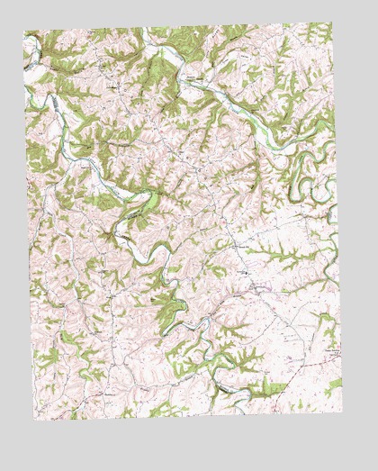
Kirksville, KY USGS Topographic Map
Click on map above to begin viewing in our Map Viewer.

This topographic map contains these locations and features:
Feature Name Type Latitude Longitude GNIS ID View Map
Back CreekStreamN37.7076°W84.4802°486177View Map
Ball BranchStreamN37.7181°W84.4072°486287View Map
Barnes Mill (historical)LocaleN37.7106°W84.3968°2557552View Map
Beech Grove ChurchChurchN37.7051°W84.4730°486728View Map
Beech Grove School (historical)SchoolN37.7049°W84.4728°2564685View Map
Bethel ChurchChurchN37.6609°W84.4855°486980View Map
Bogie BranchStreamN37.7298°W84.4260°487621View Map
Bogies Mill (historical)LocaleN37.7309°W84.4338°2557567View Map
Bradshaw Mill (historical)LocaleN37.7109°W84.4845°2557553View Map
Bradshaw School (historical)SchoolN37.6667°W84.4934°2564690View Map
Bradshawmill Post Office (historical)Post OfficeN37.7113°W84.4847°2557554View Map
Broadus BranchStreamN37.6429°W84.4288°487938View Map
Brown BranchStreamN37.7223°W84.4138°487985View Map
Caney BranchStreamN37.6540°W84.4874°488816View Map
Cincinnati BranchStreamN37.6770°W84.4427°489516View Map
Corinth ChurchChurchN37.7315°W84.4277°490104View Map
CottonburgPopulated PlaceN37.7306°W84.4619°507767View Map
Cottonsburg Post Office (historical)Post OfficeN37.7309°W84.4618°2558310View Map
Coy CemeteryCemeteryN37.6856°W84.4444°490236View Map
Crow ValleyPopulated PlaceN37.7404°W84.4144°507788View Map
Devours Mill (historical)LocaleN37.6365°W84.4583°2564703View Map
Devours Mill BranchStreamN37.6356°W84.4586°2564704View Map
Dog Walk BranchStreamN37.6562°W84.4280°490985View Map
Dry BranchStreamN37.7142°W84.4847°491149View Map
Duck BranchStreamN37.7437°W84.4452°491248View Map
Elizabeth ChurchChurchN37.7209°W84.4088°491633View Map
Freedom ChurchChurchN37.6520°W84.4744°492504View Map
Freedom School (historical)SchoolN37.6519°W84.4744°2564716View Map
Gilead Baptist ChuchChurchN37.7084°W84.4383°492830View Map
Gilead BranchStreamN37.6976°W84.4499°492826View Map
Gilead CemeteryCemeteryN37.7095°W84.4397°1744623View Map
Greens BranchStreamN37.7159°W84.4027°493334View Map
HackleyPopulated PlaceN37.6331°W84.4716°508153View Map
Hackley Post Office (historical)Post OfficeN37.6332°W84.4714°2564722View Map
Hallidays Chapel (historical)ChurchN37.6359°W84.4577°2564723View Map
Happy LandingPopulated PlaceN37.6412°W84.3810°508177View Map
King TabernacleChurchN37.6429°W84.3758°495747View Map
Kinnard CemeteryCemeteryN37.6379°W84.4066°495773View Map
KirksvillePopulated PlaceN37.6654°W84.4091°495804View Map
Kirksville DivisionCivilN37.6869°W84.3861°1937127View Map
Kirksville Elementary SchoolSchoolN37.6704°W84.4124°495805View Map
Kirksville Post Office (historical)Post OfficeN37.6655°W84.4085°2557523View Map
Kirksville Volunteer Fire DepartmentBuildingN37.6751°W84.4265°2637267View Map
Long BranchStreamN37.6917°W84.4922°497072View Map
Moberlys BranchStreamN37.7265°W84.4182°2558308View Map
Moore CemeteryCemeteryN37.7159°W84.3944°498544View Map
NinaPopulated PlaceN37.6640°W84.4663°508707View Map
Nina Post Office (historical)Post OfficeN37.6635°W84.4672°2564760View Map
Nina RidgeRidgeN37.6620°W84.4671°2564761View Map
Poosey CemeteryCemeteryN37.7379°W84.4694°501082View Map
Ross CemeteryCemeteryN37.6688°W84.4452°2557524View Map
Round HillPopulated PlaceN37.6790°W84.4160°502399View Map
Round HillSummitN37.6810°W84.4207°2557540View Map
Round Hill School (historical)SchoolN37.6791°W84.4166°2557538View Map
RuthtonPopulated PlaceN37.7329°W84.4335°508991View Map
Ruthton Post Office (historical)Post OfficeN37.7334°W84.4343°2557568View Map
Salem ChurchChurchN37.7487°W84.4733°502789View Map
Salem Church CemeteryCemeteryN37.7492°W84.4733°2557583View Map
Schoolers BranchStreamN37.7059°W84.4068°2557546View Map
Sebastian CemeteryCemeteryN37.6743°W84.4711°2564772View Map
Sebastian CemeteryCemeteryN37.6723°W84.4710°503137View Map
Spoonville Post Office (historical)Post OfficeN37.6536°W84.4750°2564776View Map
Tracy BranchStreamN37.7323°W84.4369°505456View Map
Walkers School (historical)SchoolN37.6427°W84.4625°2564788View Map
Wheeler BranchStreamN37.7395°W84.4947°506526View Map
Wheeler CemeteryCemeteryN37.6620°W84.4516°506535View Map
Wheeler Cemetery (Historical)CemeteryN37.6625°W84.4517°2564789View Map

Note: Coordinates in the location and feature list above are referenced to NAD83 datum.


Copyright (C) 2008-2025 Ryan Niemi / Sunset Dynamics ... All Rights Reserved