TopoQuest Logo
Do you find TopoQuest useful?
Help keep TopoQuest running and adding new maps/features by donating!
Bitcoin:  19c7KJd3qBynnjoSw5npx9KScwjBe4ifkT
Litecoin:  LXs6TkuXGGXo1vDsWCkWVdjQX94eUKd6ui
Home View Maps Find Maps Find Places Resources & Links


Berea, Kentucky Topographic Map

USGS Map Title: Berea, KY
USGS Map MRC: 37084E3
DRG (GeoTIFF) Download: o37084e3.tif


Neighboring USGS Topographic Map Quads:


  Kirksville, KY  
37084F4
 

  Richmond South, KY  
37084F3
 

  Moberly, KY  
37084F2
 

  Paint Lick, KY  
37084E4
 

  Berea, KY  
37084E3
 

  Bighill, KY  
37084E2
 

  Brodhead, KY  
37084D4
 

  Wildie, KY  
37084D3
 

  Johnetta, KY  
37084D2


Map MRC Location:

N38°
W85°
N38°
W84°
H8 H7 H6 H5 H4 H3 H2 H1
G8 G7 G6 G5 G4 G3 G2 G1
F8 F7 F6 F5 F4 F3 F2 F1
E8 E7 E6 E5 E4 E3 E2 E1
D8 D7 D6 D5 D4 D3 D2 D1
C8 C7 C6 C5 C4 C3 C2 C1
B8 B7 B6 B5 B4 B3 B2 B1
A8 A7 A6 A5 A4 A3 A2 A1
N37°
W85°
N37°
W84°

Berea, KY USGS 1:24K Topographic Map Preview:
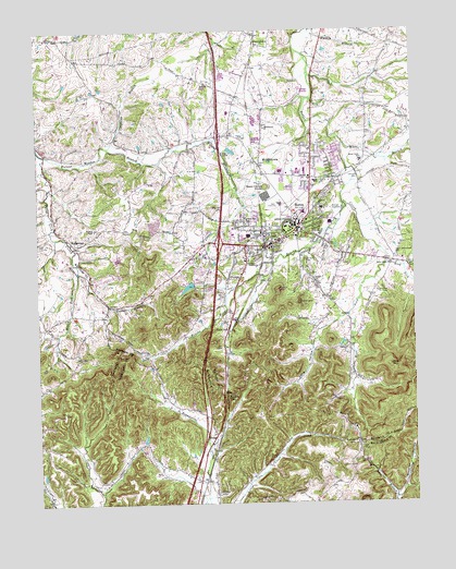
Berea, KY USGS Topographic Map
Click on map above to begin viewing in our Map Viewer.

This topographic map contains these locations and features:
Feature Name Type Latitude Longitude GNIS ID View Map
Abney CemeteryCemeteryN37.5156°W84.2691°485734View Map
Allen Chapel (historical)ChurchN37.5625°W84.2974°2557484View Map
Asbury Post Office (historical)Post OfficeN37.5449°W84.3263°2557480View Map
Baker School (historical)SchoolN37.5496°W84.3673°2564683View Map
Bear MountainSummitN37.5362°W84.2580°486572View Map
Bear Mountain HollowValleyN37.5322°W84.2697°2557478View Map
BereaPopulated PlaceN37.5687°W84.2963°486894View Map
Berea City Police DepartmentBuildingN37.5695°W84.2952°2767513View Map
Berea CollegeSchoolN37.5733°W84.2893°486902View Map
Berea Fire Department Station No 1BuildingN37.5699°W84.2944°2636477View Map
Berea Fire Department Station Number 2BuildingN37.5864°W84.2944°2636623View Map
Berea Volunteer Fire and RescueBuildingN37.5875°W84.2826°2637324View Map
Bethal Baptist ChurchChurchN37.5581°W84.2827°486978View Map
Blythewood Estates (historical)Populated PlaceN37.5897°W84.3009°2558302View Map
BoonePopulated PlaceN37.5176°W84.3166°507551View Map
Boone GapGapN37.5284°W84.3127°487693View Map
Brushy ForkStreamN37.5790°W84.2727°488121View Map
City of BereaCivilN37.5904°W84.2898°2403858View Map
Davis HollowValleyN37.5628°W84.2518°511743View Map
Dead Horse KnobSummitN37.5837°W84.2980°490719View Map
East Fork Silver CreekStreamN37.5637°W84.2588°511992View Map
Fairview CemeteryCemeteryN37.5026°W84.3160°491902View Map
FarristownPopulated PlaceN37.6226°W84.3002°491998View Map
Flat Gap Baptist ChurchChurchN37.5401°W84.3383°492193View Map
Foley Middle SchoolSchoolN37.5866°W84.2878°2557498View Map
Galilee ChurchChurchN37.5412°W84.2730°492655View Map
Gap Station (historical)LocaleN37.5171°W84.3164°2726016View Map
Glades Christian ChurchChurchN37.5854°W84.2813°492874View Map
Gospel TabernacleChurchN37.5634°W84.3047°493050View Map
Johnson CemeteryCemeteryN37.5859°W84.2677°495382View Map
Johnsons Shop Post Office (historical)Post OfficeN37.5797°W84.2731°2557491View Map
Judytown BranchStreamN37.5940°W84.3505°495545View Map
KentuckyOne Health Saint Joseph Berea HospitalHospitalN37.5764°W84.2865°2660368View Map
Long HollowValleyN37.5492°W84.2725°497119View Map
Macedonia ChurchChurchN37.5159°W84.2699°497416View Map
Mason ForkStreamN37.5615°W84.3613°497660View Map
Mason Fork Baptist Church (historical)ChurchN37.5491°W84.3670°2564751View Map
Mayde Railroad Station (historical)LocaleN37.6159°W84.3029°2557504View Map
MiddletownPopulated PlaceN37.5898°W84.2999°498158View Map
Middletown Baptist ChurchChurchN37.5990°W84.2983°498160View Map
Ogg CemeteryCemeteryN37.5963°W84.3284°2557501View Map
Rocky BranchStreamN37.5615°W84.3613°502229View Map
Scaffold Cane RidgeRidgeN37.5202°W84.2770°2557477View Map
Shearer HollowValleyN37.5016°W84.2565°515339View Map
Silver Creek Baptist ChurchChurchN37.5631°W84.2574°503509View Map
Silver Creek CemeteryCemeteryN37.5565°W84.2602°503508View Map
Silver Creek SchoolSchoolN37.5904°W84.2666°503510View Map
Slate LickPopulated PlaceN37.5465°W84.3110°503652View Map
Slate Lick Railroad Station (historical)LocaleN37.5485°W84.3092°2557481View Map
Snider Station (historical)LocaleN37.5041°W84.3208°2726038View Map
Terrill BranchStreamN37.5948°W84.2727°515895View Map
The GladesAreaN37.5863°W84.2763°2557497View Map
Todd CemeteryCemeteryN37.5554°W84.3133°505314View Map
Todd CemeteryCemeteryN37.5970°W84.3101°2558303View Map
Union Church of Christ Historical MarkerParkN37.5714°W84.2886°2745080View Map
Upper Silver Creek SchoolSchoolN37.5654°W84.2552°505902View Map
WallacetonPopulated PlaceN37.5681°W84.3622°506146View Map
Wallaceton Baptist ChurchChurchN37.5688°W84.3613°2557486View Map
Wallaceton Post Office (historical)Post OfficeN37.5683°W84.3622°2557485View Map
Walleceton United methodist ChurchChurchN37.5723°W84.3555°506142View Map
Walnut Meadow BranchStreamN37.5923°W84.3722°506190View Map
Welch MountainSummitN37.5562°W84.2952°507347View Map
West Fork Silver CreekStreamN37.5637°W84.2591°506448View Map
West Side ChurchChurchN37.5754°W84.3047°506478View Map
Williams CemeteryCemeteryN37.5640°W84.2855°506802View Map
Witt CemeteryCemeteryN37.5154°W84.2680°506975View Map
WKXO-AM (Berea)TowerN37.5867°W84.3010°517776View Map
Wolf BranchStreamN37.5221°W84.3606°2564791View Map

Note: Coordinates in the location and feature list above are referenced to NAD83 datum.


Copyright (C) 2008-2024 Ryan Niemi / Sunset Dynamics ... All Rights Reserved