TopoQuest Logo
Do you find TopoQuest useful?
Help keep TopoQuest running and adding new maps/features by donating!
Bitcoin:  19c7KJd3qBynnjoSw5npx9KScwjBe4ifkT
Litecoin:  LXs6TkuXGGXo1vDsWCkWVdjQX94eUKd6ui
Home View Maps Find Maps Find Places Resources & Links


Kitts Hill, Ohio Topographic Map

USGS Map Title: Kitts Hill, OH
USGS Map MRC: 38082E5
DRG (GeoTIFF) Download: o38082e5.tif


Neighboring USGS Topographic Map Quads:


  Pedro, OH  
38082F6
 

  Sherritts, OH  
38082F5
 

  Waterloo, OH  
38082F4
 

  Ironton, OH  
38082E6
 

  Kitts Hill, OH  
38082E5
 

  Aid, OH  
38082E4
 

  Ashland, KY  
38082D6
 

  Catlettsburg, KY  
38082D5
 

  Huntington, WV  
38082D4


Map MRC Location:

N39°
W83°
N39°
W82°
H8 H7 H6 H5 H4 H3 H2 H1
G8 G7 G6 G5 G4 G3 G2 G1
F8 F7 F6 F5 F4 F3 F2 F1
E8 E7 E6 E5 E4 E3 E2 E1
D8 D7 D6 D5 D4 D3 D2 D1
C8 C7 C6 C5 C4 C3 C2 C1
B8 B7 B6 B5 B4 B3 B2 B1
A8 A7 A6 A5 A4 A3 A2 A1
N38°
W83°
N38°
W82°

Kitts Hill, OH USGS 1:24K Topographic Map Preview:
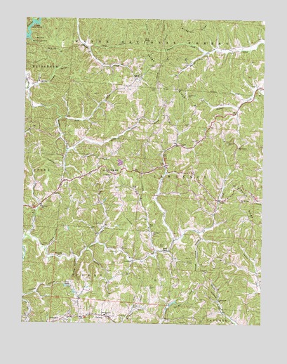
Kitts Hill, OH USGS Topographic Map
Click on map above to begin viewing in our Map Viewer.

This topographic map contains these locations and features:
Feature Name Type Latitude Longitude GNIS ID View Map
Allen CemeteryCemeteryN38.5067°W82.5660°1075251View Map
Allen CemeteryCemeteryN38.5295°W82.5757°1075252View Map
AndisPopulated PlaceN38.5509°W82.5232°1075263View Map
Andis Elementary SchoolSchoolN38.5506°W82.5227°1050550View Map
Andis Post Office (historical)Post OfficeN38.5515°W82.5235°2025707View Map
Bald KnobPopulated PlaceN38.5726°W82.5129°1067439View Map
Bald Knob CemeteryCemeteryN38.5745°W82.5185°1075300View Map
Bald Knob ChurchChurchN38.5720°W82.5129°1075301View Map
Bazell CemeteryCemeteryN38.5323°W82.5532°1075318View Map
Blair CemeteryCemeteryN38.5695°W82.5649°1961193View Map
Bluegrass RidgeRidgeN38.6215°W82.5363°1075415View Map
Brammer CemeteryCemeteryN38.5145°W82.5585°1075436View Map
Brammer PondReservoirN38.5086°W82.5463°1077856View Map
Brammer Pond DamDamN38.5067°W82.5482°1077855View Map
Buck CreekStreamN38.5715°W82.5990°1075465View Map
Centenary ChurchChurchN38.5029°W82.6015°1075550View Map
Cherryville (historical)Populated PlaceN38.6112°W82.5307°1050548View Map
Cherryville Post Office (historical)Post OfficeN38.6112°W82.5304°2025717View Map
Currington CemeteryCemeteryN38.5362°W82.5565°1075663View Map
Dearing Post Office (historical)Post OfficeN38.5029°W82.5832°2025720View Map
DeeringPopulated PlaceN38.5034°W82.5832°1075699View Map
Deering Elementary SchoolSchoolN38.5037°W82.5815°1075686View Map
Dog ForkStreamN38.5345°W82.5460°1075728View Map
Edgemeade of Ohio CenterLocaleN38.5992°W82.6177°1083205View Map
Fair Haven Lake DamDamN38.5167°W82.6032°1079217View Map
Fields CemeteryCemeteryN38.5248°W82.5785°1075845View Map
Five ForksPopulated PlaceN38.6145°W82.5607°1075854View Map
ForestdalePopulated PlaceN38.5023°W82.6035°1075866View Map
Forestdale Post Office (historical)Post OfficeN38.5029°W82.6040°2025869View Map
Fradd CemeteryCemeteryN38.5959°W82.5557°1075873View Map
Gina LakeReservoirN38.5155°W82.6019°1075921View Map
Hackworth CemeteryCemeteryN38.5406°W82.5832°1075976View Map
Hecla SchoolSchoolN38.5481°W82.6240°1050551View Map
Hungry HollowValleyN38.5990°W82.6129°1076091View Map
Ice Creek CemeteryCemeteryN38.5026°W82.5729°1076103View Map
Justice HollowValleyN38.5309°W82.6118°1076161View Map
Keys CemeteryCemeteryN38.5179°W82.5540°1076177View Map
Kitts CemeteryCemeteryN38.5615°W82.5774°1961203View Map
Kitts HillPopulated PlaceN38.5615°W82.5774°1076190View Map
Kitts Hill Post OfficePost OfficeN38.5612°W82.5777°2026100View Map
Lake VesuviusReservoirN38.6233°W82.6209°1077119View Map
Lawrence CountyCivilN38.5985°W82.5368°1074056View Map
Lawrence Township Fire Department Station 2BuildingN38.5477°W82.5239°2549580View Map
Lawrence Township Volunteer Fire Department Station 1 HeadquartersBuildingN38.5612°W82.5772°2549103View Map
Leach CemeteryCemeteryN38.5820°W82.5410°1076221View Map
Leatherwood CemeteryCemeteryN38.5215°W82.5302°1076225View Map
Leatherwood ChurchChurchN38.5092°W82.5224°1076226View Map
Little Storms CreekStreamN38.5959°W82.6241°1076279View Map
Lodge RidgeRidgeN38.5967°W82.5460°1077265View Map
Lodge Ridge CemeteryCemeteryN38.5937°W82.5393°1076288View Map
Long HollowValleyN38.6137°W82.5904°1076293View Map
Maddy CemeteryCemeteryN38.5006°W82.5388°1076324View Map
Mamre CemeteryCemeteryN38.5626°W82.5821°1961208View Map
Mamre ChurchChurchN38.5604°W82.5790°1076330View Map
Manker (historical)Populated PlaceN38.5892°W82.5127°1050549View Map
Manker Post Office (historical)Post OfficeN38.5890°W82.5124°2026091View Map
Markin ForkStreamN38.6115°W82.5302°1076343View Map
Mays CemeteryCemeteryN38.5398°W82.5568°1076350View Map
Melvin CemeteryCemeteryN38.5204°W82.5710°1076376View Map
Myrtle RidgeRidgeN38.5423°W82.5052°1076490View Map
Myrtle Ridge Baptist CemeteryCemeteryN38.5509°W82.5143°1961211View Map
Myrtle Ridge ChurchChurchN38.5498°W82.5113°1076491View Map
Ned ForkStreamN38.5301°W82.5557°1076500View Map
Oakland ChapelChurchN38.6012°W82.5643°1076544View Map
Oakland Chapel CemeteryCemeteryN38.6020°W82.5649°1698959View Map
Perry Township Volunteer Fire Department Station 1 Deering HeadquartersBuildingN38.5028°W82.5795°2549899View Map
Rock CampPopulated PlaceN38.5298°W82.5485°1076752View Map
Rock Camp Post OfficePost OfficeN38.5292°W82.5485°2026016View Map
Rock Hill SchoolSchoolN38.5479°W82.6157°1077266View Map
Ross CemeteryCemeteryN38.5570°W82.5138°1076772View Map
Russell CemeteryCemeteryN38.6129°W82.5174°1698964View Map
Sand HillSummitN38.6117°W82.6085°1076821View Map
Skillet Handle HollowValleyN38.5351°W82.5318°1046319View Map
Skin CreekStreamN38.5845°W82.6060°1076902View Map
Spring BranchStreamN38.5298°W82.5915°1076947View Map
Stanley HollowValleyN38.5117°W82.6240°1076956View Map
Sugar CreekStreamN38.5354°W82.6215°1076989View Map
Township of LawrenceCivilN38.5577°W82.5385°1086443View Map
Triedstone ChurchChurchN38.5256°W82.5671°1077070View Map
Turkey ForkStreamN38.5334°W82.5871°1077084View Map
Union ChurchChurchN38.5734°W82.5421°1077100View Map
Webb CemeteryCemeteryN38.5270°W82.5360°1077151View Map
Webb CemeteryCemeteryN38.5559°W82.5652°1077152View Map
Wildcat HollowValleyN38.5262°W82.5965°1077186View Map
Williams CemeteryCemeteryN38.5254°W82.5360°1077193View Map

Note: Coordinates in the location and feature list above are referenced to NAD83 datum.


Copyright (C) 2008-2024 Ryan Niemi / Sunset Dynamics ... All Rights Reserved