TopoQuest Logo
Do you find TopoQuest useful?
Help keep TopoQuest running and adding new maps/features by donating!
Bitcoin:  19c7KJd3qBynnjoSw5npx9KScwjBe4ifkT
Litecoin:  LXs6TkuXGGXo1vDsWCkWVdjQX94eUKd6ui
Home View Maps Find Maps Find Places Resources & Links


Waterloo, Ohio Topographic Map

USGS Map Title: Waterloo, OH
USGS Map MRC: 38082F4
DRG (GeoTIFF) Download: o38082f4.tif


Neighboring USGS Topographic Map Quads:


  Gallia, OH  
38082G5
 

  Patriot, OH  
38082G4
 

  Rodney, OH  
38082G3
 

  Sherritts, OH  
38082F5
 

  Waterloo, OH  
38082F4
 

  Mercerville, OH  
38082F3
 

  Kitts Hill, OH  
38082E5
 

  Aid, OH  
38082E4
 

  Athalia, OH  
38082E3


Map MRC Location:

N39°
W83°
N39°
W82°
H8 H7 H6 H5 H4 H3 H2 H1
G8 G7 G6 G5 G4 G3 G2 G1
F8 F7 F6 F5 F4 F3 F2 F1
E8 E7 E6 E5 E4 E3 E2 E1
D8 D7 D6 D5 D4 D3 D2 D1
C8 C7 C6 C5 C4 C3 C2 C1
B8 B7 B6 B5 B4 B3 B2 B1
A8 A7 A6 A5 A4 A3 A2 A1
N38°
W83°
N38°
W82°

Waterloo, OH USGS 1:24K Topographic Map Preview:
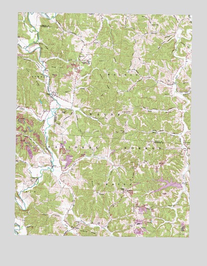
Waterloo, OH USGS Topographic Map
Click on map above to begin viewing in our Map Viewer.

This topographic map contains these locations and features:
Feature Name Type Latitude Longitude GNIS ID View Map
Aaron CreekStreamN38.6573°W82.4835°1075240View Map
Alltop HollowValleyN38.6279°W82.4660°1075256View Map
ArabiaPopulated PlaceN38.6581°W82.4735°1075271View Map
Arabia Post Office (historical)Post OfficeN38.6584°W82.4735°2025708View Map
Bradshaw CemeteryCemeteryN38.6509°W82.4854°1075433View Map
Brumfield CemeteryCemeteryN38.6654°W82.4021°1961194View Map
Brushy BranchStreamN38.6281°W82.4607°1075456View Map
Buck CreekStreamN38.6559°W82.4724°1075466View Map
Buckeye CreekStreamN38.6326°W82.4590°1077262View Map
Buffalo CreekStreamN38.7287°W82.4938°1075478View Map
Clark CemeteryCemeteryN38.7029°W82.3901°1075575View Map
Coffee and Tea CreekStreamN38.6620°W82.4810°1075606View Map
Deer Creek HollowValleyN38.7362°W82.3877°1075697View Map
Drummond CemeteryCemeteryN38.7095°W82.3813°1075742View Map
Fairview Baptist CemeteryCemeteryN38.6320°W82.4549°1961199View Map
Fairview CemeteryCemeteryN38.6834°W82.4227°1964047View Map
Fairview ChurchChurchN38.6795°W82.4224°1075826View Map
Flag SpringPopulated PlaceN38.7240°W82.4557°1079655View Map
Flag Spring CemeteryCemeteryN38.7215°W82.4518°1075858View Map
Flag Spring ChurchChurchN38.7242°W82.4552°1075859View Map
German HollowValleyN38.7387°W82.3877°1075907View Map
German RidgeRidgeN38.7477°W82.4069°1066444View Map
German Ridge CemeteryCemeteryN38.7440°W82.4040°1075908View Map
Greasy RidgePopulated PlaceN38.6454°W82.4210°1075954View Map
Greasyridge Post Office (historical)Post OfficeN38.6459°W82.4207°2025873View Map
Haskins CemeteryCemeteryN38.6359°W82.3857°1076021View Map
Hog Back RidgeRidgeN38.7301°W82.4818°1076061View Map
Irvin CemeteryCemeteryN38.6931°W82.4838°1961202View Map
Jackson CemeteryCemeteryN38.7217°W82.4365°1076125View Map
Jenkins RidgeRidgeN38.7087°W82.4385°1076140View Map
Johns CreekStreamN38.6901°W82.4779°1076149View Map
Lambert CemeteryCemeteryN38.6528°W82.4918°1698957View Map
LectaPopulated PlaceN38.6692°W82.3771°1076228View Map
Lecta Post Office (historical)Post OfficeN38.6695°W82.3777°2025994View Map
Little Buffalo CreekStreamN38.7395°W82.4865°1076257View Map
Long CreekStreamN38.6551°W82.4738°1076291View Map
Meyers HollowValleyN38.6784°W82.3835°1076381View Map
Miller HillSummitN38.7187°W82.4704°1076394View Map
Mount Pleasant ChurchChurchN38.6442°W82.4204°1076457View Map
Mount Zion CemeteryCemeteryN38.6954°W82.4202°1068783View Map
Mount Zion ChurchChurchN38.6915°W82.4202°1076466View Map
Neal CemeteryCemeteryN38.7104°W82.3901°1076497View Map
Okey CemeteryCemeteryN38.6551°W82.3785°1961213View Map
Okey ChurchChurchN38.6492°W82.3788°1076552View Map
Old Baptist CemeteryCemeteryN38.6467°W82.4196°1961214View Map
Palestine ChurchChurchN38.6334°W82.4027°1076592View Map
Payne HollowValleyN38.6426°W82.4321°500297View Map
Payne LakeReservoirN38.6999°W82.4826°1077859View Map
Payne Lake DamDamN38.6984°W82.4815°1077858View Map
Peckerwood HollowValleyN38.7173°W82.4827°1076608View Map
Peter Cave CreekStreamN38.7029°W82.3815°1076621View Map
Pigeon CreekStreamN38.6937°W82.4682°1076627View Map
Pigeon KnobSummitN38.6912°W82.4682°1076628View Map
Rankin CemeteryCemeteryN38.6381°W82.4918°1698961View Map
Rose CemeteryCemeteryN38.6295°W82.3801°1961672View Map
Rucker CemeteryCemeteryN38.6312°W82.4154°1961220View Map
Sand ForkPopulated PlaceN38.7090°W82.3885°1076819View Map
Sandfork Post Office (historical)Post OfficeN38.7084°W82.3888°1988269View Map
Saunders CemeteryCemeteryN38.7331°W82.4435°1076838View Map
Spot HollowValleyN38.6581°W82.4299°1076945View Map
Timber Ridge LakeLakeN38.6544°W82.3904°1083371View Map
Timbre Ridge LakeReservoirN38.6551°W82.3815°1079368View Map
Timbre Ridge Lake DamDamN38.6541°W82.3810°1079367View Map
Township of MasonCivilN38.6345°W82.4174°1086444View Map
Township of WalnutCivilN38.7250°W82.4130°1086146View Map
Turkey CreekStreamN38.6629°W82.3768°1077082View Map
United Baptist CemeteryCemeteryN38.6404°W82.4026°1961674View Map
Walnut ChurchChurchN38.7087°W82.3888°1077133View Map
Walnut Ridge CemeteryCemeteryN38.6787°W82.3796°1964080View Map
Walnut Ridge ChurchChurchN38.6737°W82.3796°1077135View Map
WaterlooPopulated PlaceN38.7015°W82.4738°1077142View Map
Waterloo CemeteryCemeteryN38.7031°W82.4652°1077143View Map
Waterloo High School (historical)SchoolN38.7056°W82.4738°1068806View Map
Waterloo Post OfficePost OfficeN38.7017°W82.4735°2026040View Map
Wayne National Forest - Ironton Ranger DistrictForestN38.6876°W82.4971°1083679View Map
Webster CemeteryCemeteryN38.7170°W82.4588°1077157View Map
White HollowValleyN38.6931°W82.3818°1077182View Map
Wilson RidgeRidgeN38.6417°W82.4421°1077204View Map
Wiseman CemeteryCemeteryN38.6876°W82.4682°1077212View Map
YaricoPopulated PlaceN38.6617°W82.4082°1077239View Map
Yarico Post Office (historical)Post OfficeN38.6612°W82.4082°2026047View Map

Note: Coordinates in the location and feature list above are referenced to NAD83 datum.


Copyright (C) 2008-2024 Ryan Niemi / Sunset Dynamics ... All Rights Reserved