TopoQuest Logo
Do you find TopoQuest useful?
Help keep TopoQuest running and adding new maps/features by donating!
Bitcoin:  19c7KJd3qBynnjoSw5npx9KScwjBe4ifkT
Litecoin:  LXs6TkuXGGXo1vDsWCkWVdjQX94eUKd6ui
Home View Maps Find Maps Find Places Resources & Links


Knapp Creek, New York Topographic Map

USGS Map Title: Knapp Creek, NY
USGS Map MRC: 42078A5
DRG (GeoTIFF) Download: o42078a5.tif


Neighboring USGS Topographic Map Quads:


  Salamanca, NY  
42078B6
 

  Humphrey, NY  
42078B5
 

  Hinsdale, NY  
42078B4
 

  Limestone, NY  
42078A6
 

  Knapp Creek, NY  
42078A5
 

  Olean, NY  
42078A4
 

  Bradford, PA  
41078H6
 

  Derrick City, PA  
41078H5
 

  Eldred, PA  
41078H4


Map MRC Location:

N43°
W79°
N43°
W78°
H8 H7 H6 H5 H4 H3 H2 H1
G8 G7 G6 G5 G4 G3 G2 G1
F8 F7 F6 F5 F4 F3 F2 F1
E8 E7 E6 E5 E4 E3 E2 E1
D8 D7 D6 D5 D4 D3 D2 D1
C8 C7 C6 C5 C4 C3 C2 C1
B8 B7 B6 B5 B4 B3 B2 B1
A8 A7 A6 A5 A4 A3 A2 A1
N42°
W79°
N42°
W78°

Knapp Creek, NY USGS 1:24K Topographic Map Preview:
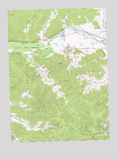
Knapp Creek, NY USGS Topographic Map
Click on map above to begin viewing in our Map Viewer.

This topographic map contains these locations and features:
Feature Name Type Latitude Longitude GNIS ID View Map
Allegany Drive-In (historical)LocaleN42.1075°W78.5364°2558454View Map
Allegany Fire DepartmentBuildingN42.0947°W78.5001°2735033View Map
Birch RunStreamN42.0917°W78.5747°944012View Map
Birch Run Country ClubLocaleN42.0876°W78.5259°974318View Map
Bradford Oil FieldOilfieldN42.0245°W78.5622°944571View Map
Carey HollowValleyN42.0767°W78.5003°969962View Map
ChipmunkPopulated PlaceN42.0570°W78.5753°946590View Map
Chipmunk CreekStreamN42.0851°W78.6203°946591View Map
Colonial Village Mobile Home ParkPopulated PlaceN42.1011°W78.5149°2598228View Map
Eagle Rod and Gun ClubLocaleN42.0845°W78.5264°974368View Map
First Free Methodist ChurchChurchN42.1089°W78.5008°2434601View Map
Fivemile CreekStreamN42.0931°W78.5061°969286View Map
Flatstone CreekStreamN42.0562°W78.5767°950262View Map
HarrisburgPopulated PlaceN42.0112°W78.5450°952276View Map
Knapp CreekPopulated PlaceN42.0070°W78.5059°954758View Map
Knapp Creek Volunteer Fire DepartmentBuildingN42.0080°W78.5003°2734674View Map
Long Acres Mobile Home ParkPopulated PlaceN42.0987°W78.5040°2598233View Map
Mount MoriahSummitN42.0734°W78.5617°957677View Map
Nichols RunPopulated PlaceN42.0034°W78.5206°958567View Map
Ninemile CreekStreamN42.0903°W78.5786°958596View Map
Sacred Heart ChurchChurchN42.0070°W78.5020°963190View Map
Saint Johns ChurchChurchN42.0828°W78.5950°963645View Map
Saint Patricks CemeteryCemeteryN42.0280°W78.6243°2554934View Map
South VandaliaPopulated PlaceN42.0834°W78.5903°965882View Map
Tenmile CreekStreamN42.0942°W78.6006°967156View Map
Town of AlleganyCivilN42.0870°W78.5212°978666View Map
Townsend HollowValleyN42.1070°W78.5506°967724View Map
Valley View Estates Mobile Home ParkPopulated PlaceN42.0943°W78.5250°2598236View Map
VandaliaPopulated PlaceN42.0962°W78.5797°968445View Map
WQRT-FM (Salamanca)TowerN42.1090°W78.6075°977796View Map

Note: Coordinates in the location and feature list above are referenced to NAD83 datum.


Copyright (C) 2008-2025 Ryan Niemi / Sunset Dynamics ... All Rights Reserved