TopoQuest Logo
Do you find TopoQuest useful?
Help keep TopoQuest running and adding new maps/features by donating!
Bitcoin:  19c7KJd3qBynnjoSw5npx9KScwjBe4ifkT
Litecoin:  LXs6TkuXGGXo1vDsWCkWVdjQX94eUKd6ui
Home View Maps Find Maps Find Places Resources & Links


Barcreek, Kentucky Topographic Map

USGS Map Title: Barcreek, KY
USGS Map MRC: 37083B6
DRG (GeoTIFF) Download: o37083b6.tif


Neighboring USGS Topographic Map Quads:


  Maulden, KY  
37083C7
 

  Oneida, KY  
37083C6
 

  Mistletoe, KY  
37083C5
 

  Manchester, KY  
37083B7
 

  Barcreek, KY  
37083B6
 

  Big Creek, KY  
37083B5
 

  Hima, KY  
37083A7
 

  Ogle, KY  
37083A6
 

  Creekville, KY  
37083A5


Map MRC Location:

N38°
W84°
N38°
W83°
H8 H7 H6 H5 H4 H3 H2 H1
G8 G7 G6 G5 G4 G3 G2 G1
F8 F7 F6 F5 F4 F3 F2 F1
E8 E7 E6 E5 E4 E3 E2 E1
D8 D7 D6 D5 D4 D3 D2 D1
C8 C7 C6 C5 C4 C3 C2 C1
B8 B7 B6 B5 B4 B3 B2 B1
A8 A7 A6 A5 A4 A3 A2 A1
N37°
W84°
N37°
W83°

Barcreek, KY USGS 1:24K Topographic Map Preview:
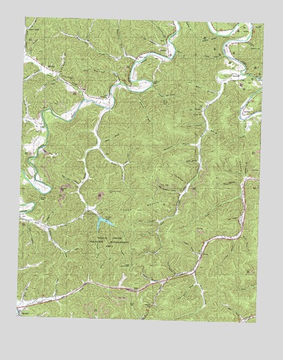
Barcreek, KY USGS Topographic Map
Click on map above to begin viewing in our Map Viewer.

This topographic map contains these locations and features:
Feature Name Type Latitude Longitude GNIS ID View Map
Antepast Post Office (historical)Post OfficeN37.2418°W83.6352°2543027View Map
Antepast SchoolSchoolN37.2415°W83.6357°510286View Map
Banks BranchStreamN37.2095°W83.6332°510385View Map
Bar Creek Post Office (historical)Post OfficeN37.2143°W83.6352°2543029View Map
BarcreekPopulated PlaceN37.2273°W83.6410°510389View Map
Bear CreekStreamN37.2287°W83.6355°510461View Map
Beech CreekStreamN37.2126°W83.7046°510514View Map
Beech Creek Wildlife Management AreaParkN37.1593°W83.7010°516832View Map
Bernice Post Office (historical)Post OfficeN37.2049°W83.7378°2543033View Map
Big BranchStreamN37.1848°W83.6316°510614View Map
Big Graveyard HollowValleyN37.1784°W83.6657°510660View Map
Britton BranchStreamN37.1598°W83.6382°510930View Map
Bullskin BranchStreamN37.2429°W83.6335°511057View Map
Burns Post Office (historical)Post OfficeN37.1536°W83.6541°2543050View Map
Burnt House BranchStreamN37.1612°W83.6346°511086View Map
Cane BranchStreamN37.1331°W83.7296°511177View Map
Cedral Post Office (historical)Post OfficeN37.2049°W83.7378°2543052View Map
Chandler BranchStreamN37.2229°W83.6824°511312View Map
Chicken BranchStreamN37.2281°W83.7408°511343View Map
Clay CountyCivilN37.1597°W83.7147°516872View Map
Coal HollowValleyN37.1644°W83.7448°511438View Map
Collins ForkStreamN37.2331°W83.7483°511475View Map
Combs LakeLakeN37.1658°W83.7046°516831View Map
Cotton GapGapN37.1745°W83.7394°511563View Map
Dan Bowling SchoolSchoolN37.1704°W83.6671°511706View Map
Davidson BranchStreamN37.1531°W83.6538°511729View Map
Deerlick BranchStreamN37.1854°W83.6324°511775View Map
DeZarns ForkStreamN37.1887°W83.6969°511752View Map
Eli BranchStreamN37.1831°W83.6324°512024View Map
Fish Trap BranchStreamN37.1959°W83.7391°512166View Map
Furnace BranchStreamN37.2418°W83.6738°512267View Map
Griffin HollowValleyN37.1528°W83.7254°512463View Map
Gum BranchStreamN37.2081°W83.6538°512479View Map
Gum GapGapN37.1312°W83.6908°512482View Map
Hacker ForkStreamN37.1406°W83.6735°512492View Map
Halfway BranchStreamN37.2448°W83.6488°512511View Map
Ham BranchStreamN37.1304°W83.7466°512531View Map
Hart BranchStreamN37.1684°W83.7496°512574View Map
Hayes ForkStreamN37.1465°W83.6577°512609View Map
HectorPopulated PlaceN37.1531°W83.6538°512628View Map
Hector GapGapN37.1306°W83.6794°512630View Map
Hector Lookout TowerTowerN37.1473°W83.6913°517171View Map
Hector Post Office (historical)Post OfficeN37.1528°W83.6546°2543087View Map
HensleyPopulated PlaceN37.2379°W83.6741°512665View Map
Hensley Post Office (historical)Post OfficeN37.2371°W83.6740°2543088View Map
Hibbard BranchStreamN37.1629°W83.7366°512675View Map
Hickory HollowValleyN37.2112°W83.6556°512683View Map
Houchell BendBendN37.2243°W83.6819°1669528View Map
Houchell Bend SchoolSchoolN37.2223°W83.6894°517769View Map
Hugh Bowling BranchStreamN37.1434°W83.6663°512838View Map
Hurricane BranchStreamN37.1979°W83.6574°512858View Map
Inyart BranchStreamN37.1984°W83.7099°512921View Map
Jacks BranchStreamN37.2045°W83.7369°512955View Map
Jackson Branch SchoolSchoolN37.2045°W83.7383°512965View Map
John Wilson SchoolSchoolN37.2234°W83.6457°513034View Map
Laurel BranchStreamN37.2368°W83.6444°513222View Map
Laurel BranchStreamN37.2376°W83.6705°513223View Map
Laurel CreekPopulated PlaceN37.2451°W83.7488°513237View Map
Laurel CreekStreamN37.2162°W83.7171°513241View Map
Lee BranchStreamN37.2131°W83.6546°513290View Map
Lick BranchStreamN37.1620°W83.6769°513383View Map
Little Beech CreekStreamN37.1976°W83.7102°513449View Map
Little Graveyard HollowValleyN37.1819°W83.6629°513487View Map
Little Wild Cat CreekStreamN37.2237°W83.6988°513538View Map
Long ForkStreamN37.1773°W83.6341°513620View Map
Longdon SchoolSchoolN37.2118°W83.6313°513633View Map
Lower Beech Creek SchoolSchoolN37.1956°W83.7094°513669View Map
Lower Laurel SchoolSchoolN37.2245°W83.7299°513701View Map
Main BranchStreamN37.2051°W83.6538°513763View Map
Manchester DivisionCivilN37.1634°W83.7482°1937131View Map
Maupin GapGapN37.1779°W83.7291°513831View Map
Maupin Gap BranchStreamN37.1780°W83.7188°2543112View Map
Middle Hector SchoolSchoolN37.1698°W83.6330°513942View Map
Mill BranchStreamN37.2223°W83.6252°513968View Map
Mill PondPopulated PlaceN37.2293°W83.7374°513995View Map
Mill Pond HollowValleyN37.2274°W83.7313°513997View Map
Mill Pond Post Office (historical)Post OfficeN37.2266°W83.7247°2543115View Map
Miller BranchStreamN37.2209°W83.6469°514002View Map
Mount Welcome Post Office (historical)Post OfficeN37.2127°W83.7052°2543117View Map
Mountain Spring GapGapN37.1781°W83.7035°514125View Map
New Prospect ChurchChurchN37.2248°W83.7288°516830View Map
Old BranchStreamN37.2184°W83.6757°514315View Map
Orchard BranchStreamN37.2323°W83.7480°514368View Map
Orchard KnobSummitN37.1427°W83.7355°2543154View Map
Paces Creek SchoolSchoolN37.1312°W83.7396°514410View Map
Panama SchoolSchoolN37.1851°W83.7405°514424View Map
Pleas Bowling BranchStreamN37.1409°W83.6557°514641View Map
Possum Trot BranchStreamN37.2073°W83.7474°514727View Map
Right Hand ForkStreamN37.1662°W83.7071°514963View Map
Road GapGapN37.1370°W83.6902°514987View Map
Sally Lee BranchStreamN37.1620°W83.7344°515183View Map
Sarah BranchStreamN37.1926°W83.6563°515250View Map
Skull BranchStreamN37.2251°W83.7313°515457View Map
Sol HollowValleyN37.2404°W83.6761°515530View Map
Spruce Pine HollowValleyN37.1876°W83.6357°515630View Map
SpurlockPopulated PlaceN37.2118°W83.6346°515635View Map
Spurlock Post Office (historical)Post OfficeN37.2120°W83.6294°2543205View Map
Suttons BranchStreamN37.2198°W83.6891°515823View Map
TanksleyPopulated PlaceN37.2168°W83.7102°515853View Map
Tanksley Post Office (historical)Post OfficeN37.2247°W83.6952°2543209View Map
Tary HollowValleyN37.1686°W83.6350°515871View Map
Town BranchStreamN37.1259°W83.6302°515981View Map
Town BranchStreamN37.1659°W83.6755°515982View Map
Town MountainSummitN37.1715°W83.6874°515987View Map
Upper Beech Creek SchoolSchoolN37.1656°W83.7202°516109View Map
Upper Hector SchoolSchoolN37.1465°W83.6574°516127View Map
Wagonroad ForkStreamN37.2345°W83.6958°516202View Map
Webb BranchStreamN37.2348°W83.6752°516257View Map
White Oak BranchStreamN37.1798°W83.7183°516311View Map
Wild CatPopulated PlaceN37.2345°W83.6908°516355View Map
Wild Cat CreekStreamN37.2329°W83.6905°516356View Map
Wild Cat SchoolSchoolN37.2348°W83.6969°516357View Map
Wildcat Post Office (historical)Post OfficeN37.2340°W83.6907°2543132View Map
Wiscoal Post Office (historical)Post OfficeN37.2368°W83.6561°2337643View Map

Note: Coordinates in the location and feature list above are referenced to NAD83 datum.


Copyright (C) 2008-2024 Ryan Niemi / Sunset Dynamics ... All Rights Reserved