TopoQuest Logo
Do you find TopoQuest useful?
Help keep TopoQuest running and adding new maps/features by donating!
Bitcoin:  19c7KJd3qBynnjoSw5npx9KScwjBe4ifkT
Litecoin:  LXs6TkuXGGXo1vDsWCkWVdjQX94eUKd6ui
Home View Maps Find Maps Find Places Resources & Links


Maulden, Kentucky Topographic Map

USGS Map Title: Maulden, KY
USGS Map MRC: 37083C7
DRG (GeoTIFF) Download: o37083c7.tif


Neighboring USGS Topographic Map Quads:


  McKee, KY  
37083D8
 

  Sturgeon, KY  
37083D7
 

  Booneville, KY  
37083D6
 

  Tyner, KY  
37083C8
 

  Maulden, KY  
37083C7
 

  Oneida, KY  
37083C6
 

  Portersburg, KY  
37083B8
 

  Manchester, KY  
37083B7
 

  Barcreek, KY  
37083B6


Map MRC Location:

N38°
W84°
N38°
W83°
H8 H7 H6 H5 H4 H3 H2 H1
G8 G7 G6 G5 G4 G3 G2 G1
F8 F7 F6 F5 F4 F3 F2 F1
E8 E7 E6 E5 E4 E3 E2 E1
D8 D7 D6 D5 D4 D3 D2 D1
C8 C7 C6 C5 C4 C3 C2 C1
B8 B7 B6 B5 B4 B3 B2 B1
A8 A7 A6 A5 A4 A3 A2 A1
N37°
W84°
N37°
W83°

Maulden, KY USGS 1:24K Topographic Map Preview:
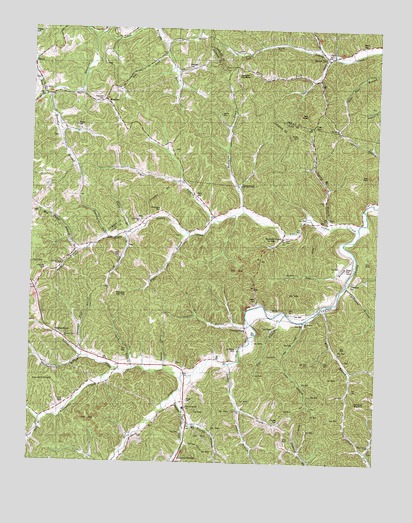
Maulden, KY USGS Topographic Map
Click on map above to begin viewing in our Map Viewer.

This topographic map contains these locations and features:
Feature Name Type Latitude Longitude GNIS ID View Map
Ball CemeteryCemeteryN37.2934°W83.7810°510375View Map
Boggs Flat CemeteriesCemeteryN37.3062°W83.7613°510831View Map
Bray CreekStreamN37.2745°W83.8196°510898View Map
Brushy BranchStreamN37.2618°W83.8177°511095View Map
Buckeye BranchStreamN37.3112°W83.8583°511019View Map
Buncomb CreekStreamN37.3226°W83.7977°511066View Map
Buncomb SchoolSchoolN37.3345°W83.8030°511067View Map
Burning Springs Fire DepartmentBuildingN37.2563°W83.8186°2637291View Map
Burning Springs ForkStreamN37.2695°W83.8221°511082View Map
Burning Springs SchoolSchoolN37.2659°W83.8188°516555View Map
Cave BranchStreamN37.2915°W83.7755°511259View Map
Cavins CemeteryCemeteryN37.3506°W83.8069°511285View Map
Chaple Baptist ChurchChurchN37.3256°W83.7688°516559View Map
Chestnut BranchStreamN37.2904°W83.7958°511325View Map
ChestnutburgPopulated PlaceN37.2890°W83.7966°511340View Map
Chestnutburg Post Office (historical)Post OfficeN37.2884°W83.7967°2543055View Map
Chestnutburg SchoolSchoolN37.2867°W83.7957°2543136View Map
Clark BranchStreamN37.3311°W83.8220°2505054View Map
Clark CemeteryCemeteryN37.3145°W83.7830°511371View Map
Clark-Dun Well HollowValleyN37.2799°W83.8118°2543056View Map
Clay GapGapN37.3473°W83.7727°511382View Map
Cope HollowValleyN37.3575°W83.8429°2505060View Map
Cradlebow BranchStreamN37.3012°W83.7610°511615View Map
Cradlebow CemeteryCemeteryN37.3015°W83.7594°511616View Map
Day CemeteryCemeteryN37.2715°W83.7580°511745View Map
Dory Post Office (historical)Post OfficeN37.2963°W83.7932°2543063View Map
Double LickStreamN37.3573°W83.8579°2505069View Map
Eds LickStreamN37.3676°W83.8266°512012View Map
Ells BranchStreamN37.2956°W83.7671°512052View Map
Ells Branch ChurchChurchN37.2906°W83.7760°512053View Map
Ells Branch SchoolSchoolN37.2943°W83.7688°512054View Map
Ethel Post Office (historical)Post OfficeN37.3207°W83.8090°2543067View Map
Ethel SchoolSchoolN37.3187°W83.8113°512091View Map
Falling Timber BranchStreamN37.3151°W83.8405°512123View Map
Falling Timber SchoolSchoolN37.3118°W83.8391°512125View Map
Farmer CemeteryCemeteryN37.3726°W83.8746°512134View Map
Fox BranchStreamN37.3098°W83.7580°512229View Map
Fuston BranchStreamN37.2646°W83.8622°2543074View Map
Genty CemeteryCemeteryN37.2973°W83.7932°512297View Map
Grassy BranchStreamN37.3181°W83.7658°512375View Map
Gum BranchStreamN37.2765°W83.8371°512480View Map
Herd ForkStreamN37.3551°W83.8716°512670View Map
Hog Camp BranchStreamN37.3112°W83.8583°512725View Map
Holcomb CemeteryCemeteryN37.3637°W83.8188°512739View Map
Holly ForkStreamN37.3665°W83.7680°512752View Map
Huckleberry BranchStreamN37.2804°W83.8560°512826View Map
Island CityPopulated PlaceN37.3665°W83.7680°512934View Map
Island City ChurchChurchN37.3593°W83.7708°512935View Map
Island City Volunteer Fire DepartmentBuildingN37.3677°W83.7657°2637246View Map
Jims BranchStreamN37.2937°W83.7827°516560View Map
Leger ForkStreamN37.3198°W83.8077°513336View Map
Lewis CemeteryCemeteryN37.3098°W83.8424°513362View Map
Little Sexton CreekStreamN37.3176°W83.7569°513524View Map
Malcolm Post Office (historical)Post OfficeN37.2772°W83.8375°2543111View Map
MauldenPopulated PlaceN37.3556°W83.8685°513826View Map
Maulden BranchStreamN37.3554°W83.8694°513827View Map
Maulden ChurchChurchN37.3343°W83.8578°2504924View Map
Maulden P OLocaleN37.3543°W83.8485°513828View Map
Maulden SchoolSchoolN37.3348°W83.8580°513829View Map
McDaniel CemeteryCemeteryN37.2826°W83.7996°513855View Map
Morris CemeteryCemeteryN37.3706°W83.7563°514065View Map
Mount Carmel ChurchChurchN37.3465°W83.7641°516564View Map
Mount Gilead ChurchChurchN37.3570°W83.8716°514090View Map
Mount Olivet ChurchChurchN37.3201°W83.8349°514102View Map
Mouth of Little Sextons Creek (historical)Populated PlaceN37.3179°W83.7571°2543159View Map
Nathanton Post Office (historical)Post OfficeN37.3631°W83.8244°2504932View Map
Nelly CemeteryCemeteryN37.3276°W83.8158°514225View Map
Opossum Trot BranchStreamN37.2823°W83.8574°514367View Map
Pennington CemeteryCemeteryN37.3229°W83.8280°514486View Map
Pennington ForkStreamN37.3148°W83.8466°514488View Map
Pigeon Roost BranchStreamN37.3162°W83.8183°514546View Map
Pine Lick BranchStreamN37.2620°W83.8708°514593View Map
Pleasant Point Baptist ChurchChurchN37.2859°W83.8624°516556View Map
Ponder BranchStreamN37.2768°W83.8258°514703View Map
Ray CemeteryCemeteryN37.2823°W83.7632°514854View Map
Reynolds CemeteryCemeteryN37.3545°W83.8494°514895View Map
Robert Clark SchoolSchoolN37.3204°W83.7708°511377View Map
Robinson CemeteryCemeteryN37.3056°W83.8694°515011View Map
Robinsons CreekStreamN37.2768°W83.8424°515015View Map
Rocky BranchStreamN37.3162°W83.8388°515058View Map
Rocky BranchStreamN37.3526°W83.8741°515065View Map
Sacker BranchStreamN37.2648°W83.7977°515164View Map
Sacker CemeteryCemeteryN37.2623°W83.7841°515165View Map
Sacker CreekStreamN37.2781°W83.8021°515166View Map
Sacker SchoolSchoolN37.2659°W83.7983°515167View Map
Sexton Creek Post OfficePost OfficeN37.3145°W83.7598°2543192View Map
Sextons CreekPopulated PlaceN37.3151°W83.7838°515330View Map
Sextons Creek Post OfficePost OfficeN37.3153°W83.7834°2543193View Map
ShepherdtownPopulated PlaceN37.2870°W83.8649°515350View Map
Silvermine RidgeRidgeN37.2731°W83.8348°2543145View Map
Silvermine SchoolSchoolN37.2773°W83.8377°515423View Map
Smith CemeteryCemeteryN37.2679°W83.8174°515507View Map
Smith CemeteryCemeteryN37.3445°W83.7788°515508View Map
SourwoodPopulated PlaceN37.3312°W83.7985°515536View Map
Spivey SchoolSchoolN37.3468°W83.7641°515597View Map
Thomas HollowValleyN37.2555°W83.8175°515930View Map
Union (historical)Populated PlaceN37.3632°W83.8226°2504980View Map
Union ChurchChurchN37.3640°W83.8196°2505025View Map
Union SchoolSchoolN37.3626°W83.8221°516102View Map
VinePopulated PlaceN37.3129°W83.8394°516185View Map
Vine Post Office (historical)Post OfficeN37.3146°W83.8462°2543127View Map
Willow Grove ChurchChurchN37.2554°W83.7513°516561View Map
Willow Grove SchoolSchoolN37.2554°W83.7513°516392View Map
Wilson CemeteryCemeteryN37.3465°W83.8588°516398View Map
Wilson's MillLocaleN37.3743°W83.8497°2505007View Map
York CemeteryCemeteryN37.2667°W83.8627°516513View Map
Zion ChurchChurchN37.2651°W83.7977°516532View Map

Note: Coordinates in the location and feature list above are referenced to NAD83 datum.


Copyright (C) 2008-2025 Ryan Niemi / Sunset Dynamics ... All Rights Reserved