TopoQuest Logo
Do you find TopoQuest useful?
Help keep TopoQuest running and adding new maps/features by donating!
Bitcoin:  19c7KJd3qBynnjoSw5npx9KScwjBe4ifkT
Litecoin:  LXs6TkuXGGXo1vDsWCkWVdjQX94eUKd6ui
Home View Maps Find Maps Find Places Resources & Links


Knoxville, Pennsylvania Topographic Map

USGS Map Title: Knoxville, PA
USGS Map MRC: 41077H4
DRG (GeoTIFF) Download: o41077h4.tif


Neighboring USGS Topographic Map Quads:


  Troupsburg, NY  
42077A5
 

  Woodhull, NY  
42077A4
 

  Borden, NY  
42077A3
 

  Potter Brook, PA  
41077H5
 

  Knoxville, PA  
41077H4
 

  Elkland, PA  
41077H3
 

  Sabinsville, PA  
41077G5
 

  Asaph, PA  
41077G4
 

  Keeneyville, PA  
41077G3


Map MRC Location:

N42°
W78°
N42°
W77°
H8 H7 H6 H5 H4 H3 H2 H1
G8 G7 G6 G5 G4 G3 G2 G1
F8 F7 F6 F5 F4 F3 F2 F1
E8 E7 E6 E5 E4 E3 E2 E1
D8 D7 D6 D5 D4 D3 D2 D1
C8 C7 C6 C5 C4 C3 C2 C1
B8 B7 B6 B5 B4 B3 B2 B1
A8 A7 A6 A5 A4 A3 A2 A1
N41°
W78°
N41°
W77°

Knoxville, PA USGS 1:24K Topographic Map Preview:
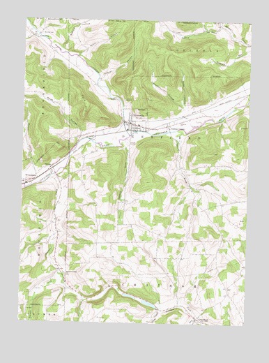
Knoxville, PA USGS Topographic Map
Click on map above to begin viewing in our Map Viewer.

This topographic map contains these locations and features:
Feature Name Type Latitude Longitude GNIS ID View Map
Abbott HollowValleyN41.9761°W77.4569°1168024View Map
Academy CornersLocaleN41.9567°W77.4189°1168032View Map
AustinburgPopulated PlaceN41.9931°W77.4947°1203000View Map
Austinburg Pioneer CemeteryCemeteryN41.9954°W77.4978°2770030View Map
Biscuit HollowValleyN41.9880°W77.4786°944039View Map
Blair CreekStreamN41.8776°W77.4011°1169788View Map
Boatman BrookStreamN41.9487°W77.4441°1198039View Map
Borough of KnoxvilleCivilN41.9605°W77.4379°1215622View Map
Bulkley BrookStreamN41.9981°W77.3905°945118View Map
Carpenter CemeteryCemeteryN41.9579°W77.4126°1171241View Map
Carpenter RunStreamN41.9567°W77.4039°1198014View Map
Champ FieldAirportN41.9597°W77.4227°2443037View Map
Chatham Volunteer Fire CompanyBuildingN41.8761°W77.4032°2653042View Map
Christie RunStreamN41.9845°W77.4697°1197637View Map
Cloos CemeteryCemeteryN41.8898°W77.3850°1172026View Map
Cook HollowValleyN41.9949°W77.4929°947348View Map
CowanesquePopulated PlaceN41.9331°W77.4972°1172548View Map
Crotch RunStreamN41.9756°W77.4586°1197638View Map
Fork HillSummitN41.9670°W77.4675°1174992View Map
Hornby HollowValleyN41.8804°W77.4222°1177423View Map
Jemison CreekStreamN41.9365°W77.4808°1178028View Map
Jemison Valley ChurchChurchN41.8953°W77.4750°1178029View Map
Joseph Howland CemeteryCemeteryN41.9249°W77.4025°2774830View Map
KnoxvillePopulated PlaceN41.9573°W77.4389°1178625View Map
Knoxville - Deerfield Volunteer Fire CompanyBuildingN41.9564°W77.4374°2652985View Map
Knoxville - Riverside CemeteryCemeteryN41.9498°W77.4420°1178626View Map
Knoxville Borough Police DepartmentBuildingN41.9568°W77.4357°2775183View Map
Knoxville Post OfficePost OfficeN41.9573°W77.4394°2772774View Map
Knoxville ReservoirReservoirN41.9671°W77.4435°1178627View Map
Little MarshPopulated PlaceN41.8767°W77.4014°1205060View Map
Moffit HollowValleyN41.9652°W77.4107°1181391View Map
PhillipsPopulated PlaceN41.9392°W77.4833°1204387View Map
Red House HollowValleyN41.9964°W77.3990°962300View Map
Rose ValleyValleyN41.9539°W77.4669°1185460View Map
Site of the Free Church CemeteryCemeteryN41.9579°W77.4400°2774816View Map
Skinner HollowValleyN41.9373°W77.4928°1187758View Map
South Brook Troups CreekStreamN41.9937°W77.4925°1193405View Map
Township of DeerfieldCivilN41.9462°W77.4220°1217105View Map
Troups CreekStreamN41.9517°W77.4405°974269View Map
Upper Jemison CemeteryCemeteryN41.8946°W77.4753°2774860View Map
Wheaton HollowValleyN41.9644°W77.4113°1191215View Map
Wood HollowValleyN41.9854°W77.4693°1191717View Map
Woodlawn CemeteryCemeteryN41.9942°W77.4903°1191748View Map
Wormer - Hillside CemeteryCemeteryN41.8771°W77.4569°2774824View Map
Yarnell BrookStreamN41.9542°W77.4097°1191862View Map

Note: Coordinates in the location and feature list above are referenced to NAD83 datum.


Copyright (C) 2008-2025 Ryan Niemi / Sunset Dynamics ... All Rights Reserved