TopoQuest Logo
Do you find TopoQuest useful?
Help keep TopoQuest running and adding new maps/features by donating!
Bitcoin:  19c7KJd3qBynnjoSw5npx9KScwjBe4ifkT
Litecoin:  LXs6TkuXGGXo1vDsWCkWVdjQX94eUKd6ui
Home View Maps Find Maps Find Places Resources & Links


Woodhull, New York Topographic Map

USGS Map Title: Woodhull, NY
USGS Map MRC: 42077A4
DRG (GeoTIFF) Download: o42077a4.tif


Neighboring USGS Topographic Map Quads:


  South Canisteo, NY  
42077B5
 

  Cameron, NY  
42077B4
 

  Rathbone, NY  
42077B3
 

  Troupsburg, NY  
42077A5
 

  Woodhull, NY  
42077A4
 

  Borden, NY  
42077A3
 

  Potter Brook, PA  
41077H5
 

  Knoxville, PA  
41077H4
 

  Elkland, PA  
41077H3


Map MRC Location:

N43°
W78°
N43°
W77°
H8 H7 H6 H5 H4 H3 H2 H1
G8 G7 G6 G5 G4 G3 G2 G1
F8 F7 F6 F5 F4 F3 F2 F1
E8 E7 E6 E5 E4 E3 E2 E1
D8 D7 D6 D5 D4 D3 D2 D1
C8 C7 C6 C5 C4 C3 C2 C1
B8 B7 B6 B5 B4 B3 B2 B1
A8 A7 A6 A5 A4 A3 A2 A1
N42°
W78°
N42°
W77°

Woodhull, NY USGS 1:24K Topographic Map Preview:
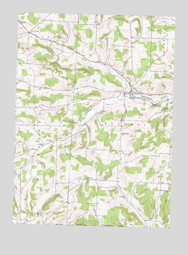
Woodhull, NY USGS Topographic Map
Click on map above to begin viewing in our Map Viewer.

This topographic map contains these locations and features:
Feature Name Type Latitude Longitude GNIS ID View Map
Bebout School (historical)SchoolN42.1087°W77.4091°943469View Map
Brown School (historical)SchoolN42.0600°W77.4450°2375594View Map
Chenango CemeteryCemeteryN42.0489°W77.4702°2547964View Map
Chenango ChurchChurchN42.0498°W77.4705°946481View Map
Chenango SchoolSchoolN42.0470°W77.4769°946489View Map
Cook Hollow School (historical)SchoolN42.0197°W77.4939°2375596View Map
Earl Beatty HillSummitN42.0848°W77.3869°948953View Map
East Lick CreekStreamN42.0745°W77.3786°949158View Map
Five CornersLocaleN42.1131°W77.4917°950192View Map
Five Corners CemeteryCemeteryN42.1126°W77.4934°2547965View Map
Five Corners School (historical)SchoolN42.1142°W77.4889°2375600View Map
Hopperville School (historical)SchoolN42.0811°W77.4856°2375604View Map
Lyons School (historical)SchoolN42.1190°W77.4372°956207View Map
Norway RidgeRidgeN42.0159°W77.3778°959022View Map
Norway Ridge CemeteryCemeteryN42.0264°W77.3832°959023View Map
Norway Ridge School (historical)SchoolN42.0215°W77.3766°959024View Map
Owlville School (historical)SchoolN42.0076°W77.4794°959701View Map
Pulteney Hill School (historical)SchoolN42.0551°W77.4155°961959View Map
Red CemeteryCemeteryN42.0277°W77.4477°962275View Map
Red School (historical)SchoolN42.0281°W77.4405°962322View Map
Sly School (historical)SchoolN42.0178°W77.4108°965444View Map
South Branch Tuscarora CreekStreamN42.0767°W77.4028°965707View Map
Town of WoodhullCivilN42.0587°W77.3926°979654View Map
Townsley School (historical)SchoolN42.1025°W77.4639°2375616View Map
Tucker School (historical)SchoolN42.0792°W77.4583°2375618View Map
WoodhullPopulated PlaceN42.0803°W77.4086°971634View Map
Woodhull AmbulanceBuildingN42.0798°W77.4111°2719200View Map
Woodhull Baptist ChurchChurchN42.0798°W77.4121°2597976View Map
Woodhull Fire DepartmentBuildingN42.0798°W77.4112°2700827View Map
Woodhull Post OfficePost OfficeN42.0802°W77.4091°2780834View Map
Woodhull Village CemeteryCemeteryN42.0787°W77.4001°2547966View Map

Note: Coordinates in the location and feature list above are referenced to NAD83 datum.


Copyright (C) 2008-2025 Ryan Niemi / Sunset Dynamics ... All Rights Reserved