TopoQuest Logo
Do you find TopoQuest useful?
Help keep TopoQuest running and adding new maps/features by donating!
Bitcoin:  19c7KJd3qBynnjoSw5npx9KScwjBe4ifkT
Litecoin:  LXs6TkuXGGXo1vDsWCkWVdjQX94eUKd6ui
Home View Maps Find Maps Find Places Resources & Links


Borden, New York Topographic Map

USGS Map Title: Borden, NY
USGS Map MRC: 42077A3
DRG (GeoTIFF) Download: o42077a3.tif


Neighboring USGS Topographic Map Quads:


  Cameron, NY  
42077B4
 

  Rathbone, NY  
42077B3
 

  Campbell, NY  
42077B2
 

  Woodhull, NY  
42077A4
 

  Borden, NY  
42077A3
 

  Addison, NY  
42077A2
 

  Knoxville, PA  
41077H4
 

  Elkland, PA  
41077H3
 

  Tioga, PA  
41077H2


Map MRC Location:

N43°
W78°
N43°
W77°
H8 H7 H6 H5 H4 H3 H2 H1
G8 G7 G6 G5 G4 G3 G2 G1
F8 F7 F6 F5 F4 F3 F2 F1
E8 E7 E6 E5 E4 E3 E2 E1
D8 D7 D6 D5 D4 D3 D2 D1
C8 C7 C6 C5 C4 C3 C2 C1
B8 B7 B6 B5 B4 B3 B2 B1
A8 A7 A6 A5 A4 A3 A2 A1
N42°
W78°
N42°
W77°

Borden, NY USGS 1:24K Topographic Map Preview:
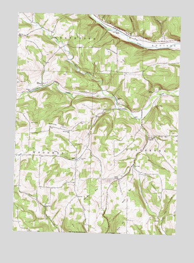
Borden, NY USGS Topographic Map
Click on map above to begin viewing in our Map Viewer.

This topographic map contains these locations and features:
Feature Name Type Latitude Longitude GNIS ID View Map
Addison HillSummitN42.0206°W77.3191°942178View Map
Addison Hill CemeteryCemeteryN42.0325°W77.2925°2547967View Map
Barney HillSummitN42.0054°W77.2919°943061View Map
Bear FallsFallsN42.0734°W77.2675°943262View Map
BordenPopulated PlaceN42.0417°W77.3275°944453View Map
Camp Brook School (historical)SchoolN42.0148°W77.3508°945556View Map
Canatoga CreekStreamN42.1142°W77.2922°945758View Map
Catherine CreekStreamN42.1076°W77.2597°946046View Map
Derby HillSummitN42.1112°W77.3278°948342View Map
Derby School (historical)SchoolN42.1058°W77.3275°2375597View Map
Derby SwitchLocaleN42.1156°W77.3000°948343View Map
East WoodhullPopulated PlaceN42.0842°W77.3547°972437View Map
Elk CreekStreamN42.0717°W77.2980°949490View Map
Elk Creek AirportAirportN42.0449°W77.3504°2443584View Map
Elk Creek CemeteryCemeteryN42.0429°W77.3247°949493View Map
Fairview School (historical)SchoolN42.0933°W77.2825°2375599View Map
FreemanPopulated PlaceN42.0556°W77.2725°950663View Map
Grace Bible FellowshipChurchN42.0418°W77.3283°2598029View Map
Harder School (historical)SchoolN42.0804°W77.3641°952201View Map
Hardscrabble HillSummitN42.1059°W77.3066°952210View Map
Helmer School (historical)SchoolN42.1140°W77.2883°952550View Map
Hillsprings FarmLocaleN42.0233°W77.3042°2544487View Map
Hurd School (historical)SchoolN42.0209°W77.3258°953516View Map
Mack HillSummitN42.0215°W77.2875°956234View Map
Mack Hill School (historical)SchoolN42.0078°W77.2881°2375606View Map
Merring School (historical)SchoolN42.1123°W77.3739°957011View Map
Mutton HillSummitN42.0112°W77.3297°958219View Map
Myers CreekStreamN42.1212°W77.3108°970394View Map
NicholsPopulated PlaceN42.0092°W77.2653°972844View Map
Nichols School (historical)SchoolN42.0128°W77.2503°2375631View Map
North Branch Tuscarora CreekStreamN42.0787°W77.3066°958727View Map
Round TopSummitN42.0834°W77.2653°963019View Map
South AddisonPopulated PlaceN42.0820°W77.2694°965655View Map
Swan CemeteryCemeteryN42.0566°W77.2584°966880View Map
Symonds HillSummitN42.0620°W77.3497°966962View Map
Symonds Hill School (historical)SchoolN42.0584°W77.3336°966963View Map
Town of TuscaroraCivilN42.0454°W77.2585°979563View Map
Tuscarora Fire DepartmentBuildingN42.0533°W77.2731°2701089View Map
Tuscarora HillSummitN42.0265°W77.2669°967996View Map
Van VleetPopulated PlaceN42.0387°W77.2839°968433View Map
Wagon Wheel Mobile Home ParkPopulated PlaceN42.0652°W77.2787°2599117View Map
Williams School (historical)SchoolN42.0773°W77.2983°971313View Map
Woods CornerPopulated PlaceN42.0315°W77.2947°973289View Map
WYDC-TV (Corning)TowerN42.0415°W77.2547°977854View Map

Note: Coordinates in the location and feature list above are referenced to NAD83 datum.


Copyright (C) 2008-2025 Ryan Niemi / Sunset Dynamics ... All Rights Reserved