TopoQuest Logo
Do you find TopoQuest useful?
Help keep TopoQuest running and adding new maps/features by donating!
Bitcoin:  19c7KJd3qBynnjoSw5npx9KScwjBe4ifkT
Litecoin:  LXs6TkuXGGXo1vDsWCkWVdjQX94eUKd6ui
Home View Maps Find Maps Find Places Resources & Links


Krumbo Reservoir, Oregon Topographic Map

USGS Map Title: Krumbo Reservoir, OR
USGS Map MRC: 42118H7
DRG (GeoTIFF) Download: o42118h7.tif


Neighboring USGS Topographic Map Quads:


  Jackass Butte, OR  
43118A8
 

  Diamond Swamp, OR  
43118A7
 

  Diamond, OR  
43118A6
 

  Irish Lake, OR  
42118H8
 

  Krumbo Reservoir, OR  
42118H7
 

  Krumbo Ridge, OR  
42118H6
 

  Frenchglen, OR  
42118G8
 

  Page Springs, OR  
42118G7
 

  McCoy Ridge, OR  
42118G6


Map MRC Location:

N43°
W119°
N43°
W118°
H8 H7 H6 H5 H4 H3 H2 H1
G8 G7 G6 G5 G4 G3 G2 G1
F8 F7 F6 F5 F4 F3 F2 F1
E8 E7 E6 E5 E4 E3 E2 E1
D8 D7 D6 D5 D4 D3 D2 D1
C8 C7 C6 C5 C4 C3 C2 C1
B8 B7 B6 B5 B4 B3 B2 B1
A8 A7 A6 A5 A4 A3 A2 A1
N42°
W119°
N42°
W118°

Krumbo Reservoir, OR USGS 1:24K Topographic Map Preview:
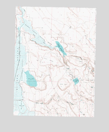
Krumbo Reservoir, OR USGS Topographic Map
Click on map above to begin viewing in our Map Viewer.

This topographic map contains these locations and features:
Feature Name Type Latitude Longitude GNIS ID View Map
Antelope CreekStreamN42.8915°W118.8080°1129839View Map
Baca LakeLakeN42.9163°W118.8491°1117121View Map
Bird WaterholeReservoirN42.9473°W118.8545°1638605View Map
Del Witzel ReservoirReservoirN42.9572°W118.7638°1638607View Map
Dry Krumbo CreekStreamN42.9429°W118.7977°1120169View Map
Dust BowlBasinN42.9396°W118.8224°1120228View Map
Dutch OvenBasinN42.9093°W118.8024°1120241View Map
Frazier LakeLakeN42.9637°W118.7580°1638608View Map
Hilbert RanchLocaleN42.9374°W118.8344°1638604View Map
Hog Wallow WellWellN42.9757°W118.7905°1638609View Map
Kern Brothers DamDamN42.9179°W118.7832°1133572View Map
Kern ReservoirReservoirN42.9158°W118.7790°1122706View Map
Knox PondReservoirN42.8855°W118.8623°1122828View Map
Krumbo CanalCanalN42.9793°W118.8508°1122846View Map
Krumbo CreekStreamN42.9763°W118.8663°1122847View Map
Krumbo DamDamN42.9549°W118.8118°1133578View Map
Krumbo ReservoirReservoirN42.9530°W118.8040°1122849View Map
Krumbo Reservoir Boat RampLocaleN42.9510°W118.8066°2700034View Map
Krumbo SpringsSpringN42.9093°W118.7521°1122851View Map
Larkspur ReservoirReservoirN42.8882°W118.8274°1638603View Map
Lower Antelope ReservoirReservoirN42.8818°W118.7931°1638601View Map
Lower Road ReservoirReservoirN42.8961°W118.8061°1638602View Map
Webb CanyonValleyN42.9110°W118.7802°1129838View Map
Webb SpringSpringN42.8776°W118.7673°1128757View Map
Webb Spring CreekStreamN42.8852°W118.8535°1128758View Map
Witzel Patrol StationLocaleN42.9582°W118.8649°1638606View Map
Witzel RanchLocaleN42.9749°W118.8724°1129262View Map

Note: Coordinates in the location and feature list above are referenced to NAD83 datum.


Copyright (C) 2008-2024 Ryan Niemi / Sunset Dynamics ... All Rights Reserved