TopoQuest Logo
Do you find TopoQuest useful?
Help keep TopoQuest running and adding new maps/features by donating!
Bitcoin:  19c7KJd3qBynnjoSw5npx9KScwjBe4ifkT
Litecoin:  LXs6TkuXGGXo1vDsWCkWVdjQX94eUKd6ui
Home View Maps Find Maps Find Places Resources & Links


Page Springs, Oregon Topographic Map

USGS Map Title: Page Springs, OR
USGS Map MRC: 42118G7
DRG (GeoTIFF) Download: o42118g7.tif


Neighboring USGS Topographic Map Quads:


  Irish Lake, OR  
42118H8
 

  Krumbo Reservoir, OR  
42118H7
 

  Krumbo Ridge, OR  
42118H6
 

  Frenchglen, OR  
42118G8
 

  Page Springs, OR  
42118G7
 

  McCoy Ridge, OR  
42118G6
 

  Roaring Springs, OR  
42118F8
 

  Tombstone Canyon, OR  
42118F7
 

  Fish Lake, OR  
42118F6


Map MRC Location:

N43°
W119°
N43°
W118°
H8 H7 H6 H5 H4 H3 H2 H1
G8 G7 G6 G5 G4 G3 G2 G1
F8 F7 F6 F5 F4 F3 F2 F1
E8 E7 E6 E5 E4 E3 E2 E1
D8 D7 D6 D5 D4 D3 D2 D1
C8 C7 C6 C5 C4 C3 C2 C1
B8 B7 B6 B5 B4 B3 B2 B1
A8 A7 A6 A5 A4 A3 A2 A1
N42°
W119°
N42°
W118°

Page Springs, OR USGS 1:24K Topographic Map Preview:
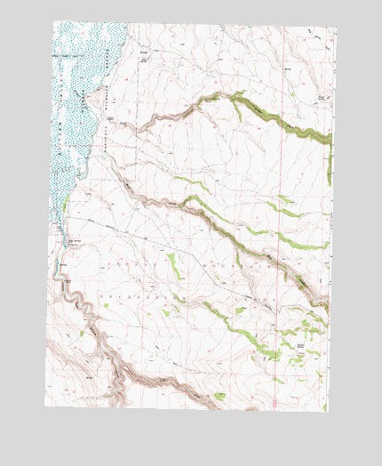
Page Springs, OR USGS Topographic Map
Click on map above to begin viewing in our Map Viewer.

This topographic map contains these locations and features:
Feature Name Type Latitude Longitude GNIS ID View Map
Bridge CreekStreamN42.8635°W118.8616°1118070View Map
Bridge Creek CanalCanalN42.8638°W118.8719°1118071View Map
Bridge Creek Reservoir Number OneReservoirN42.8529°W118.7829°1638581View Map
Bridge Creek Reservoir Number TwoReservoirN42.8456°W118.7657°1638582View Map
Butte Creek ReservoirReservoirN42.8236°W118.7837°1638588View Map
Company TroughReservoirN42.7599°W118.8541°1638591View Map
East Rim ReservoirReservoirN42.8743°W118.8004°1638586View Map
East Side CanalCanalN42.8246°W118.8619°1116729View Map
End ReservoirReservoirN42.8573°W118.8192°1638585View Map
Fish CreekStreamN42.7643°W118.8427°1120761View Map
Frazier Field ReservoirReservoirN42.7684°W118.7681°1638590View Map
Frazier SpringSpringN42.7714°W118.7647°1120964View Map
Knox SpringSpringN42.8631°W118.8329°1122830View Map
Knox Spring ReservoirReservoirN42.8588°W118.8399°1638584View Map
Lambing CreekStreamN42.8277°W118.8483°1129835View Map
Little Mud Creek ReservoirReservoirN42.8215°W118.7737°1638587View Map
Mud CreekStreamN42.8454°W118.8560°1124445View Map
New Road ReservoirReservoirN42.8595°W118.7721°1638583View Map
Page DamDamN42.8081°W118.8696°1125123View Map
Page SpringsSpringN42.8035°W118.8662°1147353View Map
Page Springs Recreation SiteLocaleN42.8035°W118.8674°1638589View Map
Steens Mountain Cooperative Management and Protection AreaParkN42.7666°W118.8177°1940276View Map
Witzel SpringSpringN42.8511°W118.7547°1129264View Map

Note: Coordinates in the location and feature list above are referenced to NAD83 datum.


Copyright (C) 2008-2025 Ryan Niemi / Sunset Dynamics ... All Rights Reserved