TopoQuest Logo
Do you find TopoQuest useful?
Help keep TopoQuest running and adding new maps/features by donating!
Bitcoin:  19c7KJd3qBynnjoSw5npx9KScwjBe4ifkT
Litecoin:  LXs6TkuXGGXo1vDsWCkWVdjQX94eUKd6ui
Home View Maps Find Maps Find Places Resources & Links


Canoncito School, New Mexico Topographic Map

USGS Map Title: Canoncito School, NM
USGS Map MRC: 35107A1
DRG (GeoTIFF) Download: o35107a1.tif


Neighboring USGS Topographic Map Quads:


  Arch Mesa, NM  
35107B2
 

  Herrera, NM  
35107B1
 

  Benavidez Ranch, NM  
35106B8
 

  Mesa Gigante, NM  
35107A2
 

  Canoncito School, NM  
35107A1
 

  La Mesita Negra, NM  
35106A8
 

  Correo, NM  
34107H2
 

  South Garcia, NM  
34107H1
 

  Dalies NW, NM  
34106H8


Map MRC Location:

N36°
W108°
N36°
W107°
H8 H7 H6 H5 H4 H3 H2 H1
G8 G7 G6 G5 G4 G3 G2 G1
F8 F7 F6 F5 F4 F3 F2 F1
E8 E7 E6 E5 E4 E3 E2 E1
D8 D7 D6 D5 D4 D3 D2 D1
C8 C7 C6 C5 C4 C3 C2 C1
B8 B7 B6 B5 B4 B3 B2 B1
A8 A7 A6 A5 A4 A3 A2 A1
N35°
W108°
N35°
W107°

Canoncito School, NM USGS 1:24K Topographic Map Preview:
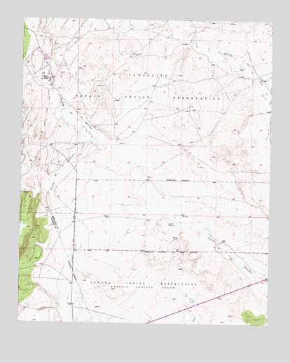
Canoncito School, NM USGS Topographic Map
Click on map above to begin viewing in our Map Viewer.

This topographic map contains these locations and features:
Feature Name Type Latitude Longitude GNIS ID View Map
Caņada los AlamosStreamN35.0670°W107.0761°897703View Map
Caņoncito ChapterCivilN35.1166°W107.0887°2419331View Map
Caņoncito MineMineN35.1092°W107.0700°915184View Map
Caņoncito Navajo Day SchoolSchoolN35.1006°W107.1123°887146View Map
Caņoncito Reservation (historical)CivilN35.0859°W107.0853°934285View Map
City of Albuquerque West Mesa WellWellN35.1000°W107.0645°924822View Map
Desid Plat Water WellWellN35.0687°W107.0945°921629View Map
Desid Plat Water WellWellN35.0686°W107.0939°919124View Map
Ferro MineMineN35.0987°W107.0870°915198View Map
Herrera RanchLocaleN35.0409°W107.0511°889926View Map
Navajo Nation Emergency Medical Services TohajiileeBuildingN35.0701°W107.1129°2657660View Map
PD and C 5 Water WellWellN35.1162°W107.1059°918704View Map
Rio Salado North Detention Dam Number 46DamN35.0584°W107.0073°923863View Map
RT-7 Water WellWellN35.0989°W107.0964°918769View Map
RWP14 Water WellWellN35.0962°W107.0967°918768View Map
RWP4 Water WellWellN35.0989°W107.0964°918770View Map
RWP7 Water WellWellN35.0598°W107.0614°918758View Map
RWP8 Water WellWellN35.0781°W107.0967°918680View Map
Sandoval CanyonValleyN35.1028°W107.1203°894549View Map

Note: Coordinates in the location and feature list above are referenced to NAD83 datum.


Copyright (C) 2008-2025 Ryan Niemi / Sunset Dynamics ... All Rights Reserved