TopoQuest Logo
Do you find TopoQuest useful?
Help keep TopoQuest running and adding new maps/features by donating!
Bitcoin:  19c7KJd3qBynnjoSw5npx9KScwjBe4ifkT
Litecoin:  LXs6TkuXGGXo1vDsWCkWVdjQX94eUKd6ui
Home View Maps Find Maps Find Places Resources & Links


La Motte, Iowa Topographic Map

USGS Map Title: La Motte, IA
USGS Map MRC: 42090C5
DRG (GeoTIFF) Download: o42090c5.tif


Neighboring USGS Topographic Map Quads:


  Dubuque South, IA  
42090D6
 

  Menominee, IL  
42090D5
 

  Galena, IL  
42090D4
 

  Zwingle, IA  
42090C6
 

  La Motte, IA  
42090C5
 

  Bellevue, IA  
42090C4
 

  Fulton, IA  
42090B6
 

  Andrew, IA  
42090B5
 

  Springbrook, IA  
42090B4


Map MRC Location:

N43°
W91°
N43°
W90°
H8 H7 H6 H5 H4 H3 H2 H1
G8 G7 G6 G5 G4 G3 G2 G1
F8 F7 F6 F5 F4 F3 F2 F1
E8 E7 E6 E5 E4 E3 E2 E1
D8 D7 D6 D5 D4 D3 D2 D1
C8 C7 C6 C5 C4 C3 C2 C1
B8 B7 B6 B5 B4 B3 B2 B1
A8 A7 A6 A5 A4 A3 A2 A1
N42°
W91°
N42°
W90°

La Motte, IA USGS 1:24K Topographic Map Preview:
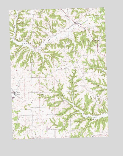
La Motte, IA USGS Topographic Map
Click on map above to begin viewing in our Map Viewer.

This topographic map contains these locations and features:
Feature Name Type Latitude Longitude GNIS ID View Map
Big Mill Creek Public Hunting AreaAreaN42.2725°W90.5335°464375View Map
City of La MotteCivilN42.2957°W90.6234°2395568View Map
City of Saint DonatusCivilN42.3623°W90.5420°2396484View Map
East Hill Catholic CemeteryCemeteryN42.2944°W90.6160°2001055View Map
Federman Farm CemeteryCemeteryN42.3546°W90.5264°1957948View Map
Freedom Field (historical)AirportN42.2667°W90.6007°466849View Map
Hoff Airport (historical)AirportN42.2620°W90.5801°466712View Map
Holy Rosary ParishChurchN42.2956°W90.6201°2001017View Map
La MottePopulated PlaceN42.2958°W90.6210°458155View Map
La Motte (historical)LocaleN42.2958°W90.6207°2001015View Map
La Motte Fire and RescueBuildingN42.2952°W90.6197°2577483View Map
La Motte Post OfficePost OfficeN42.2956°W90.6207°2001016View Map
Lux CreekStreamN42.3589°W90.5401°458689View Map
Saint DonatusPopulated PlaceN42.3608°W90.5393°460972View Map
Saint Donatus Catholic CemeteryCemeteryN42.3646°W90.5355°2001024View Map
Saint Donatus Catholic ChurchChurchN42.3639°W90.5351°2001023View Map
Saint Donatus Post OfficePost OfficeN42.3608°W90.5393°2001022View Map
Saint Donatus Town HallBuildingN42.3608°W90.5393°2001021View Map
Saint Johns ChurchChurchN42.3545°W90.5265°461051View Map
Tete De Mort Post Office (historical)Post OfficeN42.3608°W90.5393°2000889View Map
Township of Prairie SpringsCivilN42.3384°W90.6071°468575View Map
Township of RichlandCivilN42.2512°W90.6072°468606View Map
Way of the CrossLocaleN42.3639°W90.5357°2001020View Map

Note: Coordinates in the location and feature list above are referenced to NAD83 datum.


Copyright (C) 2008-2025 Ryan Niemi / Sunset Dynamics ... All Rights Reserved