TopoQuest Logo
Do you find TopoQuest useful?
Help keep TopoQuest running and adding new maps/features by donating!
Bitcoin:  19c7KJd3qBynnjoSw5npx9KScwjBe4ifkT
Litecoin:  LXs6TkuXGGXo1vDsWCkWVdjQX94eUKd6ui
Home View Maps Find Maps Find Places Resources & Links


Zwingle, Iowa Topographic Map

USGS Map Title: Zwingle, IA
USGS Map MRC: 42090C6
DRG (GeoTIFF) Download: o42090c6.tif


Neighboring USGS Topographic Map Quads:


  Peosta, IA  
42090D7
 

  Dubuque South, IA  
42090D6
 

  Menominee, IL  
42090D5
 

  Bernard, IA  
42090C7
 

  Zwingle, IA  
42090C6
 

  La Motte, IA  
42090C5
 

  Leisure Lake, IA  
42090B7
 

  Fulton, IA  
42090B6
 

  Andrew, IA  
42090B5


Map MRC Location:

N43°
W91°
N43°
W90°
H8 H7 H6 H5 H4 H3 H2 H1
G8 G7 G6 G5 G4 G3 G2 G1
F8 F7 F6 F5 F4 F3 F2 F1
E8 E7 E6 E5 E4 E3 E2 E1
D8 D7 D6 D5 D4 D3 D2 D1
C8 C7 C6 C5 C4 C3 C2 C1
B8 B7 B6 B5 B4 B3 B2 B1
A8 A7 A6 A5 A4 A3 A2 A1
N42°
W91°
N42°
W90°

Zwingle, IA USGS 1:24K Topographic Map Preview:
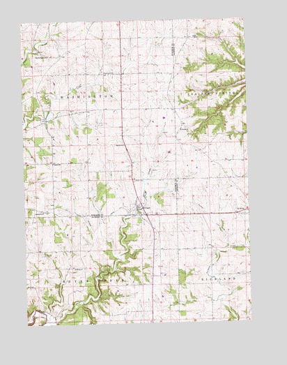
Zwingle, IA USGS Topographic Map
Click on map above to begin viewing in our Map Viewer.

This topographic map contains these locations and features:
Feature Name Type Latitude Longitude GNIS ID View Map
Ambrosy Dairy FarmsLocaleN42.3569°W90.7064°2708595View Map
Assumption CemeteryCemeteryN42.2969°W90.7390°2001455View Map
Assumption ChurchChurchN42.2967°W90.7399°454267View Map
BennettsvillePopulated PlaceN42.3600°W90.7282°464164View Map
Bennettville Post Office (historical)Post OfficeN42.3600°W90.7282°2001389View Map
Bethel CemeteryCemeteryN42.3092°W90.6886°454557View Map
Biggins SchoolSchoolN42.3164°W90.7337°454637View Map
Buncombe Post Office (historical)Post OfficeN42.3528°W90.6862°2001417View Map
Buncombe SchoolSchoolN42.3536°W90.6979°454980View Map
City of ZwingleCivilN42.2972°W90.6875°2397405View Map
DukeLocaleN42.3370°W90.6654°466221View Map
Duke Post Office (historical)Post OfficeN42.3370°W90.6654°2001388View Map
East Saint Josephs SchoolSchoolN42.3608°W90.7351°456195View Map
Emna (historical)LocaleN42.2967°W90.7362°2001387View Map
Emna Post Office (historical)Post OfficeN42.2967°W90.7362°2001386View Map
Franklin SchoolSchoolN42.3239°W90.6937°456742View Map
Holy Rosary CemeteryCemeteryN42.2942°W90.6254°457586View Map
Kleis AirportAirportN42.3042°W90.7421°466984View Map
Otter CreekStreamN42.2511°W90.7399°459926View Map
Otter Creek Community HallBuildingN42.2972°W90.6862°2001085View Map
Presley Presbyterian CemeteryCemeteryN42.3534°W90.6979°2001453View Map
Saint Lawrence Catholic ChurchChurchN42.2972°W90.6862°2001084View Map
Saint Theresa CemeteryCemeteryN42.3302°W90.6601°2001034View Map
Saint Theresa ChurchChurchN42.3303°W90.6618°461339View Map
Sullivan Post Office (historical)Post OfficeN42.3028°W90.6390°2000874View Map
Township of Otter CreekCivilN42.2512°W90.7236°468486View Map
Township of WashingtonCivilN42.3385°W90.7234°468915View Map
ZwinglePopulated PlaceN42.2978°W90.6876°463292View Map
Zwingle (historical)LocaleN42.2972°W90.6862°2001086View Map
Zwingle Athletic FieldParkN42.2972°W90.6862°2001083View Map
Zwingle CemeteryCemeteryN42.2956°W90.6882°2001456View Map
Zwingle Post OfficePost OfficeN42.2978°W90.6876°2001385View Map

Note: Coordinates in the location and feature list above are referenced to NAD83 datum.


Copyright (C) 2008-2025 Ryan Niemi / Sunset Dynamics ... All Rights Reserved