TopoQuest Logo
Do you find TopoQuest useful?
Help keep TopoQuest running and adding new maps/features by donating!
Bitcoin:  19c7KJd3qBynnjoSw5npx9KScwjBe4ifkT
Litecoin:  LXs6TkuXGGXo1vDsWCkWVdjQX94eUKd6ui
Home View Maps Find Maps Find Places Resources & Links


Lacamas Creek, Washington Topographic Map

USGS Map Title: Lacamas Creek, WA
USGS Map MRC: 45122F4
DRG (GeoTIFF) Download: o45122f4.tif


Neighboring USGS Topographic Map Quads:


  Battle Ground, WA  
45122G5
 

  Yacolt, WA  
45122G4
 

  Dole, WA  
45122G3
 

  Orchards, WA  
45122F5
 

  Lacamas Creek, WA  
45122F4
 

  Larch Mountain, WA  
45122F3
 

  Mount Tabor, OR  
45122E5
 

  Camas, WA  
45122E4
 

  Washougal, WA  
45122E3


Map MRC Location:

N46°
W123°
N46°
W122°
H8 H7 H6 H5 H4 H3 H2 H1
G8 G7 G6 G5 G4 G3 G2 G1
F8 F7 F6 F5 F4 F3 F2 F1
E8 E7 E6 E5 E4 E3 E2 E1
D8 D7 D6 D5 D4 D3 D2 D1
C8 C7 C6 C5 C4 C3 C2 C1
B8 B7 B6 B5 B4 B3 B2 B1
A8 A7 A6 A5 A4 A3 A2 A1
N45°
W123°
N45°
W122°

Lacamas Creek, WA USGS 1:24K Topographic Map Preview:
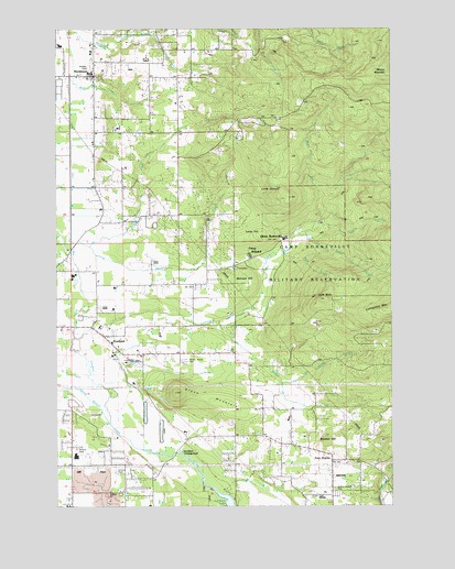
Lacamas Creek, WA USGS Topographic Map
Click on map above to begin viewing in our Map Viewer.

This topographic map contains these locations and features:
Feature Name Type Latitude Longitude GNIS ID View Map
Big DitchCanalN45.6596°W122.4962°1516503View Map
Brunner HillSummitN45.6418°W122.4006°1517000View Map
Buck CreekStreamN45.6912°W122.4151°1517021View Map
Camas Meadows Golf ClubLocaleN45.6311°W122.4482°2608379View Map
Camp BonnevilleMilitaryN45.6940°W122.4037°2512053View Map
Camp HillSummitN45.6960°W122.4245°1517287View Map
China DitchCanalN45.7143°W122.4954°1517721View Map
Church of ChristChurchN45.7415°W122.4863°2473769View Map
Church of the Nazarene of Fourth PlainChurchN45.6720°W122.4995°2473787View Map
City of Vancouver Fire Department Station 11BuildingN45.6666°W122.4803°2643909View Map
Clark County Fire District 3 Station 1BuildingN45.7381°W122.4906°2643361View Map
Clark County Fire District 3 Station 34BuildingN45.7270°W122.4173°2643363View Map
Clark ReservoirReservoirN45.6295°W122.4099°1532729View Map
Clark Reservoir DamDamN45.6298°W122.4112°1532728View Map
David CreekStreamN45.6957°W122.4073°1518494View Map
East County Fire and Rescue Station 91BuildingN45.6256°W122.3990°2643360View Map
East Fork Lacamas CreekStreamN45.6987°W122.4029°1519106View Map
East Hill Foursquare ChurchChurchN45.6423°W122.4521°2473826View Map
English PitBasinN45.6276°W122.4829°1519348View Map
Fern PrairiePopulated PlaceN45.6365°W122.3987°1519499View Map
Fern Prairie Census Designated PlaceCensusN45.6370°W122.3963°2584971View Map
Fifth PlainFlatN45.6993°W122.4920°1530526View Map
Fifth Plain CreekStreamN45.6693°W122.4940°1519523View Map
Green MountainSummitN45.6548°W122.4568°1520304View Map
Green Mountain AirportAirportN45.6627°W122.4754°1534010View Map
Green Mountain Golf CourseLocaleN45.6453°W122.4510°2608401View Map
Grove FieldAirportN45.6278°W122.4042°1533699View Map
HockinsonPopulated PlaceN45.7379°W122.4870°1520828View Map
Hockinson Census Designated PlaceCensusN45.7302°W122.4833°2408394View Map
Hockinson Community Christian SchoolSchoolN45.7387°W122.4876°1530719View Map
Hockinson Community ChurchChurchN45.7393°W122.4867°2474715View Map
Hockinson Elementary SchoolSchoolN45.7417°W122.4672°1530721View Map
Hockinson Heights Intermediate SchoolSchoolN45.7418°W122.4676°1530720View Map
Hockinson Middle SchoolSchoolN45.7384°W122.4875°1530722View Map
Lacamas Bible ChurchChurchN45.6457°W122.4241°2474125View Map
Lacamas CampgroundLocaleN45.6376°W122.4556°1521809View Map
Laurelwood Baptist ChurchChurchN45.6252°W122.4956°2474134View Map
Lechtenberg ParkParkN45.6385°W122.4587°1521984View Map
Little BaldySummitN45.6796°W122.4004°1522153View Map
Little ElkhornPopulated PlaceN45.7073°W122.4162°1522209View Map
Little Matney CreekStreamN45.6571°W122.4168°1522262View Map
LivingstonPopulated PlaceN45.6898°W122.4451°1530525View Map
Manor Evangelical ChurchChurchN45.6749°W122.4907°2474167View Map
Matney CreekStreamN45.6732°W122.4401°1515703View Map
Mill PlainPopulated PlaceN45.6429°W122.4940°1852951View Map
Mill Plain Census Designated PlaceCensusN45.6467°W122.4902°2408832View Map
Mountain ViewLocaleN45.7248°W122.4337°1530524View Map
Mud CreekStreamN45.7487°W122.4965°1523464View Map
Munsell HillSummitN45.6832°W122.4293°1523516View Map
Nelson DamDamN45.7482°W122.4162°1532649View Map
North Fork Lacamas CreekStreamN45.6985°W122.4026°1523796View Map
Pacific Middle SchoolSchoolN45.6377°W122.4941°1530725View Map
ProebstelPopulated PlaceN45.6687°W122.4818°1524654View Map
Proebstel Evangelical Free ChurchChurchN45.6679°W122.4806°2474233View Map
Shanghai CreekStreamN45.6929°W122.4884°1525613View Map
Spring BranchStreamN45.6465°W122.4815°1526399View Map
Summit View ChurchChurchN45.6787°W122.4859°2474455View Map

Note: Coordinates in the location and feature list above are referenced to NAD83 datum.


Copyright (C) 2008-2024 Ryan Niemi / Sunset Dynamics ... All Rights Reserved