TopoQuest Logo
Do you find TopoQuest useful?
Help keep TopoQuest running and adding new maps/features by donating!
Bitcoin:  19c7KJd3qBynnjoSw5npx9KScwjBe4ifkT
Litecoin:  LXs6TkuXGGXo1vDsWCkWVdjQX94eUKd6ui
Home View Maps Find Maps Find Places Resources & Links


Larch Mountain, Washington Topographic Map

USGS Map Title: Larch Mountain, WA
USGS Map MRC: 45122F3
DRG (GeoTIFF) Download: o45122f3.tif


Neighboring USGS Topographic Map Quads:


  Yacolt, WA  
45122G4
 

  Dole, WA  
45122G3
 

  Gumboot Mountain, WA  
45122G2
 

  Lacamas Creek, WA  
45122F4
 

  Larch Mountain, WA  
45122F3
 

  Bobs Mountain, WA  
45122F2
 

  Camas, WA  
45122E4
 

  Washougal, WA  
45122E3
 

  Bridal Veil, OR  
45122E2


Map MRC Location:

N46°
W123°
N46°
W122°
H8 H7 H6 H5 H4 H3 H2 H1
G8 G7 G6 G5 G4 G3 G2 G1
F8 F7 F6 F5 F4 F3 F2 F1
E8 E7 E6 E5 E4 E3 E2 E1
D8 D7 D6 D5 D4 D3 D2 D1
C8 C7 C6 C5 C4 C3 C2 C1
B8 B7 B6 B5 B4 B3 B2 B1
A8 A7 A6 A5 A4 A3 A2 A1
N45°
W123°
N45°
W122°

Larch Mountain, WA USGS 1:24K Topographic Map Preview:
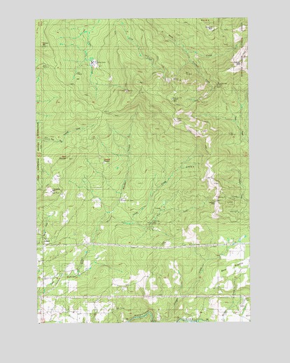
Larch Mountain, WA USGS Topographic Map
Click on map above to begin viewing in our Map Viewer.

This topographic map contains these locations and features:
Feature Name Type Latitude Longitude GNIS ID View Map
Camas DivisionCivilN45.6405°W122.3660°1939464View Map
Cougar CreekStreamN45.6254°W122.3073°1518151View Map
Creswell HeightsPopulated PlaceN45.6898°W122.3365°1518329View Map
East County Fire and Rescue Station 92BuildingN45.6586°W122.3724°2643359View Map
East Fork Little Washougal RiverStreamN45.6671°W122.3390°1519110View Map
Elkhorn MountainSummitN45.7387°W122.3712°1519301View Map
Grouse CreekStreamN45.7357°W122.2870°1520380View Map
Grouse Creek VistaLocaleN45.7218°W122.2695°1529283View Map
Grouse Vista Picnic SiteLocaleN45.7215°W122.2695°1529514View Map
IrelandPopulated PlaceN45.6593°W122.3723°1521226View Map
Jackson PassGapN45.6746°W122.2706°1529013View Map
Jones CreekStreamN45.6660°W122.3243°1521456View Map
Jones Creek CampgroundLocaleN45.6662°W122.3109°1529012View Map
Larch Corrections CenterBuildingN45.7321°W122.3420°1529014View Map
Larch MountainSummitN45.7162°W122.2954°1521907View Map
Larch Mountain Picnic SiteLocaleN45.7193°W122.2940°1529552View Map
Livingston MountainSummitN45.6790°W122.3676°1522332View Map
Pyramid RockSummitN45.7309°W122.2554°1524727View Map
Silver Star MineMineN45.7373°W122.2887°1525795View Map
Spud MountainSummitN45.6923°W122.3565°1526438View Map
SunnysidePopulated PlaceN45.6437°W122.3720°1530603View Map
Sunnyside SchoolSchoolN45.6296°W122.3579°1526752View Map
Washougal LakeLakeN45.6519°W122.3401°1530584View Map

Note: Coordinates in the location and feature list above are referenced to NAD83 datum.


Copyright (C) 2008-2024 Ryan Niemi / Sunset Dynamics ... All Rights Reserved