TopoQuest Logo
Do you find TopoQuest useful?
Help keep TopoQuest running and adding new maps/features by donating!
Bitcoin:  19c7KJd3qBynnjoSw5npx9KScwjBe4ifkT
Litecoin:  LXs6TkuXGGXo1vDsWCkWVdjQX94eUKd6ui
Home View Maps Find Maps Find Places Resources & Links


Lafayette, Minnesota Topographic Map

USGS Map Title: Lafayette, MN
USGS Map MRC: 44094D4
DRG (GeoTIFF) Download: o44094d4.tif


Neighboring USGS Topographic Map Quads:


  Gibbon, MN  
44094E5
 

  Winthrop SW, MN  
44094E4
 

  Winthrop, MN  
44094E3
 

  Saint George, MN  
44094D5
 

  Lafayette, MN  
44094D4
 

  Bernadotte, MN  
44094D3
 

  Essig, MN  
44094C5
 

  New Ulm, MN  
44094C4
 

  Courtland, MN  
44094C3


Map MRC Location:

N45°
W95°
N45°
W94°
H8 H7 H6 H5 H4 H3 H2 H1
G8 G7 G6 G5 G4 G3 G2 G1
F8 F7 F6 F5 F4 F3 F2 F1
E8 E7 E6 E5 E4 E3 E2 E1
D8 D7 D6 D5 D4 D3 D2 D1
C8 C7 C6 C5 C4 C3 C2 C1
B8 B7 B6 B5 B4 B3 B2 B1
A8 A7 A6 A5 A4 A3 A2 A1
N44°
W95°
N44°
W94°

Lafayette, MN USGS 1:24K Topographic Map Preview:
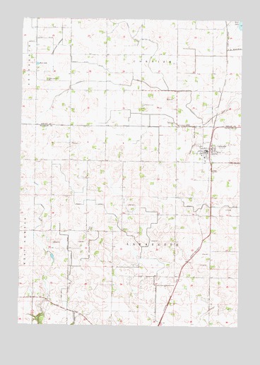
Lafayette, MN USGS Topographic Map
Click on map above to begin viewing in our Map Viewer.

This topographic map contains these locations and features:
Feature Name Type Latitude Longitude GNIS ID View Map
City of LafayetteCivilN44.4471°W94.3927°2395584View Map
Clear Lake ChurchChurchN44.4747°W94.4847°641302View Map
Clear Lake Lutheran CemeteryCemeteryN44.4750°W94.4853°2065078View Map
Cottonwood LakebedFlatN44.4883°W94.4794°641537View Map
County Ditch Number EightyfiveCanalN44.4247°W94.4919°642349View Map
County Ditch Number Four ACanalN44.4900°W94.4828°642064View Map
County Ditch Number SeventysevenCanalN44.4011°W94.4191°642307View Map
County Ditch Number ThirteenCanalN44.4919°W94.4291°641646View Map
First Lutheran ChurchChurchN44.4389°W94.3967°2063886View Map
First Lutheran ChurchChurchN44.4458°W94.3908°2063889View Map
Judicial Ditch Number OneCanalN44.4722°W94.4225°645755View Map
LafayettePopulated PlaceN44.4466°W94.3953°646312View Map
Lafayette Charter SchoolSchoolN44.4450°W94.3972°2063890View Map
Lafayette Good Samaritan CenterHospitalN44.4442°W94.3953°2063884View Map
Lafayette Post OfficePost OfficeN44.4468°W94.3941°2063885View Map
Lafayette Volunteer Fire Department and Ambulance ServiceBuildingN44.4469°W94.3936°2666418View Map
Layfayette (historical)LocaleN44.4458°W94.3931°2063887View Map
Lund ParkParkN44.4441°W94.3941°647294View Map
Methodist CemeteryCemeteryN44.4650°W94.4305°2065077View Map
Mud LakeLakeN44.4814°W94.4911°648218View Map
Saint Gregory CemeteryCemeteryN44.4500°W94.3980°650601View Map
Saint Gregory's Catholic ChurchChurchN44.4458°W94.3961°2063888View Map
School Number 53SchoolN44.4139°W94.4608°651677View Map
Township of CornishCivilN44.4997°W94.4320°663875View Map
Township of LafayetteCivilN44.3923°W94.4310°664655View Map

Note: Coordinates in the location and feature list above are referenced to NAD83 datum.


Copyright (C) 2008-2025 Ryan Niemi / Sunset Dynamics ... All Rights Reserved