TopoQuest Logo
Do you find TopoQuest useful?
Help keep TopoQuest running and adding new maps/features by donating!
Bitcoin:  19c7KJd3qBynnjoSw5npx9KScwjBe4ifkT
Litecoin:  LXs6TkuXGGXo1vDsWCkWVdjQX94eUKd6ui
Home View Maps Find Maps Find Places Resources & Links


Winthrop, Minnesota Topographic Map

USGS Map Title: Winthrop, MN
USGS Map MRC: 44094E3
DRG (GeoTIFF) Download: o44094e3.tif


Neighboring USGS Topographic Map Quads:


  Stewart, MN  
44094F4
 

  Brownton, MN  
44094F3
 

  New Auburn, MN  
44094F2
 

  Winthrop SW, MN  
44094E4
 

  Winthrop, MN  
44094E3
 

  Gaylord, MN  
44094E2
 

  Lafayette, MN  
44094D4
 

  Bernadotte, MN  
44094D3
 

  New Sweden, MN  
44094D2


Map MRC Location:

N45°
W95°
N45°
W94°
H8 H7 H6 H5 H4 H3 H2 H1
G8 G7 G6 G5 G4 G3 G2 G1
F8 F7 F6 F5 F4 F3 F2 F1
E8 E7 E6 E5 E4 E3 E2 E1
D8 D7 D6 D5 D4 D3 D2 D1
C8 C7 C6 C5 C4 C3 C2 C1
B8 B7 B6 B5 B4 B3 B2 B1
A8 A7 A6 A5 A4 A3 A2 A1
N44°
W95°
N44°
W94°

Winthrop, MN USGS 1:24K Topographic Map Preview:
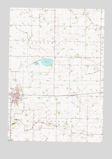
Winthrop, MN USGS Topographic Map
Click on map above to begin viewing in our Map Viewer.

This topographic map contains these locations and features:
Feature Name Type Latitude Longitude GNIS ID View Map
Alfsborg State Wildlife Management AreaParkN44.5200°W94.3691°1817666View Map
Allen LakebedFlatN44.5500°W94.3600°1817668View Map
Apostolic Christian ChurchChurchN44.5500°W94.3631°2065124View Map
Bussler Trailer CourtPopulated PlaceN44.5500°W94.3625°2065130View Map
City of WinthropCivilN44.5433°W94.3620°2397352View Map
County Ditch Number EighteenCanalN44.5833°W94.2997°1817671View Map
County Ditch Number FiftysixCanalN44.5461°W94.2872°1817662View Map
County Ditch Number FortyeightCanalN44.5005°W94.3264°1817664View Map
County Ditch Number FortytwoCanalN44.5361°W94.3544°1817660View Map
County Ditch Number Fortytwo BCanalN44.5166°W94.3397°1817661View Map
County Ditch Number TwentythreeCanalN44.5133°W94.3747°1817663View Map
Evangelical Covenant ChurchChurchN44.5419°W94.3653°2065122View Map
Faith United ChurchChurchN44.5433°W94.3625°2065123View Map
First Lutheran ChurchChurchN44.5419°W94.3608°2065121View Map
GFW High SchoolSchoolN44.5439°W94.3667°2065133View Map
Indian LakeLakeN44.5742°W94.3322°645409View Map
Indian State Wildlife Management AreaParkN44.5741°W94.3391°1817669View Map
Marsh LakebedFlatN44.5341°W94.3253°1817665View Map
Mud LakebedFlatN44.5227°W94.3683°1817667View Map
Peace Lutheran ChurchChurchN44.5442°W94.3694°2065120View Map
Saint Francis Catholic ChurchChurchN44.5439°W94.3731°2065119View Map
Saint John's Lutheran CemeteryCemeteryN44.6064°W94.2535°2065085View Map
Saint Johns ChurchChurchN44.6064°W94.2541°1817670View Map
Saint Johns SchoolSchoolN44.6072°W94.2594°650735View Map
Township of TransitCivilN44.5874°W94.3146°665804View Map
WinthropLocaleN44.5394°W94.3622°2065131View Map
WinthropPopulated PlaceN44.5430°W94.3664°654281View Map
Winthrop Ambulance ServiceBuildingN44.5401°W94.3641°2721382View Map
Winthrop City HallBuildingN44.5422°W94.3639°2065125View Map
Winthrop City LibraryBuildingN44.5422°W94.3639°2065126View Map
Winthrop Golf ClubLocaleN44.5111°W94.3736°2065132View Map
Winthrop Good Samaritan CenterHospitalN44.5375°W94.3700°2065128View Map
Winthrop Medical ClinicHospitalN44.5419°W94.3639°2065129View Map
Winthrop Police DepartmentBuildingN44.5423°W94.3640°2758774View Map
Winthrop Post OfficePost OfficeN44.5411°W94.3617°2065110View Map
Winthrop Volunteer Fire DepartmentBuildingN44.5401°W94.3648°2065127View Map
Zion Lutheran ChurchChurchN44.5431°W94.3661°2065118View Map

Note: Coordinates in the location and feature list above are referenced to NAD83 datum.


Copyright (C) 2008-2024 Ryan Niemi / Sunset Dynamics ... All Rights Reserved