TopoQuest Logo
Do you find TopoQuest useful?
Help keep TopoQuest running and adding new maps/features by donating!
Bitcoin:  19c7KJd3qBynnjoSw5npx9KScwjBe4ifkT
Litecoin:  LXs6TkuXGGXo1vDsWCkWVdjQX94eUKd6ui
Home View Maps Find Maps Find Places Resources & Links


Gibbon, Minnesota Topographic Map

USGS Map Title: Gibbon, MN
USGS Map MRC: 44094E5
DRG (GeoTIFF) Download: o44094e5.tif


Neighboring USGS Topographic Map Quads:


  Hector, MN  
44094F6
 

  Buffalo Lake, MN  
44094F5
 

  Stewart, MN  
44094F4
 

  Fairfax, MN  
44094E6
 

  Gibbon, MN  
44094E5
 

  Winthrop SW, MN  
44094E4
 

  Sleepy Eye NW, MN  
44094D6
 

  Saint George, MN  
44094D5
 

  Lafayette, MN  
44094D4


Map MRC Location:

N45°
W95°
N45°
W94°
H8 H7 H6 H5 H4 H3 H2 H1
G8 G7 G6 G5 G4 G3 G2 G1
F8 F7 F6 F5 F4 F3 F2 F1
E8 E7 E6 E5 E4 E3 E2 E1
D8 D7 D6 D5 D4 D3 D2 D1
C8 C7 C6 C5 C4 C3 C2 C1
B8 B7 B6 B5 B4 B3 B2 B1
A8 A7 A6 A5 A4 A3 A2 A1
N44°
W95°
N44°
W94°

Gibbon, MN USGS 1:24K Topographic Map Preview:
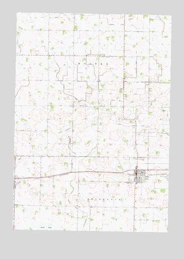
Gibbon, MN USGS Topographic Map
Click on map above to begin viewing in our Map Viewer.

This topographic map contains these locations and features:
Feature Name Type Latitude Longitude GNIS ID View Map
Alkali LakebedFlatN44.5572°W94.5858°639286View Map
Augustana CemeteryCemeteryN44.5283°W94.5322°639520View Map
Augustana Lutheran ChurchChurchN44.5292°W94.5278°2065147View Map
City of GibbonCivilN44.5354°W94.5236°2394888View Map
County Ditch Number ElevenCanalN44.5622°W94.5036°641610View Map
County Ditch Number NineteenCanalN44.5780°W94.5819°641760View Map
County Ditch Number Thirteen ACanalN44.5555°W94.5008°1817654View Map
County Ditch Number TwentytwoCanalN44.5772°W94.5411°641824View Map
Gaylord Branch LibraryBuildingN44.5319°W94.5256°2065141View Map
Gaylord Medical ClinicHospitalN44.5333°W94.5264°2065148View Map
Gaylord-Fairfax Winthrop SchoolSchoolN44.5342°W94.5219°2065149View Map
GibbonPopulated PlaceN44.5339°W94.5264°644116View Map
GibbonLocaleN44.5325°W94.5256°2065144View Map
Gibbon CemeteryCemeteryN44.5430°W94.5250°644117View Map
Gibbon Fire DepartmentBuildingN44.5342°W94.5263°2666402View Map
Gibbon Police DepartmentBuildingN44.5324°W94.5261°2758773View Map
Gibbon Post OfficePost OfficeN44.5336°W94.5264°2065142View Map
Gibbon Trailer ParkPopulated PlaceN44.5361°W94.5167°2065143View Map
Immanuel Lutheran ChurchChurchN44.5367°W94.5267°2065146View Map
Immanuel Lutheran SchoolSchoolN44.5361°W94.5267°2065150View Map
Judicial Ditch Number SevenCanalN44.5039°W94.5675°645977View Map
Kent Field (historical)AirportN44.5108°W94.5225°660181View Map
Saint Peter's Evangelical CemeteryCemeteryN44.6011°W94.5494°2065081View Map
Saint Peters Lutheran ChurchChurchN44.6011°W94.5550°2065151View Map
Saint Peters SchoolSchoolN44.6008°W94.5544°651032View Map
Saint Willebrord Catholic ChurchChurchN44.5331°W94.5281°2065145View Map
Saint Willibrord CemeteryCemeteryN44.5425°W94.5211°651085View Map
Township of MoltkeCivilN44.5860°W94.5634°665007View Map

Note: Coordinates in the location and feature list above are referenced to NAD83 datum.


Copyright (C) 2008-2025 Ryan Niemi / Sunset Dynamics ... All Rights Reserved