TopoQuest Logo
Do you find TopoQuest useful?
Help keep TopoQuest running and adding new maps/features by donating!
Bitcoin:  19c7KJd3qBynnjoSw5npx9KScwjBe4ifkT
Litecoin:  LXs6TkuXGGXo1vDsWCkWVdjQX94eUKd6ui
Home View Maps Find Maps Find Places Resources & Links


Lagro, Indiana Topographic Map

USGS Map Title: Lagro, IN
USGS Map MRC: 40085G6
DRG (GeoTIFF) Download: o40085g6.tif


Neighboring USGS Topographic Map Quads:


  North Manchester South, IN  
40085H7
 

  Servia, IN  
40085H6
 

  Bippus, IN  
40085H5
 

  Wabash, IN  
40085G7
 

  Lagro, IN  
40085G6
 

  Andrews, IN  
40085G5
 

  Somerset, IN  
40085F7
 

  La Fontaine, IN  
40085F6
 

  Mount Etna, IN  
40085F5


Map MRC Location:

N41°
W86°
N41°
W85°
H8 H7 H6 H5 H4 H3 H2 H1
G8 G7 G6 G5 G4 G3 G2 G1
F8 F7 F6 F5 F4 F3 F2 F1
E8 E7 E6 E5 E4 E3 E2 E1
D8 D7 D6 D5 D4 D3 D2 D1
C8 C7 C6 C5 C4 C3 C2 C1
B8 B7 B6 B5 B4 B3 B2 B1
A8 A7 A6 A5 A4 A3 A2 A1
N40°
W86°
N40°
W85°

Lagro, IN USGS 1:24K Topographic Map Preview:
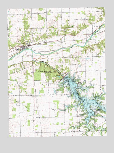
Lagro, IN USGS Topographic Map
Click on map above to begin viewing in our Map Viewer.

This topographic map contains these locations and features:
Feature Name Type Latitude Longitude GNIS ID View Map
Back CreekStreamN40.7623°W85.6525°430388View Map
Bethel ChurchChurchN40.8625°W85.6705°430945View Map
Center Grove CemeteryCemeteryN40.7700°W85.6591°432331View Map
Dick Thomas PondReservoirN40.7942°W85.6904°447764View Map
Dick Thomas Pond DamDamN40.7959°W85.6889°447763View Map
Dora Christian ChurchChurchN40.7934°W85.6880°433641View Map
Dora New Holland State Recreation AreaParkN40.7989°W85.6775°433642View Map
Fearnow LakeReservoirN40.8254°W85.6483°448739View Map
Fearnow Lake DamDamN40.8234°W85.6500°448738View Map
Hanging RockPillarN40.8292°W85.7078°435677View Map
Hominy Ridge LakeReservoirN40.8081°W85.6853°436376View Map
Hominy Ridge Lake DamDamN40.8100°W85.6833°447762View Map
Hopewell ChurchChurchN40.8703°W85.6994°436465View Map
Indian CreekStreamN40.7970°W85.6644°436737View Map
LagroPopulated PlaceN40.8381°W85.7303°449680View Map
Lagro CreekStreamN40.8362°W85.7250°437512View Map
Lagro Independent Order of Odd Fellows CemeteryCemeteryN40.8412°W85.7266°436690View Map
Lagro Volunteer Fire DepartmentBuildingN40.8344°W85.7340°2626225View Map
Leedy CemeteryCemeteryN40.7906°W85.6803°437740View Map
LincolnvillePopulated PlaceN40.7545°W85.6778°437948View Map
Lincolnville Volunteer Fire DepartmentBuildingN40.7625°W85.6772°2626607View Map
Logan CreekStreamN40.7570°W85.6305°438229View Map
Mount Hope State Recreation AreaParkN40.8020°W85.6580°439586View Map
Possum HollowValleyN40.8481°W85.6772°441484View Map
Rager CreekStreamN40.8350°W85.7203°441728View Map
Reserve Number FourteenReserveN40.8187°W85.7458°446932View Map
Rockaway CreekStreamN40.7837°W85.6547°442215View Map
Rush CreekStreamN40.7775°W85.6483°442401View Map
Saint Patrick CemeteryCemeteryN40.8432°W85.7194°442749View Map
Salamonie DamDamN40.8070°W85.6791°442869View Map
Salamonie RiverStreamN40.8328°W85.7178°442871View Map
Salamonie River State ForestForestN40.8134°W85.6991°442866View Map
Small Rush CreekStreamN40.7606°W85.6480°443645View Map
Town of LagroCivilN40.8391°W85.7276°2396704View Map
Township of LagroCivilN40.8344°W85.7092°453534View Map

Note: Coordinates in the location and feature list above are referenced to NAD83 datum.


Copyright (C) 2008-2025 Ryan Niemi / Sunset Dynamics ... All Rights Reserved