TopoQuest Logo
Do you find TopoQuest useful?
Help keep TopoQuest running and adding new maps/features by donating!
Bitcoin:  19c7KJd3qBynnjoSw5npx9KScwjBe4ifkT
Litecoin:  LXs6TkuXGGXo1vDsWCkWVdjQX94eUKd6ui
Home View Maps Find Maps Find Places Resources & Links


Andrews, Indiana Topographic Map

USGS Map Title: Andrews, IN
USGS Map MRC: 40085G5
DRG (GeoTIFF) Download: o40085g5.tif


Neighboring USGS Topographic Map Quads:


  Servia, IN  
40085H6
 

  Bippus, IN  
40085H5
 

  Huntington, IN  
40085H4
 

  Lagro, IN  
40085G6
 

  Andrews, IN  
40085G5
 

  Majenica, IN  
40085G4
 

  La Fontaine, IN  
40085F6
 

  Mount Etna, IN  
40085F5
 

  Warren, IN  
40085F4


Map MRC Location:

N41°
W86°
N41°
W85°
H8 H7 H6 H5 H4 H3 H2 H1
G8 G7 G6 G5 G4 G3 G2 G1
F8 F7 F6 F5 F4 F3 F2 F1
E8 E7 E6 E5 E4 E3 E2 E1
D8 D7 D6 D5 D4 D3 D2 D1
C8 C7 C6 C5 C4 C3 C2 C1
B8 B7 B6 B5 B4 B3 B2 B1
A8 A7 A6 A5 A4 A3 A2 A1
N40°
W86°
N40°
W85°

Andrews, IN USGS 1:24K Topographic Map Preview:
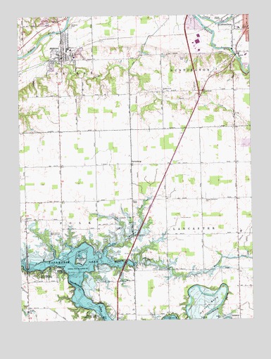
Andrews, IN USGS Topographic Map
Click on map above to begin viewing in our Map Viewer.

This topographic map contains these locations and features:
Feature Name Type Latitude Longitude GNIS ID View Map
AndrewsPopulated PlaceN40.8625°W85.6016°430170View Map
Andrews Elementary SchoolSchoolN40.8595°W85.5944°447041View Map
Andrews Town MarshalBuildingN40.8587°W85.6017°2758228View Map
Andrews Volunteer Fire DepartmentBuildingN40.8655°W85.6022°2625512View Map
Dallas Township Volunteer Fire DepartmentBuildingN40.8654°W85.6022°2701491View Map
Dolby DitchCanalN40.7875°W85.5005°433614View Map
German Settlement CemeteryCemeteryN40.7992°W85.5252°435043View Map
H and W Sand and Gravel PitMineN40.8728°W85.6092°2649429View Map
HarlansburgPopulated PlaceN40.8145°W85.5644°449667View Map
Heineys BendBendN40.7570°W85.5244°435985View Map
Huntington City Fire Department Station 3BuildingN40.8685°W85.5011°2626182View Map
Jennings ChapelChurchN40.7556°W85.6222°436988View Map
Little Majenica CreekStreamN40.7773°W85.5797°438093View Map
Loon CreekStreamN40.8675°W85.6078°438301View Map
Lost Bridge State Recreation AreaParkN40.7681°W85.6225°438312View Map
Majenica CreekStreamN40.7739°W85.5758°438490View Map
Monument City Memorial CemeteryCemeteryN40.7859°W85.6028°439373View Map
Monument IslandIslandN40.7745°W85.5925°439374View Map
Mount Etna State Recreation AreaParkN40.7517°W85.5866°439562View Map
Pleasant Grove CemeteryCemeteryN40.8439°W85.5262°441250View Map
Pleasant Grove ChurchChurchN40.8442°W85.5469°441266View Map
RiverPopulated PlaceN40.7542°W85.5069°446652View Map
Riverside CemeteryCemeteryN40.8709°W85.5964°442092View Map
Salamonie LakeReservoirN40.7735°W85.6137°442870View Map
Town of AndrewsCivilN40.8604°W85.6021°2397431View Map
Township of DallasCivilN40.8706°W85.6051°453251View Map
Township of HuntingtonCivilN40.8734°W85.5102°453424View Map
Township of LancasterCivilN40.7854°W85.5072°453538View Map
Township of PolkCivilN40.7844°W85.6024°453754View Map
Wesleyan ChurchChurchN40.7923°W85.6225°445710View Map

Note: Coordinates in the location and feature list above are referenced to NAD83 datum.


Copyright (C) 2008-2025 Ryan Niemi / Sunset Dynamics ... All Rights Reserved