TopoQuest Logo
Do you find TopoQuest useful?
Help keep TopoQuest running and adding new maps/features by donating!
Bitcoin:  19c7KJd3qBynnjoSw5npx9KScwjBe4ifkT
Litecoin:  LXs6TkuXGGXo1vDsWCkWVdjQX94eUKd6ui
Home View Maps Find Maps Find Places Resources & Links


Lagunitas Creek, New Mexico Topographic Map

USGS Map Title: Lagunitas Creek, NM
USGS Map MRC: 36106G3
DRG (GeoTIFF) Download: o36106g3.tif


Neighboring USGS Topographic Map Quads:


  West Fork Rio Brazos, NM  
36106H4
 

  Toltec Mesa, NM  
36106H3
 

  Bighorn Peak, NM  
36106H2
 

  Brazos Peak, NM  
36106G4
 

  Lagunitas Creek, NM  
36106G3
 

  Broke Off Mountain, NM  
36106G2
 

  Penasco Amarillo, NM  
36106F4
 

  East Gavilan Canyon, NM  
36106F3
 

  Burned Mountain, NM  
36106F2


Map MRC Location:

N37°
W107°
N37°
W106°
H8 H7 H6 H5 H4 H3 H2 H1
G8 G7 G6 G5 G4 G3 G2 G1
F8 F7 F6 F5 F4 F3 F2 F1
E8 E7 E6 E5 E4 E3 E2 E1
D8 D7 D6 D5 D4 D3 D2 D1
C8 C7 C6 C5 C4 C3 C2 C1
B8 B7 B6 B5 B4 B3 B2 B1
A8 A7 A6 A5 A4 A3 A2 A1
N36°
W107°
N36°
W106°

Lagunitas Creek, NM USGS 1:24K Topographic Map Preview:
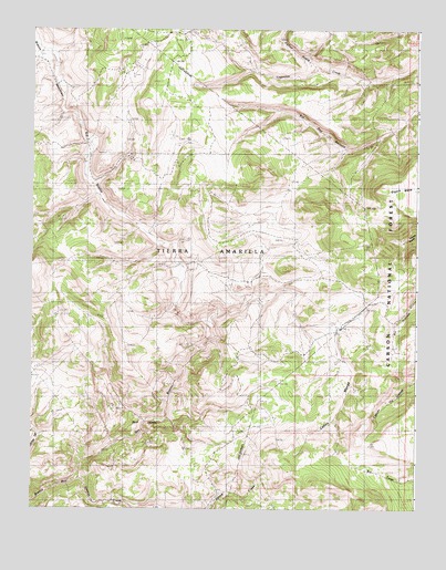
Lagunitas Creek, NM USGS Topographic Map
Click on map above to begin viewing in our Map Viewer.

This topographic map contains these locations and features:
Feature Name Type Latitude Longitude GNIS ID View Map
Amado TankReservoirN36.7705°W106.2545°913010View Map
Bad LandsAreaN36.7706°W106.3389°903491View Map
Bagwell Cow CampLocaleN36.8033°W106.3292°938806View Map
Brazos Cow CampLocaleN36.8314°W106.3142°904069View Map
Caņon MangaValleyN36.7983°W106.2761°904664View Map
Danny TankReservoirN36.8742°W106.2792°2678360View Map
Discovery TankReservoirN36.7925°W106.2578°2678359View Map
East TankReservoirN36.8718°W106.2708°913009View Map
El Camino SpringSpringN36.8740°W106.2573°913008View Map
Gavilan CreekStreamN36.7572°W106.3600°906506View Map
Jawbone TankReservoirN36.7654°W106.2759°913011View Map
Murphy Cow CampLocaleN36.7900°W106.2872°908989View Map
Murphy TankReservoirN36.8289°W106.2594°2678364View Map
Olguin MesaSummitN36.8339°W106.2631°909351View Map
Spring TankReservoirN36.7958°W106.2758°2678366View Map
Spring Tank Number TwoReservoirN36.8547°W106.2725°2678361View Map
Stewart Cow CampLocaleN36.8661°W106.3411°911415View Map
Thomas Martinez O'Reilly Cow CampLocaleN36.7895°W106.3081°913404View Map

Note: Coordinates in the location and feature list above are referenced to NAD83 datum.


Copyright (C) 2008-2025 Ryan Niemi / Sunset Dynamics ... All Rights Reserved