TopoQuest Logo
Do you find TopoQuest useful?
Help keep TopoQuest running and adding new maps/features by donating!
Bitcoin:  19c7KJd3qBynnjoSw5npx9KScwjBe4ifkT
Litecoin:  LXs6TkuXGGXo1vDsWCkWVdjQX94eUKd6ui
Home View Maps Find Maps Find Places Resources & Links


Swanville, Minnesota Topographic Map

USGS Map Title: Swanville, MN
USGS Map MRC: 45094H6
DRG (GeoTIFF) Download: o45094h6.tif


Neighboring USGS Topographic Map Quads:


  Browerville, MN  
46094A7
 

  Lake Beauty, MN  
46094A6
 

  Randall West, MN  
46094A5
 

  Long Prairie, MN  
45094H7
 

  Swanville, MN  
45094H6
 

  Flensburg, MN  
45094H5
 

  Ward Springs, MN  
45094G7
 

  Burtrum, MN  
45094G6
 

  Upsala, MN  
45094G5


Map MRC Location:

N46°
W95°
N46°
W94°
H8 H7 H6 H5 H4 H3 H2 H1
G8 G7 G6 G5 G4 G3 G2 G1
F8 F7 F6 F5 F4 F3 F2 F1
E8 E7 E6 E5 E4 E3 E2 E1
D8 D7 D6 D5 D4 D3 D2 D1
C8 C7 C6 C5 C4 C3 C2 C1
B8 B7 B6 B5 B4 B3 B2 B1
A8 A7 A6 A5 A4 A3 A2 A1
N45°
W95°
N45°
W94°

Swanville, MN USGS 1:24K Topographic Map Preview:
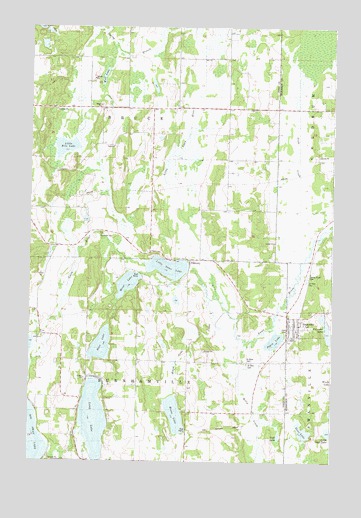
Swanville, MN USGS Topographic Map
Click on map above to begin viewing in our Map Viewer.

This topographic map contains these locations and features:
Feature Name Type Latitude Longitude GNIS ID View Map
Bass LakeLakeN45.9083°W94.7204°639678View Map
Bearhead CemeteryCemeteryN45.9400°W94.7150°639791View Map
City of SwanvilleCivilN45.9169°W94.6383°2396014View Map
Ganz LakeLakeN45.8837°W94.6366°644021View Map
Lake PepinLakeN45.9099°W94.6488°649271View Map
Little Ganz LakeLakeN45.8836°W94.6260°646809View Map
Little Rice LakeLakeN45.9652°W94.7360°646901View Map
Little Swan LakeLakeN45.9308°W94.6927°646945View Map
Little Swan LakeReservoirN45.9300°W94.6870°1776348View Map
Little Swan Lake DamDamN45.9300°W94.6870°1776347View Map
Little Swan RiverStreamN45.9227°W94.6731°654544View Map
Long LakeLakeN45.8873°W94.7232°647069View Map
Molly CreekStreamN45.9094°W94.6606°648020View Map
Mons LakeLakeN45.9263°W94.7097°648036View Map
Moose LakeLakeN45.8885°W94.6896°648075View Map
Moose Lake CreekStreamN45.9216°W94.6756°648087View Map
PillsburyPopulated PlaceN45.9333°W94.6836°649431View Map
Pillsbury Post Office (historical)Post OfficeN45.9333°W94.6833°2068978View Map
Polander LakeLakeN45.9133°W94.6271°649614View Map
Saint John Catholic ChurchChurchN45.9169°W94.6428°2068732View Map
Saint John CemeteryCemeteryN45.9033°W94.6600°650639View Map
Saint Peter CemeteryCemeteryN45.9038°W94.6597°651007View Map
Saint Peter CemeteryCemeteryN45.9272°W94.6356°651008View Map
Saint Peter's Lutheran ChurchChurchN45.9122°W94.6383°2068731View Map
Spring Branch Swan RiverStreamN46.0000°W94.6920°652423View Map
Spring Brook CemeteryCemeteryN45.9288°W94.6353°652428View Map
Stoll LakeLakeN45.8823°W94.6468°652658View Map
SwanvillePopulated PlaceN45.9102°W94.6436°652916View Map
Swanville (historical)LocaleN45.9111°W94.6431°2068733View Map
Swanville Bible ChurchChurchN45.9144°W94.6383°2068730View Map
Swanville Fire DepartmentBuildingN45.9170°W94.6407°2666395View Map
Swanville Post OfficePost OfficeN45.9142°W94.6406°2068734View Map
Swanville Public LibraryBuildingN45.9153°W94.6400°2068735View Map
Swanville SchoolsSchoolN45.9111°W94.6411°2068736View Map
Township of BruceCivilN45.9768°W94.7104°663688View Map
Township of BurnhamvilleCivilN45.8900°W94.7052°663707View Map
Wolf LakeLakeN45.9856°W94.7200°654311View Map

Note: Coordinates in the location and feature list above are referenced to NAD83 datum.


Copyright (C) 2008-2025 Ryan Niemi / Sunset Dynamics ... All Rights Reserved