TopoQuest Logo
Do you find TopoQuest useful?
Help keep TopoQuest running and adding new maps/features by donating!
Bitcoin:  19c7KJd3qBynnjoSw5npx9KScwjBe4ifkT
Litecoin:  LXs6TkuXGGXo1vDsWCkWVdjQX94eUKd6ui
Home View Maps Find Maps Find Places Resources & Links


Barnes Corners, New York Topographic Map

USGS Map Title: Barnes Corners, NY
USGS Map MRC: 43075G7
DRG (GeoTIFF) Download: o43075g7.tif


Neighboring USGS Topographic Map Quads:


  Watertown, NY  
43075H8
 

  Rutland Center, NY  
43075H7
 

  Copenhagen, NY  
43075H6
 

  Rodman, NY  
43075G8
 

  Barnes Corners, NY  
43075G7
 

  New Boston, NY  
43075G6
 

  Boylston Center, NY  
43075F8
 

  Worth Center, NY  
43075F7
 

  Sears Pond, NY  
43075F6


Map MRC Location:

N44°
W76°
N44°
W75°
H8 H7 H6 H5 H4 H3 H2 H1
G8 G7 G6 G5 G4 G3 G2 G1
F8 F7 F6 F5 F4 F3 F2 F1
E8 E7 E6 E5 E4 E3 E2 E1
D8 D7 D6 D5 D4 D3 D2 D1
C8 C7 C6 C5 C4 C3 C2 C1
B8 B7 B6 B5 B4 B3 B2 B1
A8 A7 A6 A5 A4 A3 A2 A1
N43°
W76°
N43°
W75°

Barnes Corners, NY USGS 1:24K Topographic Map Preview:
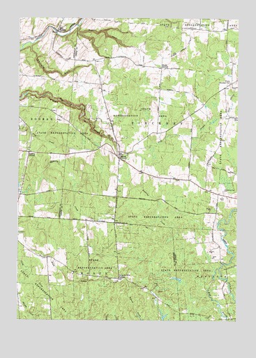
Barnes Corners, NY USGS Topographic Map
Click on map above to begin viewing in our Map Viewer.

This topographic map contains these locations and features:
Feature Name Type Latitude Longitude GNIS ID View Map
Babbits CornersLocaleN43.8192°W75.8691°942747View Map
Barnes CornersPopulated PlaceN43.8170°W75.8177°943043View Map
Bear GulfValleyN43.8717°W75.8413°943265View Map
Cronk CornersLocaleN43.8545°W75.7938°947768View Map
Denning CreekStreamN43.8201°W75.8088°948307View Map
East RodmanPopulated PlaceN43.8701°W75.8533°949236View Map
Forks Number TwoLocaleN43.8484°W75.7532°950454View Map
Newton CemeteryCemeteryN43.8012°W75.7585°958526View Map
Pigeon CreekStreamN43.7631°W75.8107°960372View Map
Rainbow FallsFallsN43.8324°W75.8353°2786914View Map
Saints Peter and Paul CemeteryCemeteryN43.8034°W75.7578°964287View Map
School Number 1 (historical)SchoolN43.8183°W75.8189°2096825View Map
School Number 11 (historical)SchoolN43.8703°W75.7722°2096847View Map
School Number 11 (historical)SchoolN43.8069°W75.8717°2096993View Map
School Number 2 (historical)SchoolN43.8511°W75.8289°2096826View Map
School Number 3 (historical)SchoolN43.8547°W75.7939°2096827View Map
School Number 3 (historical)SchoolN43.7747°W75.8536°2096991View Map
School Number 4 (historical)SchoolN43.7744°W75.7592°2096828View Map
School Number 4 (historical)SchoolN43.8733°W75.8172°2096842View Map
School Number 6 (historical)SchoolN43.7944°W75.8189°2096843View Map
School Number 7 (historical)SchoolN43.7672°W75.8172°2096992View Map
School Number 8 (historical)SchoolN43.7508°W75.7503°2096844View Map
School Number 8 (historical)SchoolN43.8461°W75.7569°2096845View Map
School Number 9 (historical)SchoolN43.8008°W75.7533°2096846View Map
Seven by Nine CornersLocaleN43.7676°W75.8171°964858View Map
Shingle GulfValleyN43.8637°W75.8685°965116View Map
Town of PinckneyCivilN43.8342°W75.7806°979367View Map
West Branch Deer RiverStreamN43.7717°W75.7602°970757View Map

Note: Coordinates in the location and feature list above are referenced to NAD83 datum.


Copyright (C) 2008-2025 Ryan Niemi / Sunset Dynamics ... All Rights Reserved