TopoQuest Logo
Do you find TopoQuest useful?
Help keep TopoQuest running and adding new maps/features by donating!
Bitcoin:  19c7KJd3qBynnjoSw5npx9KScwjBe4ifkT
Litecoin:  LXs6TkuXGGXo1vDsWCkWVdjQX94eUKd6ui
Home View Maps Find Maps Find Places Resources & Links


Rutland Center, New York Topographic Map

USGS Map Title: Rutland Center, NY
USGS Map MRC: 43075H7
DRG (GeoTIFF) Download: o43075h7.tif


Neighboring USGS Topographic Map Quads:


  Brownville, NY  
44075A8
 

  Black River, NY  
44075A7
 

  Deferiet, NY  
44075A6
 

  Watertown, NY  
43075H8
 

  Rutland Center, NY  
43075H7
 

  Copenhagen, NY  
43075H6
 

  Rodman, NY  
43075G8
 

  Barnes Corners, NY  
43075G7
 

  New Boston, NY  
43075G6


Map MRC Location:

N44°
W76°
N44°
W75°
H8 H7 H6 H5 H4 H3 H2 H1
G8 G7 G6 G5 G4 G3 G2 G1
F8 F7 F6 F5 F4 F3 F2 F1
E8 E7 E6 E5 E4 E3 E2 E1
D8 D7 D6 D5 D4 D3 D2 D1
C8 C7 C6 C5 C4 C3 C2 C1
B8 B7 B6 B5 B4 B3 B2 B1
A8 A7 A6 A5 A4 A3 A2 A1
N43°
W76°
N43°
W75°

Rutland Center, NY USGS 1:24K Topographic Map Preview:
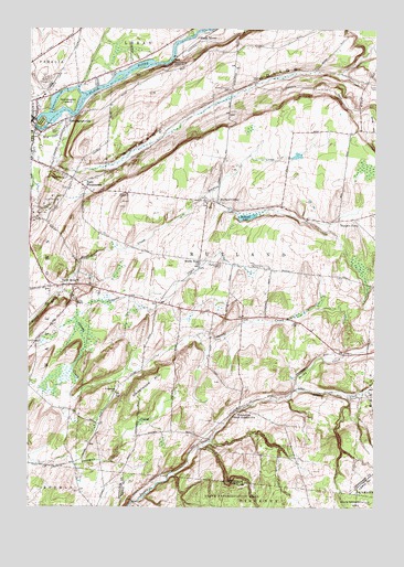
Rutland Center, NY USGS Topographic Map
Click on map above to begin viewing in our Map Viewer.

This topographic map contains these locations and features:
Feature Name Type Latitude Longitude GNIS ID View Map
Boynton CreekStreamN43.9287°W75.8574°944549View Map
Burrs MillsPopulated PlaceN43.9328°W75.8588°945279View Map
Burrville Cider Mill FallsFallsN43.9302°W75.8590°2786697View Map
Burrville Congregational ChurchChurchN43.9319°W75.8678°2615649View Map
Butternut FallsFallsN43.9634°W75.8632°2788111View Map
Calvary CemeteryCemeteryN43.9735°W75.8678°945492View Map
Christian Life CenterChurchN43.9609°W75.8539°2615735View Map
Clark CemeteryCemeteryN43.9870°W75.7928°946750View Map
Cotes CemeteryCemeteryN43.9854°W75.7503°947512View Map
Delano IslandIslandN43.9753°W75.8708°948259View Map
East WatertownPopulated PlaceN43.9584°W75.8546°949267View Map
Harpers FerryLocaleN43.9503°W75.7574°952247View Map
Harpers Ferry Church (historical)ChurchN43.9514°W75.7544°2353049View Map
Huntington IslandIslandN43.9806°W75.8610°953497View Map
HuntingtonvillePopulated PlaceN43.9762°W75.8619°953502View Map
Jacobs CreekStreamN43.9309°W75.8630°953906View Map
Maple Hill CemeteryCemeteryN43.9383°W75.8062°956427View Map
Middle Road ChurchChurchN43.9395°W75.8133°957133View Map
New Testament FellowshipChurchN43.9544°W75.8737°2616138View Map
Orvis HillSummitN43.9756°W75.7508°959497View Map
Rutland CenterPopulated PlaceN43.9545°W75.8069°963126View Map
Rutland Fire Department Station 2BuildingN43.8994°W75.8023°2734773View Map
Rutland HollowValleyN43.9626°W75.8566°963127View Map
Rutland Hollow CemeteryCemeteryN43.9839°W75.8028°963128View Map
Rutland LakeLakeN43.9512°W75.7964°963129View Map
School Number 10 (historical)SchoolN43.9406°W75.8261°2353059View Map
School Number 2 (historical)SchoolN43.9758°W75.8625°2353050View Map
School Number 2 (historical)SchoolN43.9272°W75.8192°2353051View Map
School Number 4 (historical)SchoolN43.9356°W75.7881°2353052View Map
School Number 5 (historical)SchoolN43.9511°W75.7758°2353053View Map
School Number 6 (historical)SchoolN43.9556°W75.8106°2353054View Map
School Number 7 (historical)SchoolN43.9603°W75.8578°2353055View Map
School Number 8 (historical)SchoolN43.8936°W75.8369°2353056View Map
School Number 9 (historical)SchoolN43.9325°W75.8586°2353057View Map
School Number 9 (historical)SchoolN43.9833°W75.8017°2353058View Map
Staplin CreekStreamN43.9353°W75.8591°966238View Map
Stebbins CreekStreamN43.9059°W75.7780°970655View Map
Town of RutlandCivilN43.9477°W75.7949°979444View Map
TylersvillePopulated PlaceN43.9009°W75.7994°968100View Map
Underwood CemeteryCemeteryN43.9049°W75.8428°968132View Map
Underwood HillSummitN43.9084°W75.8288°968134View Map
United Pentecostal ChurchChurchN43.9613°W75.8565°2617136View Map
Watertown QuarryMineN43.9897°W75.8683°2567151View Map
Watertown Volunteer Fire Department Station 2BuildingN43.9328°W75.8670°2734741View Map
WCIZ-FM (Watertown)TowerN43.9565°W75.8455°978618View Map
Woodward SidehillCliffN43.9909°W75.8235°971731View Map

Note: Coordinates in the location and feature list above are referenced to NAD83 datum.


Copyright (C) 2008-2025 Ryan Niemi / Sunset Dynamics ... All Rights Reserved