TopoQuest Logo
Do you find TopoQuest useful?
Help keep TopoQuest running and adding new maps/features by donating!
Bitcoin:  19c7KJd3qBynnjoSw5npx9KScwjBe4ifkT
Litecoin:  LXs6TkuXGGXo1vDsWCkWVdjQX94eUKd6ui
Home View Maps Find Maps Find Places Resources & Links


Barnes Lake, Michigan Topographic Map

USGS Map Title: Barnes Lake, MI
USGS Map MRC: 43083B3
DRG (GeoTIFF) Download: o43083b3.tif


Neighboring USGS Topographic Map Quads:


  Juniata, MI  
43083C4
 

  Mayville, MI  
43083C3
 

  Clifford, MI  
43083C2
 

  Columbiaville, MI  
43083B4
 

  Barnes Lake, MI  
43083B3
 

  North Branch, MI  
43083B2
 

  Elba, MI  
43083A4
 

  Lapeer, MI  
43083A3
 

  Attica, MI  
43083A2


Map MRC Location:

N44°
W84°
N44°
W83°
H8 H7 H6 H5 H4 H3 H2 H1
G8 G7 G6 G5 G4 G3 G2 G1
F8 F7 F6 F5 F4 F3 F2 F1
E8 E7 E6 E5 E4 E3 E2 E1
D8 D7 D6 D5 D4 D3 D2 D1
C8 C7 C6 C5 C4 C3 C2 C1
B8 B7 B6 B5 B4 B3 B2 B1
A8 A7 A6 A5 A4 A3 A2 A1
N43°
W84°
N43°
W83°

Barnes Lake, MI USGS 1:24K Topographic Map Preview:
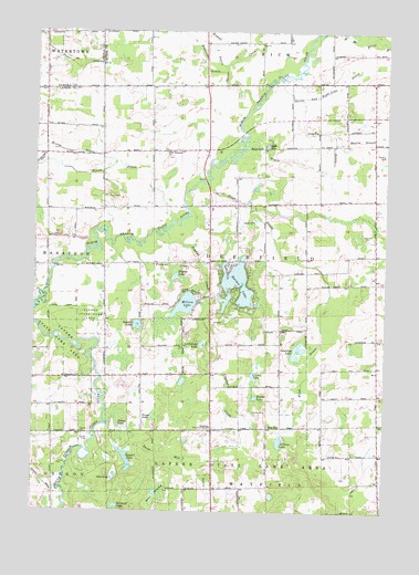
Barnes Lake, MI USGS Topographic Map
Click on map above to begin viewing in our Map Viewer.

This topographic map contains these locations and features:
Feature Name Type Latitude Longitude GNIS ID View Map
Barnes LakeLakeN43.1845°W83.3025°620620View Map
Barnes Lake-Millers Lake Census Designated PlaceCensusN43.1796°W83.3123°2393327View Map
Bass LakeLakeN43.1334°W83.3463°620686View Map
Bear SwampSwampN43.1292°W83.3308°620874View Map
Corbin LakeLakeN43.1606°W83.2967°623822View Map
Country Christian ChurchChurchN43.2036°W83.3125°2575639View Map
Crystal CreekStreamN43.1975°W83.3286°624169View Map
Crystal Creek CampgroundsLocaleN43.1772°W83.3100°2575757View Map
Deerfield Church of ChristChurchN43.1470°W83.3113°624499View Map
Deerfield Pines Mobile Home ParkPopulated PlaceN43.1933°W83.3156°2575638View Map
Deerfield Township Fire DepartmentBuildingN43.2038°W83.3120°2620064View Map
Degrow BranchStreamN43.2209°W83.2686°624513View Map
Degrow DrainCanalN43.2239°W83.2688°624514View Map
Dipper LakeLakeN43.1860°W83.3245°624691View Map
East Deerfield ChurchChurchN43.2197°W83.2755°625174View Map
Faith Community ChurchChurchN43.2069°W83.2503°2575637View Map
Fitch DrainCanalN43.1859°W83.2719°626094View Map
Forest DrainStreamN43.2003°W83.3269°626254View Map
Fostoria Census Designated PlaceCensusN43.2495°W83.3713°2628665View Map
Fostoria DrainCanalN43.2411°W83.3624°626322View Map
Guaddey LakeLakeN43.1667°W83.2806°627488View Map
Hortin LakeLakeN43.1470°W83.3441°628636View Map
Kester DrainStreamN43.2159°W83.3469°629629View Map
Kings Landing Kamp GroundLocaleN43.1814°W83.3161°2575758View Map
Lapeer State Game AreaParkN43.1756°W83.3547°630151View Map
Littlefield LakeLakeN43.1685°W83.3151°630831View Map
Margret LakeLakeN43.1262°W83.3450°631548View Map
Maxwell DrainCanalN43.2189°W83.2924°631760View Map
Millers LakeLakeN43.1789°W83.3213°632403View Map
Millis SchoolSchoolN43.1472°W83.2869°632415View Map
New Life in Christ Lutheran ChurchChurchN43.2161°W83.2542°2575636View Map
Norway LakeLakeN43.1439°W83.2872°633754View Map
Peoples Baptist ChurchChurchN43.1603°W83.3317°2575756View Map
Riddle LakeLakeN43.1548°W83.2960°635901View Map
Sand Hill DrainStreamN43.1400°W83.3411°637178View Map
Sawdel LakeLakeN43.1393°W83.3422°637289View Map
Selders LakeLakeN43.1735°W83.3382°637564View Map
Squaw CreekStreamN43.2297°W83.2991°638670View Map
Sutter and Eight Line DrainCanalN43.2367°W83.2672°639127View Map
Sutter LakeLakeN43.2205°W83.2927°639128View Map
Sutter's Recreation AreaLocaleN43.2208°W83.2911°2575640View Map
Sweet SchoolSchoolN43.1892°W83.3313°1614495View Map
Township of DeerfieldCivilN43.1918°W83.2920°1626169View Map
Trune LakeLakeN43.1495°W83.3325°1615141View Map
West Deerfield CemeteryCemeteryN43.2180°W83.3283°2575825View Map
West Deerfield ChurchChurchN43.2184°W83.3294°1616098View Map

Note: Coordinates in the location and feature list above are referenced to NAD83 datum.


Copyright (C) 2008-2025 Ryan Niemi / Sunset Dynamics ... All Rights Reserved