TopoQuest Logo
Do you find TopoQuest useful?
Help keep TopoQuest running and adding new maps/features by donating!
Bitcoin:  19c7KJd3qBynnjoSw5npx9KScwjBe4ifkT
Litecoin:  LXs6TkuXGGXo1vDsWCkWVdjQX94eUKd6ui
Home View Maps Find Maps Find Places Resources & Links


North Branch, Michigan Topographic Map

USGS Map Title: North Branch, MI
USGS Map MRC: 43083B2
DRG (GeoTIFF) Download: o43083b2.tif


Neighboring USGS Topographic Map Quads:


  Mayville, MI  
43083C3
 

  Clifford, MI  
43083C2
 

  Marlette, MI  
43083C1
 

  Barnes Lake, MI  
43083B3
 

  North Branch, MI  
43083B2
 

  Burnside, MI  
43083B1
 

  Lapeer, MI  
43083A3
 

  Attica, MI  
43083A2
 

  Imlay City, MI  
43083A1


Map MRC Location:

N44°
W84°
N44°
W83°
H8 H7 H6 H5 H4 H3 H2 H1
G8 G7 G6 G5 G4 G3 G2 G1
F8 F7 F6 F5 F4 F3 F2 F1
E8 E7 E6 E5 E4 E3 E2 E1
D8 D7 D6 D5 D4 D3 D2 D1
C8 C7 C6 C5 C4 C3 C2 C1
B8 B7 B6 B5 B4 B3 B2 B1
A8 A7 A6 A5 A4 A3 A2 A1
N43°
W84°
N43°
W83°

North Branch, MI USGS 1:24K Topographic Map Preview:
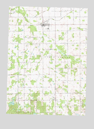
North Branch, MI USGS Topographic Map
Click on map above to begin viewing in our Map Viewer.

This topographic map contains these locations and features:
Feature Name Type Latitude Longitude GNIS ID View Map
Arnold DrainCanalN43.2481°W83.1519°620237View Map
Bear LakeLakeN43.1306°W83.2387°620851View Map
Birch Valley CampLocaleN43.1397°W83.1286°621420View Map
Bottom CreekStreamN43.2159°W83.1966°621765View Map
Bottom Creek CemeteryCemeteryN43.1717°W83.1931°2575803View Map
Cedar CreekStreamN43.2131°W83.1799°622902View Map
Cedar LakeLakeN43.1256°W83.2050°622936View Map
Duperow LakeLakeN43.1295°W83.2299°625012View Map
Elm CreekStreamN43.2131°W83.1799°625502View Map
First Baptist ChurchChurchN43.2289°W83.1933°2575622View Map
Fishell DrainCanalN43.1678°W83.1847°626052View Map
Five LakesLakeN43.1376°W83.2406°626111View Map
Five LakesPopulated PlaceN43.1428°W83.2319°1617557View Map
Five Lakes CemeteryCemeteryN43.1403°W83.2425°2575817View Map
Five Lakes DrainCanalN43.1467°W83.2352°626115View Map
Five Lakes Post Office (historical)Post OfficeN43.1428°W83.2319°2575336View Map
Five Lakes SchoolSchoolN43.1411°W83.2352°626116View Map
Gravel CreekStreamN43.2247°W83.2080°627240View Map
Greenwood CemeteryCemeteryN43.1711°W83.2241°627382View Map
Indian CreekStreamN43.2472°W83.2422°628970View Map
Kings MillPopulated PlaceN43.1422°W83.1727°629717View Map
Kings Mill Post Office (historical)Post OfficeN43.1422°W83.1728°2575331View Map
Kings Mill Station (historical)LocaleN43.1442°W83.1722°2575283View Map
Lapeer County Emergency Medical Services Station 2BuildingN43.2301°W83.2029°2661890View Map
Lees Lake DrainCanalN43.1572°W83.2249°630272View Map
Maple Grove CemeteryCemeteryN43.2242°W83.1360°631436View Map
McLaren Family Care CenterHospitalN43.2292°W83.1981°2575634View Map
Methodist ChurchChurchN43.2297°W83.1919°2575624View Map
Monroe DrainCanalN43.1497°W83.1574°632577View Map
North BranchPopulated PlaceN43.2295°W83.1966°633486View Map
North Branch DrainCanalN43.2347°W83.1749°633507View Map
North Branch Elementary SchoolSchoolN43.2281°W83.1964°2575633View Map
North Branch High SchoolSchoolN43.2250°W83.1875°2575631View Map
North Branch LibraryBuildingN43.2294°W83.1992°2575630View Map
North Branch Meadows Mobile Home ParkPopulated PlaceN43.2317°W83.1853°2575678View Map
North Branch Memorial ParkParkN43.2303°W83.1864°2575676View Map
North Branch Middle SchoolSchoolN43.2244°W83.1875°2575632View Map
North Branch Police DepartmentBuildingN43.2292°W83.1954°2575628View Map
North Branch Post OfficePost OfficeN43.2294°W83.1931°2575627View Map
North Branch Station (historical)LocaleN43.2297°W83.1861°2575620View Map
North Branch Township Fire DepartmentBuildingN43.2301°W83.2027°2620223View Map
North Branch Wesleyan ChurchChurchN43.2294°W83.2022°2575621View Map
Pioneer Bank Historical MarkerParkN43.2293°W83.1947°2571260View Map
Robinet DrainCanalN43.1381°W83.1819°636044View Map
Rockwell DrainCanalN43.1797°W83.1747°636092View Map
Ruth Fox Elementary SchoolSchoolN43.2256°W83.1889°2575629View Map
Saint James Lutheran ChurchChurchN43.2289°W83.2022°2575626View Map
Saints Peter and Paul Catholic ChurchChurchN43.2283°W83.1919°2575623View Map
Saints Peter and Paul CemeteryCemeteryN43.2059°W83.2069°636449View Map
Stephens Post Office (historical)Post OfficeN43.1292°W83.2328°2575319View Map
Township of North BranchCivilN43.1945°W83.1749°1626811View Map
Village of North BranchCivilN43.2290°W83.1908°2399512View Map
Washakie Golf and RV ResortLocaleN43.2056°W83.2189°2575635View Map
Westlawn CemeteryCemeteryN43.2292°W83.2249°1616215View Map
Wilson DrainCanalN43.2436°W83.1994°1616571View Map

Note: Coordinates in the location and feature list above are referenced to NAD83 datum.


Copyright (C) 2008-2025 Ryan Niemi / Sunset Dynamics ... All Rights Reserved