TopoQuest Logo
Do you find TopoQuest useful?
Help keep TopoQuest running and adding new maps/features by donating!
Bitcoin:  19c7KJd3qBynnjoSw5npx9KScwjBe4ifkT
Litecoin:  LXs6TkuXGGXo1vDsWCkWVdjQX94eUKd6ui
Home View Maps Find Maps Find Places Resources & Links


Needham, Arkansas Topographic Map

USGS Map Title: Needham, AR
USGS Map MRC: 35090G5
DRG (GeoTIFF) Download: o35090g5.tif


Neighboring USGS Topographic Map Quads:


  Lorado, AR  
35090H6
 

  Brookland, AR  
35090H5
 

  Dixie, AR  
35090H4
 

  Jonesboro, AR  
35090G6
 

  Needham, AR  
35090G5
 

  Lake City, AR  
35090G4
 

  Greenfield, AR  
35090F6
 

  Trumann, AR  
35090F5
 

  Hatchie Coon, AR  
35090F4


Map MRC Location:

N36°
W91°
N36°
W90°
H8 H7 H6 H5 H4 H3 H2 H1
G8 G7 G6 G5 G4 G3 G2 G1
F8 F7 F6 F5 F4 F3 F2 F1
E8 E7 E6 E5 E4 E3 E2 E1
D8 D7 D6 D5 D4 D3 D2 D1
C8 C7 C6 C5 C4 C3 C2 C1
B8 B7 B6 B5 B4 B3 B2 B1
A8 A7 A6 A5 A4 A3 A2 A1
N35°
W91°
N35°
W90°

Needham, AR USGS 1:24K Topographic Map Preview:
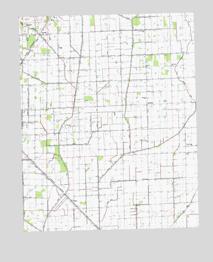
Needham, AR USGS Topographic Map
Click on map above to begin viewing in our Map Viewer.

This topographic map contains these locations and features:
Feature Name Type Latitude Longitude GNIS ID View Map
Air - Evacuation Lifeteam 2BuildingN35.8223°W90.5220°2119157View Map
Bridger CreekStreamN35.8323°W90.5854°46946View Map
Brown ChurchChurchN35.7654°W90.5343°47004View Map
Brown School (historical)SchoolN35.7645°W90.5354°64550View Map
Butler DitchCanalN35.8276°W90.5704°76477View Map
Classic AirstripAirportN35.8235°W90.5492°2650734View Map
Cottage Home ChurchChurchN35.8109°W90.5901°48065View Map
Cross Roads ChurchChurchN35.8454°W90.5165°76715View Map
Disinger-Farrville Landing Strip (historical)AirportN35.8681°W90.6204°64674View Map
Ditch Number 2CanalN35.7729°W90.5176°82141View Map
Ditch Number 3CanalN35.8731°W90.5307°64573View Map
Ditch Number 7CanalN35.7612°W90.5801°82375View Map
FarrvillePopulated PlaceN35.8642°W90.6098°64557View Map
Gum PointPopulated PlaceN35.7792°W90.5354°57857View Map
Gum Point School (historical)SchoolN35.8012°W90.5357°64563View Map
Gum Slough DitchCanalN35.7990°W90.5273°49727View Map
Herget Chapel (historical)ChurchN35.8137°W90.5351°84266View Map
HergettPopulated PlaceN35.7676°W90.5912°77166View Map
John Parker Strip (historical)AirportN35.7748°W90.6190°83741View Map
Jonesboro Industrial Development Corporation Industrial ParkLocaleN35.8134°W90.5704°64689View Map
Lateral Number 1CanalN35.7854°W90.6126°82474View Map
Lateral Number 2CanalN35.8048°W90.5754°82481View Map
Lateral Number 2 Moores DitchCanalN35.8292°W90.6193°82484View Map
Lateral Number 3CanalN35.8112°W90.6101°82486View Map
Liberty ChurchChurchN35.7940°W90.5073°51105View Map
Little Bay DitchCanalN35.7759°W90.5926°51185View Map
Main DitchCanalN35.7609°W90.6062°51619View Map
Main DitchCanalN35.8173°W90.5512°51622View Map
Maple Slough DitchCanalN35.8462°W90.5459°51660View Map
Mount Olive ChurchChurchN35.8659°W90.5359°52364View Map
Murray CreekStreamN35.8362°W90.5901°52560View Map
NeedhamPopulated PlaceN35.8226°W90.5351°58244View Map
Needham ChurchChurchN35.8451°W90.5357°52589View Map
Needham ChurchChurchN35.8259°W90.5354°64567View Map
Pekin (historical)Populated PlaceN35.8192°W90.5084°64576View Map
PhillipsPopulated PlaceN35.8165°W90.5843°58357View Map
Phillips School (historical)SchoolN35.8106°W90.5893°64577View Map
Pleasant Valley School (historical)SchoolN35.8004°W90.5004°64579View Map
Pleasant Valley United Methodist ChurchChurchN35.7981°W90.5032°78065View Map
Providence Gum Point ChurchChurchN35.8017°W90.5357°53831View Map
Rogers CHapelChurchN35.8570°W90.5965°78208View Map
Rogers School (historical)SchoolN35.8567°W90.5971°64582View Map
Township of NettletonCivilN35.8113°W90.5940°66466View Map
Webbs Mill (historical)Populated PlaceN35.8184°W90.5668°64707View Map
Whitburg (historical)Populated PlaceN35.8501°W90.5973°64592View Map

Note: Coordinates in the location and feature list above are referenced to NAD83 datum.


Copyright (C) 2008-2024 Ryan Niemi / Sunset Dynamics ... All Rights Reserved