TopoQuest Logo
Do you find TopoQuest useful?
Help keep TopoQuest running and adding new maps/features by donating!
Bitcoin:  19c7KJd3qBynnjoSw5npx9KScwjBe4ifkT
Litecoin:  LXs6TkuXGGXo1vDsWCkWVdjQX94eUKd6ui
Home View Maps Find Maps Find Places Resources & Links


Lake Minnewaska, Minnesota Topographic Map

USGS Map Title: Lake Minnewaska, MN
USGS Map MRC: 45095E4
DRG (GeoTIFF) Download: o45095e4.tif


Neighboring USGS Topographic Map Quads:


  Lowry, MN  
45095F5
 

  Glenwood, MN  
45095F4
 

  Villard, MN  
45095F3
 

  Starbuck, MN  
45095E5
 

  Lake Minnewaska, MN  
45095E4
 

  Terrace, MN  
45095E3
 

  Lake Hassel, MN  
45095D5
 

  Swift Falls, MN  
45095D4
 

  Lake Simon, MN  
45095D3


Map MRC Location:

N46°
W96°
N46°
W95°
H8 H7 H6 H5 H4 H3 H2 H1
G8 G7 G6 G5 G4 G3 G2 G1
F8 F7 F6 F5 F4 F3 F2 F1
E8 E7 E6 E5 E4 E3 E2 E1
D8 D7 D6 D5 D4 D3 D2 D1
C8 C7 C6 C5 C4 C3 C2 C1
B8 B7 B6 B5 B4 B3 B2 B1
A8 A7 A6 A5 A4 A3 A2 A1
N45°
W96°
N45°
W95°

Lake Minnewaska, MN USGS 1:24K Topographic Map Preview:
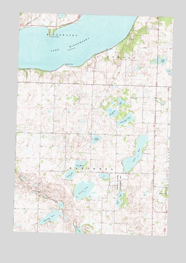
Lake Minnewaska, MN USGS Topographic Map
Click on map above to begin viewing in our Map Viewer.

This topographic map contains these locations and features:
Feature Name Type Latitude Longitude GNIS ID View Map
Barsness ChurchChurchN45.5786°W95.4067°639653View Map
Barsness Lutheran CemeteryCemeteryN45.5789°W95.4069°2066882View Map
Blue MoundsSummitN45.5191°W95.4756°640296View Map
Camp LakeLakeN45.5999°W95.3828°640817View Map
Celia LakeLakeN45.5333°W95.4559°641038View Map
Edwards LakeLakeN45.5086°W95.4706°643190View Map
Fosse LakeLakeN45.6240°W95.4664°2359649View Map
Gilbertson LakeLakeN45.5656°W95.4116°644130View Map
Helle LakeLakeN45.5184°W95.4156°644853View Map
KMGK-FM (Glenwood)TowerN45.6147°W95.3914°663049View Map
Lake BenLakeN45.5462°W95.4029°639912View Map
Lake Ben CemeteryCemeteryN45.5469°W95.3967°646330View Map
Lake JennumLakeN45.5540°W95.4352°645626View Map
Lake MaryLakeN45.5394°W95.4486°647596View Map
Lake MinnewaskaLakeN45.6178°W95.4506°647959View Map
Lawrence PointCapeN45.6116°W95.4753°646539View Map
Nelson LakeLakeN45.5251°W95.4447°648454View Map
Pezhekee Golf CourseLocaleN45.6119°W95.4123°659919View Map
Pope CountyCivilN45.5860°W95.4445°659506View Map
Steenerson LakeLakeN45.5695°W95.4230°652603View Map
Swenson PointCapeN45.5961°W95.4628°652950View Map
Township of BarsnessCivilN45.5421°W95.4391°663514View Map

Note: Coordinates in the location and feature list above are referenced to NAD83 datum.


Copyright (C) 2008-2025 Ryan Niemi / Sunset Dynamics ... All Rights Reserved