TopoQuest Logo
Do you find TopoQuest useful?
Help keep TopoQuest running and adding new maps/features by donating!
Bitcoin:  19c7KJd3qBynnjoSw5npx9KScwjBe4ifkT
Litecoin:  LXs6TkuXGGXo1vDsWCkWVdjQX94eUKd6ui
Home View Maps Find Maps Find Places Resources & Links


Lowry, Minnesota Topographic Map

USGS Map Title: Lowry, MN
USGS Map MRC: 45095F5
DRG (GeoTIFF) Download: o45095f5.tif


Neighboring USGS Topographic Map Quads:


  Kensington, MN  
45095G6
 

  Farwell, MN  
45095G5
 

  Lake Mary, MN  
45095G4
 

  Starbuck NW, MN  
45095F6
 

  Lowry, MN  
45095F5
 

  Glenwood, MN  
45095F4
 

  Cyrus, MN  
45095E6
 

  Starbuck, MN  
45095E5
 

  Lake Minnewaska, MN  
45095E4


Map MRC Location:

N46°
W96°
N46°
W95°
H8 H7 H6 H5 H4 H3 H2 H1
G8 G7 G6 G5 G4 G3 G2 G1
F8 F7 F6 F5 F4 F3 F2 F1
E8 E7 E6 E5 E4 E3 E2 E1
D8 D7 D6 D5 D4 D3 D2 D1
C8 C7 C6 C5 C4 C3 C2 C1
B8 B7 B6 B5 B4 B3 B2 B1
A8 A7 A6 A5 A4 A3 A2 A1
N45°
W96°
N45°
W95°

Lowry, MN USGS 1:24K Topographic Map Preview:
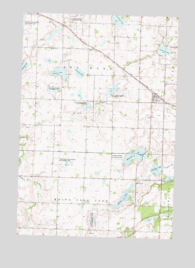
Lowry, MN USGS Topographic Map
Click on map above to begin viewing in our Map Viewer.

This topographic map contains these locations and features:
Feature Name Type Latitude Longitude GNIS ID View Map
Anderson LakeLakeN45.7182°W95.6247°639355View Map
Ben Wade CemeteryCemeteryN45.7302°W95.6029°639911View Map
Ben Wade Covenant ChurchChurchN45.7042°W95.5178°2066915View Map
City of LowryCivilN45.7049°W95.5191°2395778View Map
County Ditch Number SevenCanalN45.6944°W95.5120°642285View Map
Diamond LakeLakeN45.7306°W95.5114°642801View Map
Early Indherred Community CemeteryCemeteryN45.6439°W95.5094°2066889View Map
Farwell CemeteryCemeteryN45.7482°W95.6194°2066876View Map
Farwell State Wildlife Management AreaParkN45.7433°W95.6248°643577View Map
Indherred ChurchChurchN45.6561°W95.5298°645400View Map
Indherred Church CemeteryCemeteryN45.6308°W95.5300°2066888View Map
Jorgenson LakeLakeN45.7479°W95.5492°645740View Map
Judicial Ditch Number ThreeCanalN45.7383°W95.5037°645888View Map
Larson LakeLakeN45.7165°W95.5945°646501View Map
LowryPopulated PlaceN45.7050°W95.5181°647272View Map
LowryLocaleN45.7069°W95.5183°2066911View Map
Lowry City HallBuildingN45.7056°W95.5181°2066913View Map
Lowry Fire DepartmentBuildingN45.7047°W95.5177°2666543View Map
Lowry Post OfficePost OfficeN45.7050°W95.5178°2066912View Map
Lowry State Wildlife Management AreaParkN45.7000°W95.5700°647274View Map
Malmedal LakeLakeN45.6713°W95.5324°647414View Map
Mitmoen LakeLakeN45.7168°W95.5788°648003View Map
Norunga CemeteryCemeteryN45.7300°W95.5717°2066875View Map
Norunga ChurchChurchN45.7302°W95.5720°648746View Map
Saint Paul's Lutheran ChurchChurchN45.7036°W95.5189°2066914View Map
Saint Pauls CemeteryCemeteryN45.7002°W95.5520°650988View Map
Starbuck at Magmental Lake Wayside ParkParkN45.6719°W95.5256°2066955View Map
Strandness LakeLakeN45.6639°W95.5148°652715View Map
Township of Ben WadeCivilN45.7157°W95.5727°663573View Map
Township of White Bear LakeCivilN45.6297°W95.5744°665982View Map
Wade State Wildlife Management AreaParkN45.7069°W95.5992°653710View Map
White Bear State Wildlife Management AreaParkN45.6638°W95.5900°654078View Map
Wollan LakeLakeN45.6478°W95.5397°654327View Map

Note: Coordinates in the location and feature list above are referenced to NAD83 datum.


Copyright (C) 2008-2025 Ryan Niemi / Sunset Dynamics ... All Rights Reserved