TopoQuest Logo
Do you find TopoQuest useful?
Help keep TopoQuest running and adding new maps/features by donating!
Bitcoin:  19c7KJd3qBynnjoSw5npx9KScwjBe4ifkT
Litecoin:  LXs6TkuXGGXo1vDsWCkWVdjQX94eUKd6ui
Home View Maps Find Maps Find Places Resources & Links


Terrace, Minnesota Topographic Map

USGS Map Title: Terrace, MN
USGS Map MRC: 45095E3
DRG (GeoTIFF) Download: o45095e3.tif


Neighboring USGS Topographic Map Quads:


  Glenwood, MN  
45095F4
 

  Villard, MN  
45095F3
 

  Westport, MN  
45095F2
 

  Lake Minnewaska, MN  
45095E4
 

  Terrace, MN  
45095E3
 

  Sedan, MN  
45095E2
 

  Swift Falls, MN  
45095D4
 

  Lake Simon, MN  
45095D3
 

  Lake Johanna, MN  
45095D2


Map MRC Location:

N46°
W96°
N46°
W95°
H8 H7 H6 H5 H4 H3 H2 H1
G8 G7 G6 G5 G4 G3 G2 G1
F8 F7 F6 F5 F4 F3 F2 F1
E8 E7 E6 E5 E4 E3 E2 E1
D8 D7 D6 D5 D4 D3 D2 D1
C8 C7 C6 C5 C4 C3 C2 C1
B8 B7 B6 B5 B4 B3 B2 B1
A8 A7 A6 A5 A4 A3 A2 A1
N45°
W96°
N45°
W95°

Terrace, MN USGS 1:24K Topographic Map Preview:
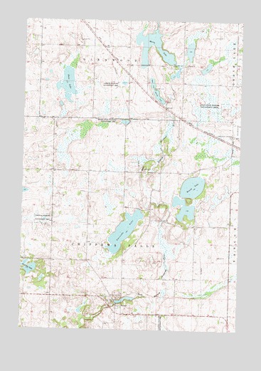
Terrace, MN USGS Topographic Map
Click on map above to begin viewing in our Map Viewer.

This topographic map contains these locations and features:
Feature Name Type Latitude Longitude GNIS ID View Map
Anderson LakeLakeN45.5238°W95.3696°639354View Map
Chippewa Falls CemeteryCemeteryN45.5135°W95.3177°2066874View Map
Chippewa River DamDamN45.5116°W95.3203°1776758View Map
Heinks State Wildlife Management AreaParkN45.5841°W95.3186°644846View Map
Immaculate Conception CemeteryCemeteryN45.5786°W95.2542°645341View Map
Lake Linka Structure Number 1 DamDamN45.5011°W95.3725°1776408View Map
Lake Linka Trail Erosion Control ReservoirReservoirN45.5011°W95.3725°1776409View Map
Marlu LakeReservoirN45.6177°W95.3004°647548View Map
Marlu Lake DamDamN45.6077°W95.2895°1776339View Map
Marlu Mill Pond Structure DamDamN45.6022°W95.2914°1777283View Map
Marlu MillpondReservoirN45.6035°W95.2882°1777284View Map
Minnewaska Assembly of God ChurchChurchN45.6111°W95.3661°2066848View Map
Pine Hill ParkPopulated PlaceN45.6194°W95.3389°2066850View Map
Pope County Waterfowl Production AreaParkN45.5387°W95.2705°2765461View Map
Round LakeLakeN45.5583°W95.2771°650331View Map
Sedan State Wildlife Management AreasParkN45.5900°W95.2695°651840View Map
State LakeLakeN45.5999°W95.3504°652584View Map
Swenoda LakeLakeN45.5399°W95.3160°652946View Map
TerracePopulated PlaceN45.5100°W95.3200°653092View Map
Terrace Post Office (historical)Post OfficeN45.5100°W95.3197°2066934View Map
Township of Chippewa FallsCivilN45.5421°W95.3164°663796View Map
Township of GlenwoodCivilN45.6228°W95.3364°664281View Map

Note: Coordinates in the location and feature list above are referenced to NAD83 datum.


Copyright (C) 2008-2025 Ryan Niemi / Sunset Dynamics ... All Rights Reserved