TopoQuest Logo
Do you find TopoQuest useful?
Help keep TopoQuest running and adding new maps/features by donating!
Bitcoin:  19c7KJd3qBynnjoSw5npx9KScwjBe4ifkT
Litecoin:  LXs6TkuXGGXo1vDsWCkWVdjQX94eUKd6ui
Home View Maps Find Maps Find Places Resources & Links


Lake Munson, Florida Topographic Map

USGS Map Title: Lake Munson, FL
USGS Map MRC: 30084C3
DRG (GeoTIFF) Download: o30084c3.tif


Neighboring USGS Topographic Map Quads:


  Midway, FL  
30084D4
 

  Tallahassee, FL  
30084D3
 

  Lafayette, FL  
30084D2
 

  Hilliardville, FL  
30084C4
 

  Lake Munson, FL  
30084C3
 

  Woodville, FL  
30084C2
 

  Crawfordville West, FL  
30084B4
 

  Crawfordville East, FL  
30084B3


Map MRC Location:

N31°
W85°
N31°
W84°
H8 H7 H6 H5 H4 H3 H2 H1
G8 G7 G6 G5 G4 G3 G2 G1
F8 F7 F6 F5 F4 F3 F2 F1
E8 E7 E6 E5 E4 E3 E2 E1
D8 D7 D6 D5 D4 D3 D2 D1
C8 C7 C6 C5 C4 C3 C2 C1
B8 B7 B6 B5 B4 B3 B2 B1
A8 A7 A6 A5 A4 A3 A2 A1
N30°
W85°
N30°
W84°

Lake Munson, FL USGS 1:24K Topographic Map Preview:
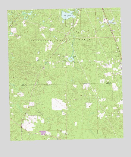
Lake Munson, FL USGS Topographic Map
Click on map above to begin viewing in our Map Viewer.

This topographic map contains these locations and features:
Feature Name Type Latitude Longitude GNIS ID View Map
BethelPopulated PlaceN30.2521°W84.3241°305277View Map
Blue SinkBasinN30.3521°W84.3085°306899View Map
Eightmile PondLakeN30.3263°W84.3028°305626View Map
Fisher CreekStreamN30.3010°W84.3643°305675View Map
Harvey CemeteryCemeteryN30.2624°W84.3202°306892View Map
Haywood Cates Baptist ChurchChurchN30.3627°W84.2652°306793View Map
Lake Bradford Baptist ChurchChurchN30.3627°W84.3332°306836View Map
Lake MunsonLakeN30.3690°W84.3086°306093View Map
Leon Sinks Geological AreaParkN30.3096°W84.3485°307065View Map
LutterlohPopulated PlaceN30.3285°W84.2530°305996View Map
Mount Olive ChurchChurchN30.2513°W84.3241°306891View Map
Munson SloughStreamN30.3183°W84.2988°306092View Map
New Hope ChurchChurchN30.3746°W84.3677°307006View Map
Northern Hills Church of GodChurchN30.3099°W84.3041°306771View Map
River Sink Volunteer Fire Department Station 11BuildingN30.2828°W84.3535°2643999View Map
Riversink SpringSpringN30.2763°W84.3410°306291View Map
Saint Peters ChurchChurchN30.3246°W84.3113°306331View Map
Sixmile PondLakeN30.3605°W84.2569°306400View Map
Sutton CemeteryCemeteryN30.2521°W84.3541°306893View Map
Woodville Census Designated PlaceCensusN30.3114°W84.2595°2403043View Map
Woodville Volunteer Fire Department and Emergency Medical Services Station 13BuildingN30.3211°W84.2531°2644314View Map
Zion Hill ChurchChurchN30.2505°W84.3693°306626View Map

Note: Coordinates in the location and feature list above are referenced to NAD83 datum.


Copyright (C) 2008-2024 Ryan Niemi / Sunset Dynamics ... All Rights Reserved