TopoQuest Logo
Do you find TopoQuest useful?
Help keep TopoQuest running and adding new maps/features by donating!
Bitcoin:  19c7KJd3qBynnjoSw5npx9KScwjBe4ifkT
Litecoin:  LXs6TkuXGGXo1vDsWCkWVdjQX94eUKd6ui
Home View Maps Find Maps Find Places Resources & Links


Barnumton, Missouri Topographic Map

USGS Map Title: Barnumton, MO
USGS Map MRC: 38092A8
DRG (GeoTIFF) Download: o38092a8.tif


Neighboring USGS Topographic Map Quads:


  Knobby, MO  
38093B1
 

  Bollinger Creek, MO  
38092B8
 

  Sunrise Beach, MO  
38092B7
 

  Climax Springs, MO  
38093A1
 

  Barnumton, MO  
38092A8
 

  Green Bay Terrace, MO  
38092A7
 

  Branch, MO  
37093H1
 

  Macks Creek, MO  
37092H8
 

  Hahatonka, MO  
37092H7


Map MRC Location:

N39°
W93°
N39°
W92°
H8 H7 H6 H5 H4 H3 H2 H1
G8 G7 G6 G5 G4 G3 G2 G1
F8 F7 F6 F5 F4 F3 F2 F1
E8 E7 E6 E5 E4 E3 E2 E1
D8 D7 D6 D5 D4 D3 D2 D1
C8 C7 C6 C5 C4 C3 C2 C1
B8 B7 B6 B5 B4 B3 B2 B1
A8 A7 A6 A5 A4 A3 A2 A1
N38°
W93°
N38°
W92°

Barnumton, MO USGS 1:24K Topographic Map Preview:
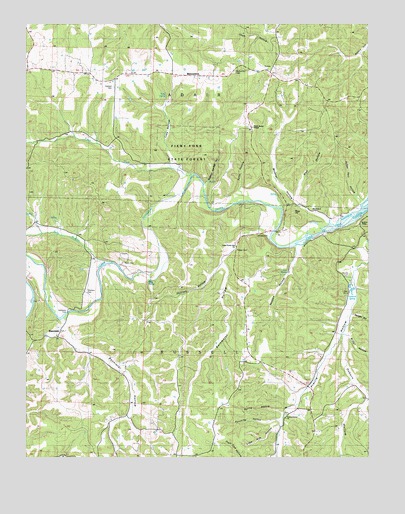
Barnumton, MO USGS Topographic Map
Click on map above to begin viewing in our Map Viewer.

This topographic map contains these locations and features:
Feature Name Type Latitude Longitude GNIS ID View Map
BannisterPopulated PlaceN38.0350°W92.9882°740656View Map
Bannister FordPopulated PlaceN38.0417°W92.9849°740657View Map
Bannister HollowValleyN38.0386°W92.9860°713623View Map
BarnumtonPopulated PlaceN38.1100°W92.9366°740660View Map
Barnumton CemeteryCemeteryN38.1111°W92.9238°742746View Map
Blue SpringSpringN38.0503°W92.9558°738315View Map
Bridge HollowValleyN38.0350°W92.8824°714697View Map
Camden School (historical)SchoolN38.0648°W92.9821°745258View Map
Coelleda (historical)LocaleN38.0534°W92.9030°744745View Map
Crocker School (historical)SchoolN38.1086°W92.9752°745257View Map
Eadsons SpringSpringN38.0469°W92.8808°717230View Map
Edwards CemeteryCemeteryN38.0472°W92.9777°742743View Map
Estes HollowValleyN38.0778°W92.9219°717632View Map
Fiery ForkStreamN38.0817°W92.9399°717906View Map
Fiery Fork State ForestForestN38.0875°W92.9444°742744View Map
Grainger CemeteryCemeteryN38.1067°W92.9680°742747View Map
Hazel Valley School (historical)SchoolN38.0081°W92.9602°745261View Map
Hurst CemeteryCemeteryN38.0561°W92.9646°742742View Map
Husson HollowValleyN38.0609°W92.9016°720046View Map
Kolb BranchStreamN38.0564°W92.9702°720689View Map
Lime Kiln HollowValleyN38.0089°W92.9082°721068View Map
Little Niangua RiverStreamN38.0714°W92.9066°721283View Map
Lower Prairie Hollow ChurchChurchN38.0609°W92.9235°742741View Map
Mineral HollowValleyN38.0686°W92.8894°722427View Map
Mission Point ChurchChurchN38.1111°W92.9238°722467View Map
Morg HillSummitN38.0692°W92.9041°722606View Map
Morgan HollowValleyN38.0411°W92.8807°722618View Map
Nonsuch (historical)LocaleN38.0700°W92.8905°744769View Map
Osborn HollowValleyN38.0353°W92.8838°723864View Map
Ozark Bethel ChapelChurchN38.0953°W92.9174°742745View Map
Parrack Grove CemeteryCemeteryN38.0120°W92.9054°2681385View Map
Parrack Grove ChurchChurchN38.0111°W92.9052°729793View Map
Phillips HollowValleyN38.0553°W92.9294°724294View Map
Poe SpringSpringN38.0537°W92.9046°724685View Map
Prairie HollowValleyN38.0614°W92.8763°724863View Map
Prairie Hollow School (historical)SchoolN38.0575°W92.8782°745260View Map
Punching HollowValleyN38.0109°W92.9080°725002View Map
Ragg School (historical)SchoolN38.0617°W92.9244°745259View Map
Raggs CemeteryCemeteryN38.0597°W92.9232°742740View Map
Rainwater HollowValleyN38.0656°W92.9138°729808View Map
Southwest Camden County Fire Protection District Station 1 HeadquartersBuildingN38.0349°W92.9905°2621608View Map
Spring HollowValleyN38.0131°W92.9074°726939View Map
Sulphur Springs HollowValleyN38.0792°W92.9338°727277View Map
Susan Hart HollowValleyN38.0736°W92.8777°727344View Map
Toby HollowValleyN38.0848°W92.9471°727687View Map
Toby SpringSpringN38.1045°W92.9491°738316View Map
Warren CemeteryCemeteryN38.0525°W92.8824°742739View Map
Well HollowValleyN38.0753°W92.9016°728494View Map
Whitaker CemeteryCemeteryN38.1070°W92.9682°728704View Map

Note: Coordinates in the location and feature list above are referenced to NAD83 datum.


Copyright (C) 2008-2025 Ryan Niemi / Sunset Dynamics ... All Rights Reserved