TopoQuest Logo
Do you find TopoQuest useful?
Help keep TopoQuest running and adding new maps/features by donating!
Bitcoin:  19c7KJd3qBynnjoSw5npx9KScwjBe4ifkT
Litecoin:  LXs6TkuXGGXo1vDsWCkWVdjQX94eUKd6ui
Home View Maps Find Maps Find Places Resources & Links


Sodergreen Lake, Wyoming Topographic Map

USGS Map Title: Sodergreen Lake, WY
USGS Map MRC: 41105B8
DRG (GeoTIFF) Download: o41105b8.tif


Neighboring USGS Topographic Map Quads:


  Rex Lake, WY  
41106C1
 

  Millbrook, WY  
41105C8
 

  Miller, WY  
41105C7
 

  Lake Owen, WY  
41106B1
 

  Sodergreen Lake, WY  
41105B8
 

  Caldwell Lake, WY  
41105B7
 

  Woods Landing, WY  
41106A1
 

  Jelm Mountain, WY  
41105A8
 

  Downey Lakes, WY  
41105A7


Map MRC Location:

N42°
W106°
N42°
W105°
H8 H7 H6 H5 H4 H3 H2 H1
G8 G7 G6 G5 G4 G3 G2 G1
F8 F7 F6 F5 F4 F3 F2 F1
E8 E7 E6 E5 E4 E3 E2 E1
D8 D7 D6 D5 D4 D3 D2 D1
C8 C7 C6 C5 C4 C3 C2 C1
B8 B7 B6 B5 B4 B3 B2 B1
A8 A7 A6 A5 A4 A3 A2 A1
N41°
W106°
N41°
W105°

Sodergreen Lake, WY USGS 1:24K Topographic Map Preview:
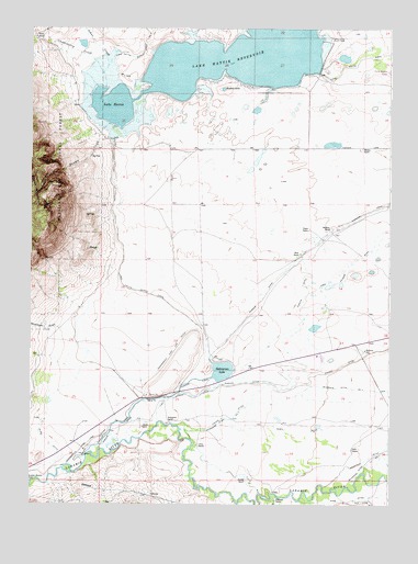
Sodergreen Lake, WY USGS Topographic Map
Click on map above to begin viewing in our Map Viewer.

This topographic map contains these locations and features:
Feature Name Type Latitude Longitude GNIS ID View Map
Big Laramie Valley Volunteer Fire Department 1BuildingN41.1642°W105.9016°2673676View Map
Burg DitchCanalN41.1425°W105.9956°1598506View Map
Chokecherry CreekStreamN41.2341°W105.9756°1598749View Map
Chokecherry GulchValleyN41.2347°W105.9756°1604373View Map
Eike RanchLocaleN41.1394°W105.8881°1599551View Map
Engen RanchLocaleN41.1975°W105.9036°1599618View Map
Erickson RanchLocaleN41.1975°W105.8956°1599628View Map
Fellhauer RanchLocaleN41.1261°W105.9147°1599686View Map
Fisher DitchCanalN41.1591°W105.8983°1599734View Map
Hansen CreekStreamN41.2250°W105.9739°1600197View Map
Harmony SchoolSchoolN41.1655°W105.8839°1600218View Map
Harson RanchLocaleN41.2186°W105.8853°1600222View Map
Jenkins RanchLocaleN41.1314°W105.9236°1600601View Map
Johns CreekStreamN41.2386°W105.9761°1600633View Map
Johnson RanchLocaleN41.1450°W105.9614°1600648View Map
Lake HattieReservoirN41.2416°W105.8989°1608836View Map
Lake HattieLakeN41.2297°W105.9719°1600231View Map
Lake Hattie DamDamN41.2416°W105.8989°1605648View Map
Lake Hattie ReservoirReservoirN41.2478°W105.8961°1600802View Map
Lake Hattie Supply CanalCanalN41.1858°W105.9697°1600803View Map
Moonshine GulchValleyN41.1708°W105.9892°1601526View Map
Olsen DitchCanalN41.1461°W105.9072°1601920View Map
Orton RanchLocaleN41.1405°W105.9419°1601946View Map
Parker DitchCanalN41.1566°W105.9097°1602031View Map
Riverside Ditch Number 2CanalN41.1514°W105.9158°1605453View Map
Russell LakeLakeN41.2341°W105.9336°1602651View Map
Sheep MountainSummitN41.1998°W105.9986°1604347View Map
Short RanchLocaleN41.1911°W105.9067°1602903View Map
Sodergreen High Line DitchCanalN41.1486°W105.9667°1603058View Map
Sodergreen LakeLakeN41.1602°W105.9334°1603059View Map
Sodergreen RanchLocaleN41.1464°W105.9514°1603060View Map
South Albany DivisionCivilN41.1786°W105.9018°1939740View Map
Strom RanchLocaleN41.2472°W105.9986°1603410View Map

Note: Coordinates in the location and feature list above are referenced to NAD83 datum.


Copyright (C) 2008-2025 Ryan Niemi / Sunset Dynamics ... All Rights Reserved