TopoQuest Logo
Do you find TopoQuest useful?
Help keep TopoQuest running and adding new maps/features by donating!
Bitcoin:  19c7KJd3qBynnjoSw5npx9KScwjBe4ifkT
Litecoin:  LXs6TkuXGGXo1vDsWCkWVdjQX94eUKd6ui
Home View Maps Find Maps Find Places Resources & Links


Lake Tambour, Louisiana Topographic Map

USGS Map Title: Lake Tambour, LA
USGS Map MRC: 29090C5
DRG (GeoTIFF) Download: o29090c5.tif


Neighboring USGS Topographic Map Quads:


  Dulac, LA  
29090D6
 

  Montegut, LA  
29090D5
 

  Lake Bully Camp, LA  
29090D4
 

  Lake Quitman, LA  
29090C6
 

  Lake Tambour, LA  
29090C5
 

  Lake Felicity, LA  
29090C4
 

  Cocodrie, LA  
29090B6
 

  Lake La Graisse, LA  
29090B5
 

  Jacko Bay, LA  
29090B4


Map MRC Location:

N30°
W91°
N30°
W90°
H8 H7 H6 H5 H4 H3 H2 H1
G8 G7 G6 G5 G4 G3 G2 G1
F8 F7 F6 F5 F4 F3 F2 F1
E8 E7 E6 E5 E4 E3 E2 E1
D8 D7 D6 D5 D4 D3 D2 D1
C8 C7 C6 C5 C4 C3 C2 C1
B8 B7 B6 B5 B4 B3 B2 B1
A8 A7 A6 A5 A4 A3 A2 A1
N29°
W91°
N29°
W90°

Lake Tambour, LA USGS 1:24K Topographic Map Preview:
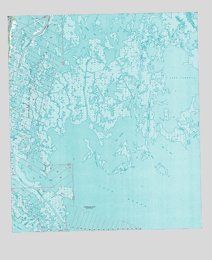
Lake Tambour, LA USGS Topographic Map
Click on map above to begin viewing in our Map Viewer.

This topographic map contains these locations and features:
Feature Name Type Latitude Longitude GNIS ID View Map
Bay BourbeuxLakeN29.3044°W90.5531°553367View Map
Bay la FleurLakeN29.2887°W90.6073°553363View Map
Bay la PeurLakeN29.2930°W90.5206°553364View Map
Bay LucienLakeN29.2747°W90.6195°553390View Map
Bay NegresseLakeN29.2511°W90.6231°553391View Map
Bayou Charles TheriotGutN29.3113°W90.5340°532502View Map
Bayou ChitigueBayN29.3209°W90.5862°532520View Map
Bayou ChouvereBayN29.3641°W90.5129°532525View Map
Bayou de l' OuestGutN29.2713°W90.6226°532397View Map
Bayou de MangueBayN29.3163°W90.5732°532560View Map
Bayou du CougrantBayN29.3074°W90.5928°532413View Map
Bayou DufereneBayN29.3300°W90.5588°532575View Map
Bayou JackGutN29.2572°W90.6140°532632View Map
Bayou la FleurGutN29.2708°W90.5956°532421View Map
Bayou LucienGutN29.2602°W90.6095°532678View Map
Bayou PortageBayN29.3078°W90.6203°532737View Map
Bayou TambourBayN29.3574°W90.5259°532784View Map
Bayou TerrebonneBayN29.2549°W90.5919°532790View Map
Flat BayouGutN29.2938°W90.5337°534977View Map
Grand BayouBayN29.3188°W90.6063°535308View Map
Grand Bayou BourbeuxGutN29.2908°W90.5701°535316View Map
Lake BarreLakeN29.2555°W90.5137°553352View Map
Oyster BayouStreamN29.2949°W90.5073°537929View Map
Petit Bayou BourbeuxGutN29.2861°W90.5551°538089View Map
Seabreeze Pass Gas FieldOilfieldN29.2649°W90.5759°551952View Map

Note: Coordinates in the location and feature list above are referenced to NAD83 datum.


Copyright (C) 2008-2024 Ryan Niemi / Sunset Dynamics ... All Rights Reserved