TopoQuest Logo
Do you find TopoQuest useful?
Help keep TopoQuest running and adding new maps/features by donating!
Bitcoin:  19c7KJd3qBynnjoSw5npx9KScwjBe4ifkT
Litecoin:  LXs6TkuXGGXo1vDsWCkWVdjQX94eUKd6ui
Home View Maps Find Maps Find Places Resources & Links


Montegut, Louisiana Topographic Map

USGS Map Title: Montegut, LA
USGS Map MRC: 29090D5
DRG (GeoTIFF) Download: o29090d5.tif


Neighboring USGS Topographic Map Quads:


  Houma, LA  
29090E6
 

  Bourg, LA  
29090E5
 

  Larose, LA  
29090E4
 

  Dulac, LA  
29090D6
 

  Montegut, LA  
29090D5
 

  Lake Bully Camp, LA  
29090D4
 

  Lake Quitman, LA  
29090C6
 

  Lake Tambour, LA  
29090C5
 

  Lake Felicity, LA  
29090C4


Map MRC Location:

N30°
W91°
N30°
W90°
H8 H7 H6 H5 H4 H3 H2 H1
G8 G7 G6 G5 G4 G3 G2 G1
F8 F7 F6 F5 F4 F3 F2 F1
E8 E7 E6 E5 E4 E3 E2 E1
D8 D7 D6 D5 D4 D3 D2 D1
C8 C7 C6 C5 C4 C3 C2 C1
B8 B7 B6 B5 B4 B3 B2 B1
A8 A7 A6 A5 A4 A3 A2 A1
N29°
W91°
N29°
W90°

Montegut, LA USGS 1:24K Topographic Map Preview:
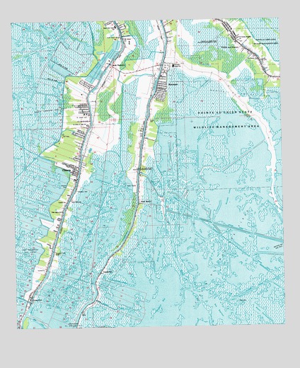
Montegut, LA USGS Topographic Map
Click on map above to begin viewing in our Map Viewer.

This topographic map contains these locations and features:
Feature Name Type Latitude Longitude GNIS ID View Map
Bay BaptisteBayN29.3772°W90.5279°532347View Map
Bay Baptiste Gas FieldOilfieldN29.3874°W90.5429°553366View Map
Bayou BarreBayN29.3902°W90.5431°532434View Map
Bayou La CacheBayN29.3910°W90.6014°532649View Map
Billy Goat BayBayN29.4113°W90.5614°533125View Map
Boudreaux CanalBayN29.4780°W90.5971°533343View Map
Boudreaux Canal BridgeBridgeN29.3861°W90.6200°2601244View Map
Boudreaux Canal Little Caillou SchoolSchoolN29.3870°W90.6185°533344View Map
Bush CanalBayN29.3751°W90.6109°533576View Map
Calvary Church (historical)ChurchN29.4922°W90.5740°551898View Map
Canal Saint Jean CharlesBayN29.3930°W90.5066°533700View Map
ChauvinPopulated PlaceN29.4386°W90.5954°553961View Map
Chauvin Census Designated PlaceCensusN29.4455°W90.5940°2402767View Map
Chauvin Post OfficePost OfficeN29.4734°W90.5879°1631786View Map
Dugas CemeteryCemeteryN29.4597°W90.5620°534645View Map
Duplantis School (historical)SchoolN29.4055°W90.6084°551903View Map
Humble CanalBayN29.4283°W90.5528°535855View Map
Lacache Middle SchoolSchoolN29.4580°W90.5904°554949View Map
Lake Boudreaux Gas FieldOilfieldN29.4063°W90.6220°1629534View Map
LapeyrousePopulated PlaceN29.3977°W90.5856°543377View Map
Lapeyrouse CanalCanalN29.3936°W90.5759°536336View Map
Lirette Oil and Gas FieldOilfieldN29.4188°W90.5387°536470View Map
Little Caillou ChurchChurchN29.4269°W90.5987°536502View Map
Little Caillou Elementary SchoolSchoolN29.4227°W90.6029°1629698View Map
Little Caillou Volunteer Fire Department Station 2BuildingN29.4319°W90.5974°2691647View Map
Lower Montegut SchoolSchoolN29.4208°W90.5690°536769View Map
Madison BayBayN29.3780°W90.5602°555210View Map
Madison CanalCanalN29.3827°W90.5801°536818View Map
MontegutPopulated PlaceN29.4744°W90.5570°555352View Map
Montegut / Pointe - aux - Chenes Fire DepartmentBuildingN29.4814°W90.5543°2332417View Map
Montegut / Pointe - aux - Chenes Fire Department Station 2BuildingN29.4859°W90.5132°2332536View Map
Montegut / Pointe - aux - Chenes Fire Department Station 4BuildingN29.4168°W90.5696°2691822View Map
Montegut Baptist ChurchChurchN29.4681°W90.5595°2602262View Map
Montegut Census Designated PlaceCensusN29.4656°W90.5618°2403301View Map
Montegut Elementary SchoolSchoolN29.4776°W90.5555°551922View Map
Montegut Middle SchoolSchoolN29.4818°W90.5498°551923View Map
Montegut Oil and Gas FieldOilfieldN29.4713°W90.5237°537183View Map
Montegut Post OfficePost OfficeN29.4698°W90.5585°1631792View Map
Moses Israel ChurchChurchN29.4941°W90.5729°537244View Map
Mount Calvary ChurchChurchN29.4927°W90.5731°537295View Map
Mount Olive Baptist ChurchChurchN29.4895°W90.5717°2602374View Map
New Beginning Community Outreach CenterChurchN29.4991°W90.5503°2602300View Map
New Life Christian MinistriesChurchN29.4785°W90.5549°2602457View Map
Point BarrePopulated PlaceN29.4258°W90.5676°538285View Map
Point-Aux-ChenesPopulated PlaceN29.4977°W90.5534°551937View Map
Pointe - Aux - Chenes Elementary SchoolSchoolN29.4905°W90.5205°555693View Map
Pointe FarmsLocaleN29.4766°W90.5287°551938View Map
Sacred Heart CemeteryCemeteryN29.4802°W90.5540°551939View Map
Sacred Heart ChurchChurchN29.4802°W90.5548°538778View Map
Saint Charles ChurchChurchN29.4841°W90.5104°538821View Map
Saint Joseph CemeteryCemeteryN29.4616°W90.5895°551945View Map
Saint Joseph ChurchChurchN29.4622°W90.5895°551946View Map
Saint Joseph SchoolSchoolN29.4624°W90.5906°538922View Map
Saint Peters ChurchChurchN29.4202°W90.5687°539056View Map
Sarah PlantationPopulated PlaceN29.4822°W90.5787°543646View Map
Smith RidgeRidgeN29.4958°W90.5718°539446View Map
Smith Ridge School (historical)SchoolN29.4886°W90.5720°539447View Map
South Chauvin Gas FieldOilfieldN29.4672°W90.6009°551954View Map
South Houma Oil and Gas FieldOilfieldN29.4722°W90.6229°539497View Map
South Terrebonne Church of ChristChurchN29.4837°W90.5535°2602814View Map
Terrebonne Parish Library Chauvin BranchBuildingN29.4405°W90.5948°2603158View Map
Terrebonne Parish Library Montegut BranchBuildingN29.4779°W90.5556°2603160View Map
Terrebonne Parrish Consolidated Government Clinton Street Sewage PlantLocaleN29.4436°W90.6056°2603518View Map
Thibodaux CemeteryCemeteryN29.4310°W90.5965°539862View Map
Upper Little Caillou Elementary SchoolSchoolN29.4976°W90.5764°2493473View Map
Upper Little Caillou Elementary SchoolSchoolN29.4976°W90.5766°2434821View Map
Ward SevenCivilN29.4397°W90.6123°545225View Map
Ward SixCivilN29.4105°W90.5129°545224View Map
Wonder LakeBayN29.4371°W90.5112°556465View Map

Note: Coordinates in the location and feature list above are referenced to NAD83 datum.


Copyright (C) 2008-2024 Ryan Niemi / Sunset Dynamics ... All Rights Reserved