TopoQuest Logo
Do you find TopoQuest useful?
Help keep TopoQuest running and adding new maps/features by donating!
Bitcoin:  19c7KJd3qBynnjoSw5npx9KScwjBe4ifkT
Litecoin:  LXs6TkuXGGXo1vDsWCkWVdjQX94eUKd6ui
Home View Maps Find Maps Find Places Resources & Links


Lamar North, Missouri Topographic Map

USGS Map Title: Lamar North, MO
USGS Map MRC: 37094E3
DRG (GeoTIFF) Download: o37094e3.tif


Neighboring USGS Topographic Map Quads:


  Bronaugh, MO  
37094F4
 

  Sheldon, MO  
37094F3
 

  Bellamy, MO  
37094F2
 

  Iantha, MO  
37094E4
 

  Lamar North, MO  
37094E3
 

  Milford, MO  
37094E2
 

  Nashville, MO  
37094D4
 

  Lamar South, MO  
37094D3
 

  Kenoma, MO  
37094D2


Map MRC Location:

N38°
W95°
N38°
W94°
H8 H7 H6 H5 H4 H3 H2 H1
G8 G7 G6 G5 G4 G3 G2 G1
F8 F7 F6 F5 F4 F3 F2 F1
E8 E7 E6 E5 E4 E3 E2 E1
D8 D7 D6 D5 D4 D3 D2 D1
C8 C7 C6 C5 C4 C3 C2 C1
B8 B7 B6 B5 B4 B3 B2 B1
A8 A7 A6 A5 A4 A3 A2 A1
N37°
W95°
N37°
W94°

Lamar North, MO USGS 1:24K Topographic Map Preview:
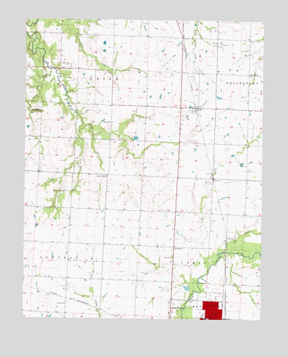
Lamar North, MO USGS Topographic Map
Click on map above to begin viewing in our Map Viewer.

This topographic map contains these locations and features:
Feature Name Type Latitude Longitude GNIS ID View Map
Bakers Grove CemeteryCemeteryN37.6064°W94.3519°713579View Map
Bakers Grove School (historical)SchoolN37.6048°W94.3575°746180View Map
Barton CountyCivilN37.5023°W94.3471°758460View Map
Barton County Memorial HospitalHospitalN37.5057°W94.3009°2655071View Map
Bucks Run CreekStreamN37.6045°W94.3619°714989View Map
Caput School (historical)SchoolN37.5823°W94.3305°715387View Map
Central ChapelChurchN37.5598°W94.3322°715670View Map
Central School (historical)SchoolN37.5062°W94.3533°715685View Map
Curless Lake DamDamN37.5517°W94.3202°763436View Map
Don Bunton DamDamN37.5784°W94.2786°762962View Map
Earl Dumm DamDamN37.5384°W94.3269°762898View Map
Elm BranchStreamN37.5287°W94.2658°717501View Map
FairbanksLocaleN37.6045°W94.3558°746182View Map
Fairbanks Post Office (historical)Post OfficeN37.6045°W94.3558°1940206View Map
Haines Grove School (historical)SchoolN37.5531°W94.3544°718983View Map
Hornaday (historical)LocaleN37.5081°W94.3508°740439View Map
IrwinPopulated PlaceN37.5887°W94.2855°720173View Map
Irwin Census Designated PlaceCensusN37.5886°W94.2872°2587082View Map
Irwin School (historical)SchoolN37.5884°W94.2930°746183View Map
Lamar Area Vocational-Technical SchoolSchoolN37.5022°W94.2822°2710023View Map
Lamar Elementary SchoolSchoolN37.5003°W94.2797°2710021View Map
Lamar High SchoolSchoolN37.5011°W94.2822°2710019View Map
Nigh CemeteryCemeteryN37.5342°W94.2647°723372View Map
Ozark School (historical)SchoolN37.5298°W94.2958°723944View Map
Rockdale School (historical)SchoolN37.6028°W94.2572°725477View Map
Shady Grove School (historical)SchoolN37.5442°W94.2597°746181View Map
Township of LamarCivilN37.5034°W94.2534°766279View Map
Township of UnionCivilN37.6040°W94.3294°766288View Map

Note: Coordinates in the location and feature list above are referenced to NAD83 datum.


Copyright (C) 2008-2025 Ryan Niemi / Sunset Dynamics ... All Rights Reserved