TopoQuest Logo
Do you find TopoQuest useful?
Help keep TopoQuest running and adding new maps/features by donating!
Bitcoin:  19c7KJd3qBynnjoSw5npx9KScwjBe4ifkT
Litecoin:  LXs6TkuXGGXo1vDsWCkWVdjQX94eUKd6ui
Home View Maps Find Maps Find Places Resources & Links


Lamberton, Minnesota Topographic Map

USGS Map Title: Lamberton, MN
USGS Map MRC: 44095B3
DRG (GeoTIFF) Download: o44095b3.tif


Neighboring USGS Topographic Map Quads:


  Wabasso SW, MN  
44095C4
 

  Wabasso SE, MN  
44095C3
 

  Wanda, MN  
44095C2
 

  Walnut Grove, MN  
44095B4
 

  Lamberton, MN  
44095B3
 

  Sanborn, MN  
44095B2
 

  Westbrook, MN  
44095A4
 

  Storden, MN  
44095A3
 

  Jeffers, MN  
44095A2


Map MRC Location:

N45°
W96°
N45°
W95°
H8 H7 H6 H5 H4 H3 H2 H1
G8 G7 G6 G5 G4 G3 G2 G1
F8 F7 F6 F5 F4 F3 F2 F1
E8 E7 E6 E5 E4 E3 E2 E1
D8 D7 D6 D5 D4 D3 D2 D1
C8 C7 C6 C5 C4 C3 C2 C1
B8 B7 B6 B5 B4 B3 B2 B1
A8 A7 A6 A5 A4 A3 A2 A1
N44°
W96°
N44°
W95°

Lamberton, MN USGS 1:24K Topographic Map Preview:
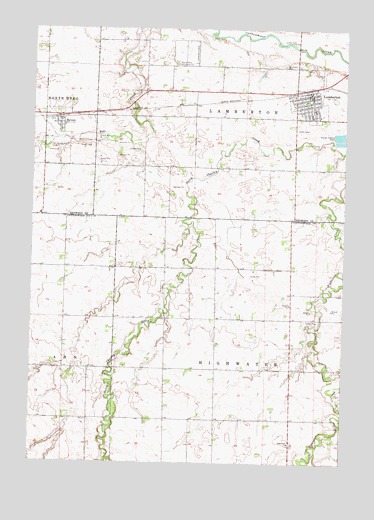
Lamberton, MN USGS Topographic Map
Click on map above to begin viewing in our Map Viewer.

This topographic map contains these locations and features:
Feature Name Type Latitude Longitude GNIS ID View Map
City of LambertonCivilN44.2306°W95.2678°2395619View Map
City of RevereCivilN44.2216°W95.3611°2396355View Map
Highwater CemeteryCemeteryN44.1302°W95.2714°2050995View Map
Highwater ChurchChurchN44.1308°W95.2708°644961View Map
Kuhar ParkParkN44.2461°W95.2758°646271View Map
LambertonLocaleN44.2328°W95.2639°2064511View Map
LambertonPopulated PlaceN44.2311°W95.2642°646457View Map
Lamberton ClinicHospitalN44.2300°W95.2639°2064515View Map
Lamberton Fire Department and Ambulance ServiceBuildingN44.2313°W95.2652°2064510View Map
Lamberton Police DepartmentBuildingN44.2314°W95.2648°2064509View Map
Lamberton Post OfficePost OfficeN44.2308°W95.2631°2064508View Map
Lamberton Public LibraryBuildingN44.2317°W95.2636°2064507View Map
Our Saviour's Lutheran ChurchChurchN44.2250°W95.2603°2064512View Map
Red Rock Central High SchoolSchoolN44.2269°W95.2625°2064517View Map
Redwood County Waterfowl Production AreaParkN44.2436°W95.3330°2776743View Map
ReverePopulated PlaceN44.2238°W95.3644°649950View Map
RevereLocaleN44.2244°W95.3650°2064473View Map
Revere Fire StationBuildingN44.2222°W95.3647°2064469View Map
Revere Post OfficePost OfficeN44.2239°W95.3642°2064472View Map
Revere Town HallBuildingN44.2203°W95.3647°2064471View Map
Saint Joseph CemeteryCemeteryN44.2394°W95.2750°650751View Map
Saint Joseph's ChurchChurchN44.2308°W95.2689°2064513View Map
Township of HighwaterCivilN44.1519°W95.2813°664472View Map
Township of LambertonCivilN44.2391°W95.2902°664716View Map
United Methodist ChurchChurchN44.2258°W95.2672°2064514View Map
University of Minnesota Experimental StationLocaleN44.2400°W95.3183°659964View Map
Valley View ManorHospitalN44.2239°W95.2589°2064516View Map

Note: Coordinates in the location and feature list above are referenced to NAD83 datum.


Copyright (C) 2008-2025 Ryan Niemi / Sunset Dynamics ... All Rights Reserved