TopoQuest Logo
Do you find TopoQuest useful?
Help keep TopoQuest running and adding new maps/features by donating!
Bitcoin:  19c7KJd3qBynnjoSw5npx9KScwjBe4ifkT
Litecoin:  LXs6TkuXGGXo1vDsWCkWVdjQX94eUKd6ui
Home View Maps Find Maps Find Places Resources & Links


Sanborn, Minnesota Topographic Map

USGS Map Title: Sanborn, MN
USGS Map MRC: 44095B2
DRG (GeoTIFF) Download: o44095b2.tif


Neighboring USGS Topographic Map Quads:


  Wabasso SE, MN  
44095C3
 

  Wanda, MN  
44095C2
 

  Clements SE, MN  
44095C1
 

  Lamberton, MN  
44095B3
 

  Sanborn, MN  
44095B2
 

  Sanborn NE, MN  
44095B1
 

  Storden, MN  
44095A3
 

  Jeffers, MN  
44095A2
 

  Sanborn SE, MN  
44095A1


Map MRC Location:

N45°
W96°
N45°
W95°
H8 H7 H6 H5 H4 H3 H2 H1
G8 G7 G6 G5 G4 G3 G2 G1
F8 F7 F6 F5 F4 F3 F2 F1
E8 E7 E6 E5 E4 E3 E2 E1
D8 D7 D6 D5 D4 D3 D2 D1
C8 C7 C6 C5 C4 C3 C2 C1
B8 B7 B6 B5 B4 B3 B2 B1
A8 A7 A6 A5 A4 A3 A2 A1
N44°
W96°
N44°
W95°

Sanborn, MN USGS 1:24K Topographic Map Preview:
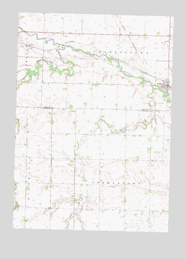
Sanborn, MN USGS Topographic Map
Click on map above to begin viewing in our Map Viewer.

This topographic map contains these locations and features:
Feature Name Type Latitude Longitude GNIS ID View Map
City of SanbornCivilN44.2098°W95.1297°2396531View Map
Dry CreekStreamN44.2080°W95.1405°642934View Map
Dutch Charley CreekStreamN44.2313°W95.2136°642992View Map
Faith ChurchChurchN44.2352°W95.1286°643536View Map
Farmers Golf and Health ClubLocaleN44.2097°W95.1283°2064461View Map
Germantown ChurchChurchN44.1936°W95.2022°644103View Map
Germantown Evangelical United Methodist CemeteryCemeteryN44.1955°W95.1994°2064541View Map
Highwater CreekStreamN44.2163°W95.2394°644962View Map
Lamberton CemeteryCemeteryN44.2302°W95.2433°646458View Map
Saint Thomas ChurchChurchN44.2092°W95.1253°2064466View Map
SanbornLocaleN44.2122°W95.1292°2064464View Map
SanbornPopulated PlaceN44.2097°W95.1286°651130View Map
Sanborn CemeteryCemeteryN44.1963°W95.1261°651131View Map
Sanborn Fire DepartmentBuildingN44.2099°W95.1305°2666587View Map
Sanborn Post OfficePost OfficeN44.2100°W95.1278°2064462View Map
Sanborn Town HallBuildingN44.2100°W95.1300°2064465View Map
Soldiers and Sailors City ParkParkN44.2042°W95.1303°2064463View Map
Township of CharlestownCivilN44.2404°W95.1712°663783View Map
Township of GermantownCivilN44.1518°W95.1607°664262View Map
Zion Evangelical Lutheran ChurchChurchN44.2103°W95.1314°2064468View Map
Zion Lutheran SchoolSchoolN44.2097°W95.1308°2064467View Map

Note: Coordinates in the location and feature list above are referenced to NAD83 datum.


Copyright (C) 2008-2025 Ryan Niemi / Sunset Dynamics ... All Rights Reserved