TopoQuest Logo
Do you find TopoQuest useful?
Help keep TopoQuest running and adding new maps/features by donating!
Bitcoin:  19c7KJd3qBynnjoSw5npx9KScwjBe4ifkT
Litecoin:  LXs6TkuXGGXo1vDsWCkWVdjQX94eUKd6ui
Home View Maps Find Maps Find Places Resources & Links


Landmark, Idaho Topographic Map

USGS Map Title: Landmark, ID
USGS Map MRC: 44115F5
DRG (GeoTIFF) Download: o44115f5.tif


Neighboring USGS Topographic Map Quads:


  White Rock Peak, ID  
44115G6
 

  Log Mountain, ID  
44115G5
 

  Chilcoot Peak, ID  
44115G4
 

  Warm Lake, ID  
44115F6
 

  Landmark, ID  
44115F5
 

  Pistol Lake, ID  
44115F4
 

  Rice Peak, ID  
44115E6
 

  Tyndall Meadows, ID  
44115E5
 

  Honeymoon Lake, ID  
44115E4


Map MRC Location:

N45°
W116°
N45°
W115°
H8 H7 H6 H5 H4 H3 H2 H1
G8 G7 G6 G5 G4 G3 G2 G1
F8 F7 F6 F5 F4 F3 F2 F1
E8 E7 E6 E5 E4 E3 E2 E1
D8 D7 D6 D5 D4 D3 D2 D1
C8 C7 C6 C5 C4 C3 C2 C1
B8 B7 B6 B5 B4 B3 B2 B1
A8 A7 A6 A5 A4 A3 A2 A1
N44°
W116°
N44°
W115°

Landmark, ID USGS 1:24K Topographic Map Preview:
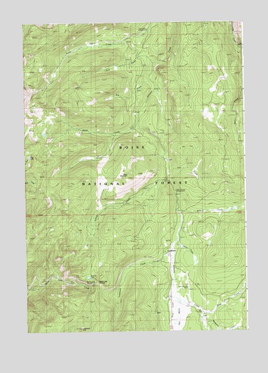
Landmark, ID USGS Topographic Map
Click on map above to begin viewing in our Map Viewer.

This topographic map contains these locations and features:
Feature Name Type Latitude Longitude GNIS ID View Map
Bobcat CreekStreamN44.6718°W115.5362°377978View Map
Buck MountainSummitN44.6877°W115.5662°396184View Map
Buck Mountain CampgroundLocaleN44.6818°W115.5398°400472View Map
Burnt Log TrailTrailN44.7288°W115.5307°378563View Map
East Fork Burntlog CreekStreamN44.7377°W115.5012°381065View Map
Fan CreekStreamN44.6902°W115.5426°398551View Map
Fulton CreekStreamN44.6624°W115.5387°398552View Map
Knox LakeLakeN44.6957°W115.6227°398553View Map
LandmarkPopulated PlaceN44.6563°W115.5451°396766View Map
Landmark CreekStreamN44.6574°W115.5418°384410View Map
Landmark Ranger StationLocaleN44.6577°W115.5421°394091View Map
Landmark RockPillarN44.6263°W115.5940°384413View Map
Landmark USFS AirportAirportN44.6411°W115.5333°400855View Map
Lunch CreekStreamN44.6863°W115.5437°386288View Map
Mosquito CreekStreamN44.6296°W115.5254°387262View Map
Park CreekStreamN44.7341°W115.5507°388208View Map
Pen BasinBasinN44.6332°W115.5343°398461View Map
Pen Basin CampgroundLocaleN44.6316°W115.5243°398555View Map
Pen Basin Recreation SiteLocaleN44.6255°W115.5140°400731View Map
Pid CreekStreamN44.7274°W115.5534°388426View Map
Rock CreekStreamN44.6385°W115.5426°389497View Map
Sand CreekStreamN44.6321°W115.5251°389895View Map
Sheep CreekStreamN44.7088°W115.5598°390189View Map
Summit LakeLakeN44.6470°W115.5898°391632View Map
Summit Lake CampgroundLocaleN44.6449°W115.5865°400473View Map
Trout Creek CampgroundLocaleN44.7471°W115.5551°398550View Map
Trout Creek TrailTrailN44.7321°W115.6198°392427View Map
Warm Lake Lodge Recreation SiteLocaleN44.6285°W115.6007°400730View Map
Warm Lake SummitSummitN44.6449°W115.5854°392854View Map

Note: Coordinates in the location and feature list above are referenced to NAD83 datum.


Copyright (C) 2008-2025 Ryan Niemi / Sunset Dynamics ... All Rights Reserved