TopoQuest Logo
Do you find TopoQuest useful?
Help keep TopoQuest running and adding new maps/features by donating!
Bitcoin:  19c7KJd3qBynnjoSw5npx9KScwjBe4ifkT
Litecoin:  LXs6TkuXGGXo1vDsWCkWVdjQX94eUKd6ui
Home View Maps Find Maps Find Places Resources & Links


Warm Lake, Idaho Topographic Map

USGS Map Title: Warm Lake, ID
USGS Map MRC: 44115F6
DRG (GeoTIFF) Download: o44115f6.tif


Neighboring USGS Topographic Map Quads:


  Blackmare, ID  
44115G7
 

  White Rock Peak, ID  
44115G6
 

  Log Mountain, ID  
44115G5
 

  Gold Fork Rock, ID  
44115F7
 

  Warm Lake, ID  
44115F6
 

  Landmark, ID  
44115F5
 

  Oro Mountain, ID  
44115E7
 

  Rice Peak, ID  
44115E6
 

  Tyndall Meadows, ID  
44115E5


Map MRC Location:

N45°
W116°
N45°
W115°
H8 H7 H6 H5 H4 H3 H2 H1
G8 G7 G6 G5 G4 G3 G2 G1
F8 F7 F6 F5 F4 F3 F2 F1
E8 E7 E6 E5 E4 E3 E2 E1
D8 D7 D6 D5 D4 D3 D2 D1
C8 C7 C6 C5 C4 C3 C2 C1
B8 B7 B6 B5 B4 B3 B2 B1
A8 A7 A6 A5 A4 A3 A2 A1
N44°
W116°
N44°
W115°

Warm Lake, ID USGS 1:24K Topographic Map Preview:
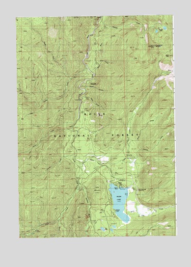
Warm Lake, ID USGS Topographic Map
Click on map above to begin viewing in our Map Viewer.

This topographic map contains these locations and features:
Feature Name Type Latitude Longitude GNIS ID View Map
Aunt Mellys SpringSpringN44.7085°W115.6957°399424View Map
Billy Rice Public Swimming AreaLocaleN44.6560°W115.6796°394619View Map
Cabin CreekStreamN44.6668°W115.6854°378630View Map
Cabin PeakSummitN44.7266°W115.6287°397511View Map
Cline MountainSummitN44.6521°W115.6868°398529View Map
Curtis CreekStreamN44.6524°W115.7032°380182View Map
Dime CreekStreamN44.7024°W115.7001°380597View Map
Dollar CreekStreamN44.7227°W115.6954°380698View Map
Dollar Creek WayTrailN44.7066°W115.7404°380701View Map
Hayes CreekStreamN44.7224°W115.6940°396632View Map
Kinney PointCapeN44.6396°W115.6737°398548View Map
Kinney Point Summer Home AreaPopulated PlaceN44.6385°W115.6746°394612View Map
Kline MineMineN44.6555°W115.6932°394859View Map
Klines GraveCemeteryN44.6643°W115.6870°398547View Map
KnoxLocaleN44.6688°W115.6857°384288View Map
Knox CreekStreamN44.6760°W115.6618°396752View Map
Lakeshore Summer Home AreaPopulated PlaceN44.6460°W115.6618°400580View Map
McCall Fish HatcheryParkN44.6667°W115.7018°401627View Map
Mirror CreekStreamN44.7307°W115.6921°398549View Map
Nickel CreekStreamN44.7091°W115.6968°387563View Map
North Fork Dollar CreekStreamN44.7152°W115.7062°387687View Map
North Shore Lodge Recreation SiteLocaleN44.6532°W115.6709°394613View Map
Paradise ValleyValleyN44.6680°W115.6634°398544View Map
Paradise Valley Summer Home AreaPopulated PlaceN44.6696°W115.6590°394609View Map
Penny Spring CampgroundLocaleN44.7138°W115.6926°400469View Map
Picnic PointCapeN44.6532°W115.6704°398398View Map
Picnic Point CampgroundLocaleN44.6543°W115.6723°394608View Map
Reeves CreekStreamN44.6674°W115.6659°389278View Map
Roaring CreekStreamN44.7443°W115.6846°389424View Map
Roaring LakesLakeN44.7426°W115.6320°389428View Map
Shoreline Boat RampLocaleN44.6524°W115.6668°394607View Map
Shoreline CampgroundLocaleN44.6568°W115.6696°398397View Map
Shoreline Drive Summer Home AreaPopulated PlaceN44.6474°W115.6776°394611View Map
Six-bit CreekStreamN44.6863°W115.7062°390492View Map
South Fork Salmon River CampgroundLocaleN44.6530°W115.7018°394610View Map
Thunderbolt MountainSummitN44.7324°W115.6396°392116View Map
Trail CreekStreamN44.6366°W115.7165°392304View Map
Tule LakeLakeN44.6295°W115.6838°392442View Map
Two-bit CreekStreamN44.6724°W115.7040°392563View Map
Warm LakeLakeN44.6452°W115.6702°392852View Map
Warm LakePopulated PlaceN44.6541°W115.6676°398316View Map
Warm Lake CreekStreamN44.6663°W115.6985°392853View Map
Warm Lake Lodge CampgroundLocaleN44.6521°W115.6565°400368View Map
Warm Lake Recreation SiteLocaleN44.6513°W115.6626°394614View Map

Note: Coordinates in the location and feature list above are referenced to NAD83 datum.


Copyright (C) 2008-2024 Ryan Niemi / Sunset Dynamics ... All Rights Reserved